Property Record
75 Carver Ave, Westwood, NJ 07675
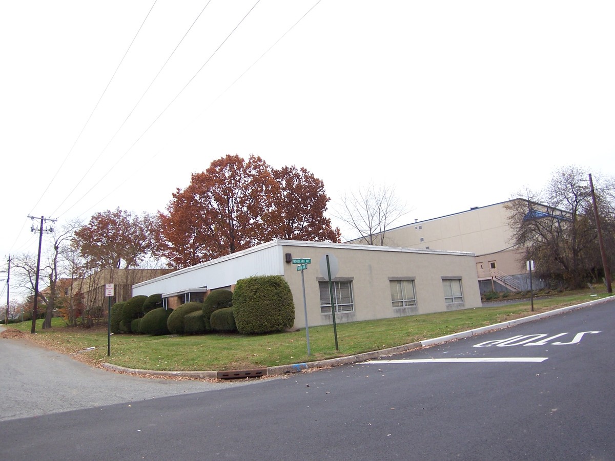
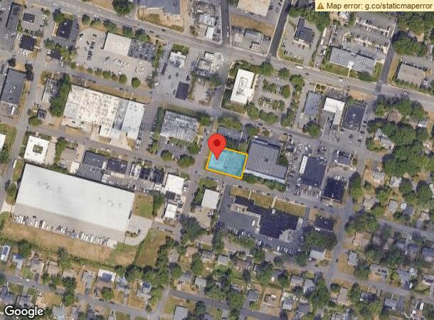
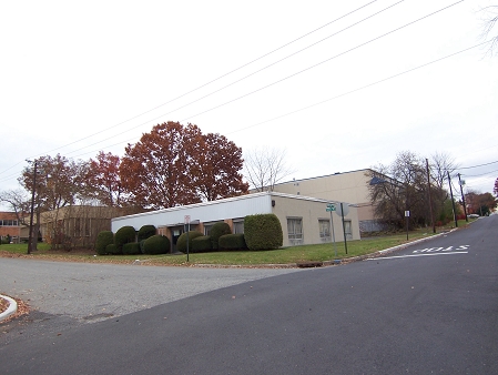
This Property Is For Sale
NEARBY LISTINGS FOR SALE OR LEASE
Property Detail
75 Carver Ave
New York-Jersey City-White Plains, NY-NJ
100X150
67-02107-0000-00001
Bergen
Industrialgeneral
New Jersey
X
1
34003C0182H
0.34 AC
2023
Northeast Bergen
2024
Northern New Jersey
059100
DEMOGRAPHICS near 75 Carver Ave
1 Mile
3 Mile
5 Mile
2024 Total Population
9,022
95,548
265,545
2029 Population
9,001
95,350
265,011
Pop Growth 2024-2029
(0.23%)
(0.21%)
(0.20%)
Average Age
42
43
42
2024 Total Households
3,356
33,234
90,134
HH Growth 2024-2029
(0.24%)
(0.29%)
(0.26%)
Median Household Inc
$130,347
$139,061
$135,837
Avg Household Size
2.60
2.80
2.90
2024 Avg HH Vehicles
2.00
2.00
2.00
Median Home Value
$611,111
$636,417
$661,485
Median Year Built
1963
1957
1958
Nearby Places
- Restaurants
- Banks
- Shops
- Fitness
- Groceries
PUBLIC TRANSPORTATION
COMMUTER RAIL
Westwood (Pascack Valley Line - NJ Transit Commuter Rail (NJ Transit))
DRIVE
WALK
Distance
Westwood (Pascack Valley Line - NJ Transit Commuter Rail (NJ Transit))
2 min
1.4 mi
Emerson (Pascack Valley Line - NJ Transit Commuter Rail (NJ Transit))
DRIVE
WALK
Distance
Emerson (Pascack Valley Line - NJ Transit Commuter Rail (NJ Transit))
2 min
1.6 mi
AIRPORT
Laguardia
DRIVE
WALK
Distance
Laguardia
37 min
22.8 mi
Newark Liberty International
DRIVE
WALK
Distance
Newark Liberty International
32 min
25.4 mi
Westchester County
DRIVE
WALK
Distance
Westchester County
43 min
28.7 mi
Freight Ports
NY - Red Hook Container Terminal
DRIVE
WALK
Distance
NY - Red Hook Container Terminal
46 min
27.6 mi
Nearby Properties
Address
Land Use
TOTAL SIZE
Lot Size
Zoning
Address
Land Use
TOTAL SIZE
Lot Size
Zoning
19.96 AC
HSO
Address
Land Use
TOTAL SIZE
Lot Size
Zoning
232,368 SF
5.10 AC
Address
Land Use
TOTAL SIZE
Lot Size
Zoning
8.78 AC
HSO
Address
Land Use
TOTAL SIZE
Lot Size
Zoning
Address
Land Use
TOTAL SIZE
Lot Size
Zoning
23,572 SF
98.75 AC
CR
Address
Land Use
TOTAL SIZE
Lot Size
Zoning
9.20 AC
OR
Address
Land Use
TOTAL SIZE
Lot Size
Zoning
329,043 SF
15.24 AC
Address
Land Use
TOTAL SIZE
Lot Size
Zoning
47,623 SF
88.60 AC
B
Address
Land Use
TOTAL SIZE
Lot Size
Zoning
21.74 AC
SC
Address
Land Use
TOTAL SIZE
Lot Size
Zoning
82.73 AC
Address
Land Use
TOTAL SIZE
Lot Size
Zoning
0.78 AC
B
Address
Land Use
TOTAL SIZE
Lot Size
Zoning
57,890 SF
26.61 AC
R100
Address
Land Use
TOTAL SIZE
Lot Size
Zoning
185,878 SF
33.44 AC
B
Address
Land Use
TOTAL SIZE
Lot Size
Zoning
1,620 SF
37.22 AC
R225
Address
Land Use
TOTAL SIZE
Lot Size
Zoning
845.02 AC
Address
Land Use
TOTAL SIZE
Lot Size
Zoning
3.33 AC
R3
Address
Land Use
TOTAL SIZE
Lot Size
Zoning
36.37 AC
R4
Address
Land Use
TOTAL SIZE
Lot Size
Zoning
15,065 SF
9.30 AC
RC
Address
Land Use
TOTAL SIZE
Lot Size
Zoning
31,892 SF
15.55 AC
R100
Address
Land Use
TOTAL SIZE
Lot Size
Zoning
191,950 SF
43.03 AC
RA25
Address
Land Use
TOTAL SIZE
Lot Size
Zoning
34,971 SF
11.35 AC
R75
Address
Land Use
TOTAL SIZE
Lot Size
Zoning
62,728 SF
14.49 AC
RA15
Address
Land Use
TOTAL SIZE
Lot Size
Zoning
5.37 AC
B2
Address
Land Use
TOTAL SIZE
Lot Size
Zoning
144,751 SF
22.87 AC
RA
Address
Land Use
TOTAL SIZE
Lot Size
Zoning
4 AC
HSO
Address
Land Use
TOTAL SIZE
Lot Size
Zoning
40.47 AC
DISTRICTN
Address
Land Use
TOTAL SIZE
Lot Size
Zoning
5.17 AC
B2
Address
Land Use
TOTAL SIZE
Lot Size
Zoning
9.70 AC
Address
Land Use
TOTAL SIZE
Lot Size
Zoning
41,552 SF
115.62 AC
A-1
Address
Land Use
TOTAL SIZE
Lot Size
Zoning
8.42 AC
LI
The World's #1 Commercial Real Estate Marketplace
Connect with us
© 2025 CoStar Group
The information above has been obtained from sources believed reliable. While we do not doubt its accuracy we have not verified it and make no guarantee, warranty or representation about it. It is your responsibility to independently confirm its accuracy and completeness. Any projections, opinions, assumptions, or estimates used are for example only and do not represent the current or future performance of the property. The value of this transaction to you depends on tax and other factors which should be evaluated by your tax, financial, and legal advisors. You and your advisors should conduct a careful, independent investigation of the property to determine to your satisfaction the suitability of the property for your needs.