Property Record
75 Gilmore Dr, Sutton, MA 01590

NEARBY LISTINGS FOR SALE OR LEASE
-
-
View all Sutton listings for sale on LoopNet.com
Property Detail
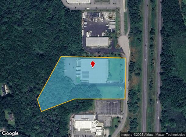
75 Gilmore Dr
Manufacturinglight
Worcester
X
Massachusetts
25027C1002E
7.02 AC
2024
Outlying Worcester
2024
Boston
751101
Worcester, MA-CT
52,848 SF
SUTT-000045-000000-000063
DEMOGRAPHICS near 75 Gilmore Dr
1 Mile
3 Mile
5 Mile
2024 Total Population
855
13,754
43,334
2029 Population
859
13,707
43,105
Pop Growth 2024-2029
+ 0.47%
(0.34%)
(0.53%)
Average Age
43
41
42
2024 Total Households
306
5,234
16,774
HH Growth 2024-2029
+ 0.65%
(0.40%)
(0.60%)
Median Household Inc
$151,087
$107,586
$112,880
Avg Household Size
2.70
2.60
2.50
2024 Avg HH Vehicles
2.00
2.00
2.00
Median Home Value
$450,000
$405,534
$406,538
Median Year Built
1981
1970
1976
Nearby Places
- Restaurants
- Banks
- Shops
- Fitness
- Groceries
PUBLIC TRANSPORTATION
AIRPORT
Worcester Regional
DRIVE
WALK
Distance
Worcester Regional
30 min
19.3 mi
Freight Ports
Port of Davisville, RI
DRIVE
WALK
Distance
Port of Davisville, RI
62 min
47.0 mi
Nearby Properties
Address
Land Use
TOTAL SIZE
Lot Size
Zoning
Address
Land Use
TOTAL SIZE
Lot Size
Zoning
607,486 SF
69.67 AC
AG
Address
Land Use
TOTAL SIZE
Lot Size
Zoning
161,541 SF
30.04 AC
Address
Land Use
TOTAL SIZE
Lot Size
Zoning
158,722 SF
77.55 AC
Address
Land Use
TOTAL SIZE
Lot Size
Zoning
134,096 SF
61.68 AC
C
Address
Land Use
TOTAL SIZE
Lot Size
Zoning
6,743 SF
7.12 AC
IND
Address
Land Use
TOTAL SIZE
Lot Size
Zoning
173,667 SF
2.44 AC
Address
Land Use
TOTAL SIZE
Lot Size
Zoning
216,167 SF
26.06 AC
C
Address
Land Use
TOTAL SIZE
Lot Size
Zoning
246,552 SF
24.55 AC
Address
Land Use
TOTAL SIZE
Lot Size
Zoning
607,486 SF
31.09 AC
OLI
Address
Land Use
TOTAL SIZE
Lot Size
Zoning
178,775 SF
36.78 AC
Address
Land Use
TOTAL SIZE
Lot Size
Zoning
312,077 SF
13.66 AC
C
Address
Land Use
TOTAL SIZE
Lot Size
Zoning
37,781 SF
29.16 AC
Address
Land Use
TOTAL SIZE
Lot Size
Zoning
55,671 SF
3.53 AC
Address
Land Use
TOTAL SIZE
Lot Size
Zoning
32,156 SF
3.59 AC
VR
Address
Land Use
TOTAL SIZE
Lot Size
Zoning
67,716 SF
42.39 AC
Address
Land Use
TOTAL SIZE
Lot Size
Zoning
134,072 SF
8.27 AC
VB
Address
Land Use
TOTAL SIZE
Lot Size
Zoning
19,913 SF
0.78 AC
Address
Land Use
TOTAL SIZE
Lot Size
Zoning
116,864 SF
16.87 AC
OLI
Address
Land Use
TOTAL SIZE
Lot Size
Zoning
607,486 SF
3.84 AC
IND
Address
Land Use
TOTAL SIZE
Lot Size
Zoning
100,882 SF
25.60 AC
Address
Land Use
TOTAL SIZE
Lot Size
Zoning
6.17 AC
Address
Land Use
TOTAL SIZE
Lot Size
Zoning
107.27 AC
Address
Land Use
TOTAL SIZE
Lot Size
Zoning
2.72 AC
Address
Land Use
TOTAL SIZE
Lot Size
Zoning
90,000 SF
9.40 AC
OLI
Address
Land Use
TOTAL SIZE
Lot Size
Zoning
28,875 SF
0.61 AC
Address
Land Use
TOTAL SIZE
Lot Size
Zoning
57,554 SF
2.19 AC
Address
Land Use
TOTAL SIZE
Lot Size
Zoning
29,851 SF
7.27 AC
OLI
Address
Land Use
TOTAL SIZE
Lot Size
Zoning
87.37 AC
IND
Address
Land Use
TOTAL SIZE
Lot Size
Zoning
30,742 SF
5.42 AC
CB
Address
Land Use
TOTAL SIZE
Lot Size
Zoning
1,950 SF
506 AC
R1
The World's #1 Commercial Real Estate Marketplace
Connect with us
© 2025 CoStar Group
The information above has been obtained from sources believed reliable. While we do not doubt its accuracy we have not verified it and make no guarantee, warranty or representation about it. It is your responsibility to independently confirm its accuracy and completeness. Any projections, opinions, assumptions, or estimates used are for example only and do not represent the current or future performance of the property. The value of this transaction to you depends on tax and other factors which should be evaluated by your tax, financial, and legal advisors. You and your advisors should conduct a careful, independent investigation of the property to determine to your satisfaction the suitability of the property for your needs.