Property Record
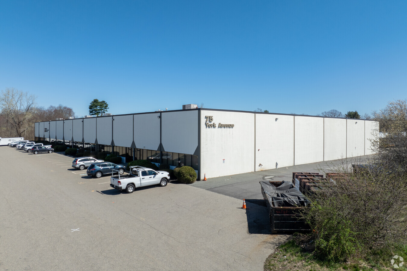
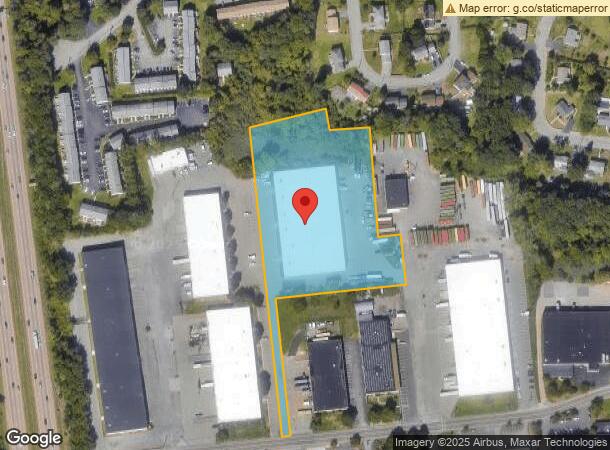
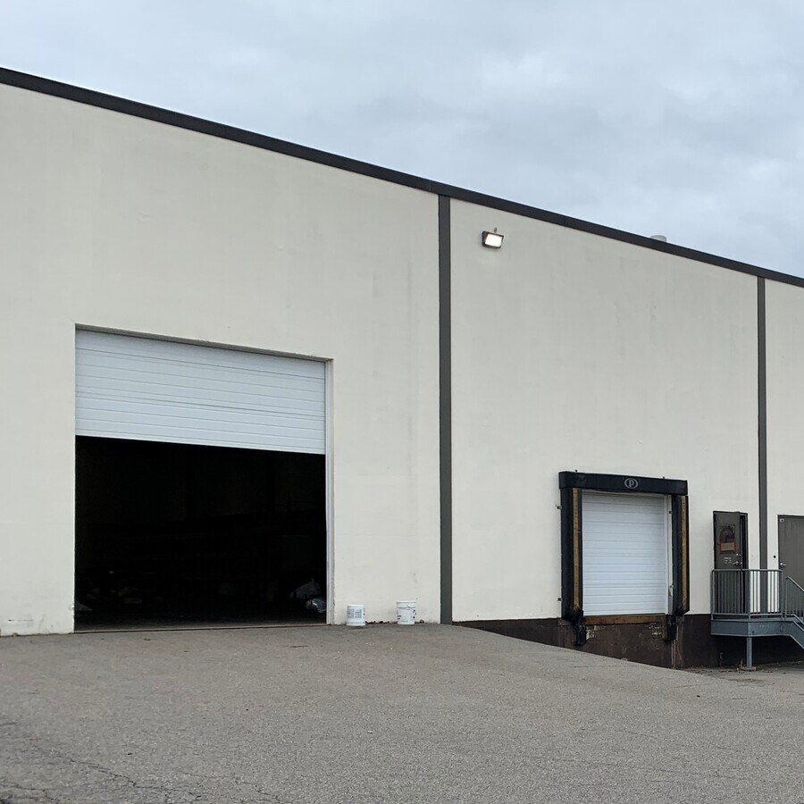
75 York Ave, Randolph, MA 02368
Current Lease Availabilities
NEARBY LISTINGS FOR SALE OR LEASE
Property Detail
75 York Ave
RAND-000026-B000000-000012
Norfolk
Warehouse
Massachusetts
X
12
25021C0212E
4.32 AC
2024
Route 24
2024
Boston
420202
Boston-Cambridge-Newton, MA-NH
54,000 SF
DEMOGRAPHICS near 75 York Ave
1 Mile
3 Mile
5 Mile
2024 Total Population
10,438
45,867
151,425
2029 Population
10,238
45,422
150,163
Pop Growth 2024-2029
(1.92%)
(0.97%)
(0.83%)
Average Age
41
42
42
2024 Total Households
3,798
16,537
56,992
HH Growth 2024-2029
(2.05%)
(1.03%)
(0.82%)
Median Household Inc
$82,918
$93,735
$104,616
Avg Household Size
2.70
2.70
2.60
2024 Avg HH Vehicles
2.00
2.00
2.00
Median Home Value
$444,236
$473,201
$538,675
Median Year Built
1967
1967
1964
Nearby Places
- Restaurants
- Banks
- Shops
- Fitness
- Groceries
PUBLIC TRANSPORTATION
COMMUTER RAIL
Holbrook/Randolph (Middleborough/Lakeville Line - Massachusetts Bay Transportation Authority Commuter Rail (Purple Line))
DRIVE
WALK
Distance
Holbrook/Randolph (Middleborough/Lakeville Line - Massachusetts Bay Transportation Authority Commuter Rail (Purple Line))
9 min
3.8 mi
Braintree (Kingston/Plymouth Line - Massachusetts Bay Transportation Authority Commuter Rail (Purple Line), Middleborough/Lakeville Line - Massachusetts Bay Transportation Authority Commuter Rail (Purple Line))
DRIVE
WALK
Distance
Braintree (Kingston/Plymouth Line - Massachusetts Bay Transportation Authority Commuter Rail (Purple Line), Middleborough/Lakeville Line - Massachusetts Bay Transportation Authority Commuter Rail (Purple Line))
13 min
5.6 mi
AIRPORT
General Edward Lawrence Logan International
DRIVE
WALK
Distance
General Edward Lawrence Logan International
30 min
17.8 mi
Freight Ports
Port of Boston
DRIVE
WALK
Distance
Port of Boston
27 min
15.6 mi
Nearby Properties
Address
Land Use
TOTAL SIZE
Lot Size
Zoning
Address
Land Use
TOTAL SIZE
Lot Size
Zoning
26,430 SF
38.40 AC
RMFD
Address
Land Use
TOTAL SIZE
Lot Size
Zoning
154,871 SF
34.30 AC
SRAA
Address
Land Use
TOTAL SIZE
Lot Size
Zoning
23.20 AC
RH
Address
Land Use
TOTAL SIZE
Lot Size
Zoning
37,252 SF
44.33 AC
SRAA
Address
Land Use
TOTAL SIZE
Lot Size
Zoning
13.08 AC
HB
Address
Land Use
TOTAL SIZE
Lot Size
Zoning
140,489 SF
36.47 AC
SRB
Address
Land Use
TOTAL SIZE
Lot Size
Zoning
254,787 SF
55.40 AC
Address
Land Use
TOTAL SIZE
Lot Size
Zoning
543,189 SF
22.90 AC
LI
Address
Land Use
TOTAL SIZE
Lot Size
Zoning
1,728 SF
40.20 AC
LI
Address
Land Use
TOTAL SIZE
Lot Size
Zoning
16.08 AC
OSC
Address
Land Use
TOTAL SIZE
Lot Size
Zoning
38,616 SF
160 AC
PROSD
Address
Land Use
TOTAL SIZE
Lot Size
Zoning
13.86 AC
I
Address
Land Use
TOTAL SIZE
Lot Size
Zoning
132,143 SF
23.70 AC
RH
Address
Land Use
TOTAL SIZE
Lot Size
Zoning
86,564 SF
8.45 AC
GBHD
Address
Land Use
TOTAL SIZE
Lot Size
Zoning
10.10 AC
CSBD
Address
Land Use
TOTAL SIZE
Lot Size
Zoning
7.27 AC
GB
Address
Land Use
TOTAL SIZE
Lot Size
Zoning
130,356 SF
14.70 AC
SRA
Address
Land Use
TOTAL SIZE
Lot Size
Zoning
128,753 SF
17.50 AC
SRAA
Address
Land Use
TOTAL SIZE
Lot Size
Zoning
494,520 SF
20.80 AC
IND
Address
Land Use
TOTAL SIZE
Lot Size
Zoning
146,402 SF
10 AC
RES
Address
Land Use
TOTAL SIZE
Lot Size
Zoning
138,400 SF
55.71 AC
RM
Address
Land Use
TOTAL SIZE
Lot Size
Zoning
150,000 SF
11.91 AC
HBD
Address
Land Use
TOTAL SIZE
Lot Size
Zoning
114,176 SF
11.69 AC
RH
Address
Land Use
TOTAL SIZE
Lot Size
Zoning
298,820 SF
19.65 AC
LI
Address
Land Use
TOTAL SIZE
Lot Size
Zoning
34.45 AC
HB
Address
Land Use
TOTAL SIZE
Lot Size
Zoning
141,373 SF
19.52 AC
LI
Address
Land Use
TOTAL SIZE
Lot Size
Zoning
128,760 SF
19.51 AC
LI
Address
Land Use
TOTAL SIZE
Lot Size
Zoning
66,139 SF
20.30 AC
SRA
Address
Land Use
TOTAL SIZE
Lot Size
Zoning
13,671 SF
592.70 AC
PROSD
Address
Land Use
TOTAL SIZE
Lot Size
Zoning
121,424 SF
11.11 AC
HB
The World's #1 Commercial Real Estate Marketplace
Connect with us
© 2025 CoStar Group
The information above has been obtained from sources believed reliable. While we do not doubt its accuracy we have not verified it and make no guarantee, warranty or representation about it. It is your responsibility to independently confirm its accuracy and completeness. Any projections, opinions, assumptions, or estimates used are for example only and do not represent the current or future performance of the property. The value of this transaction to you depends on tax and other factors which should be evaluated by your tax, financial, and legal advisors. You and your advisors should conduct a careful, independent investigation of the property to determine to your satisfaction the suitability of the property for your needs.