Property Record
7501 Us Highway 64 E, Ramseur, NC 27316
NEARBY LISTINGS FOR SALE OR LEASE
-
-
View all Ramseur listings for sale on LoopNet.com
Property Detail
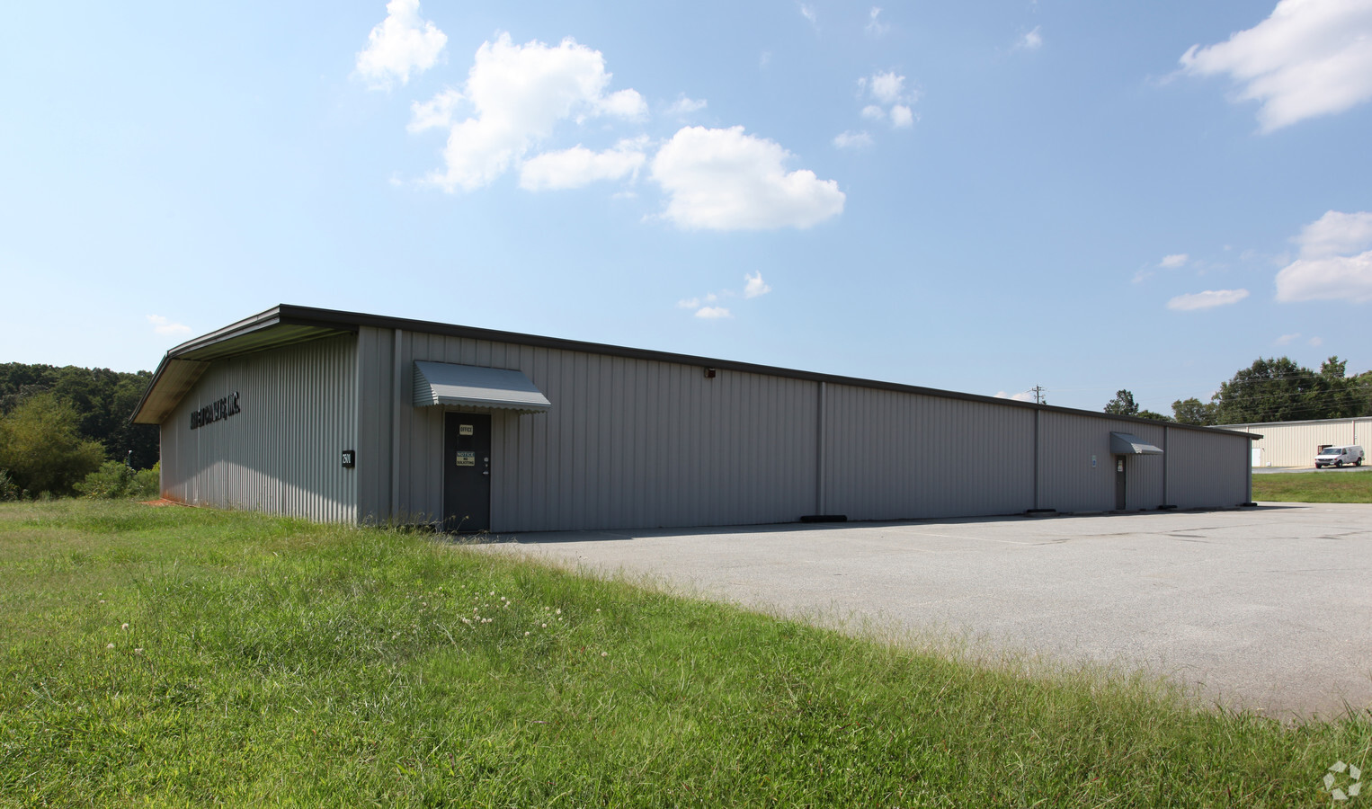
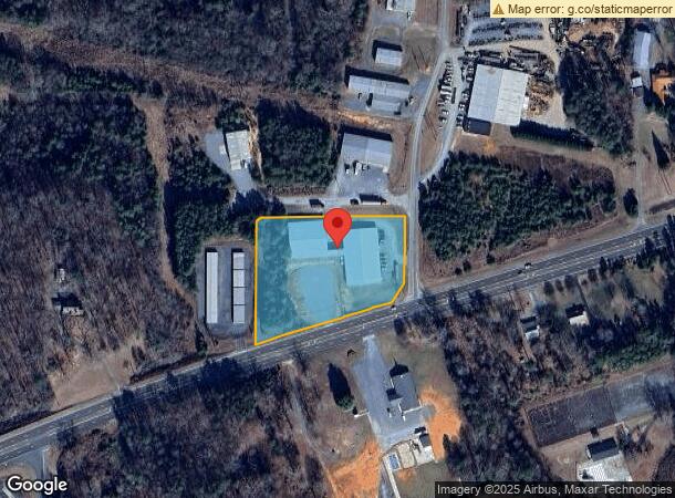
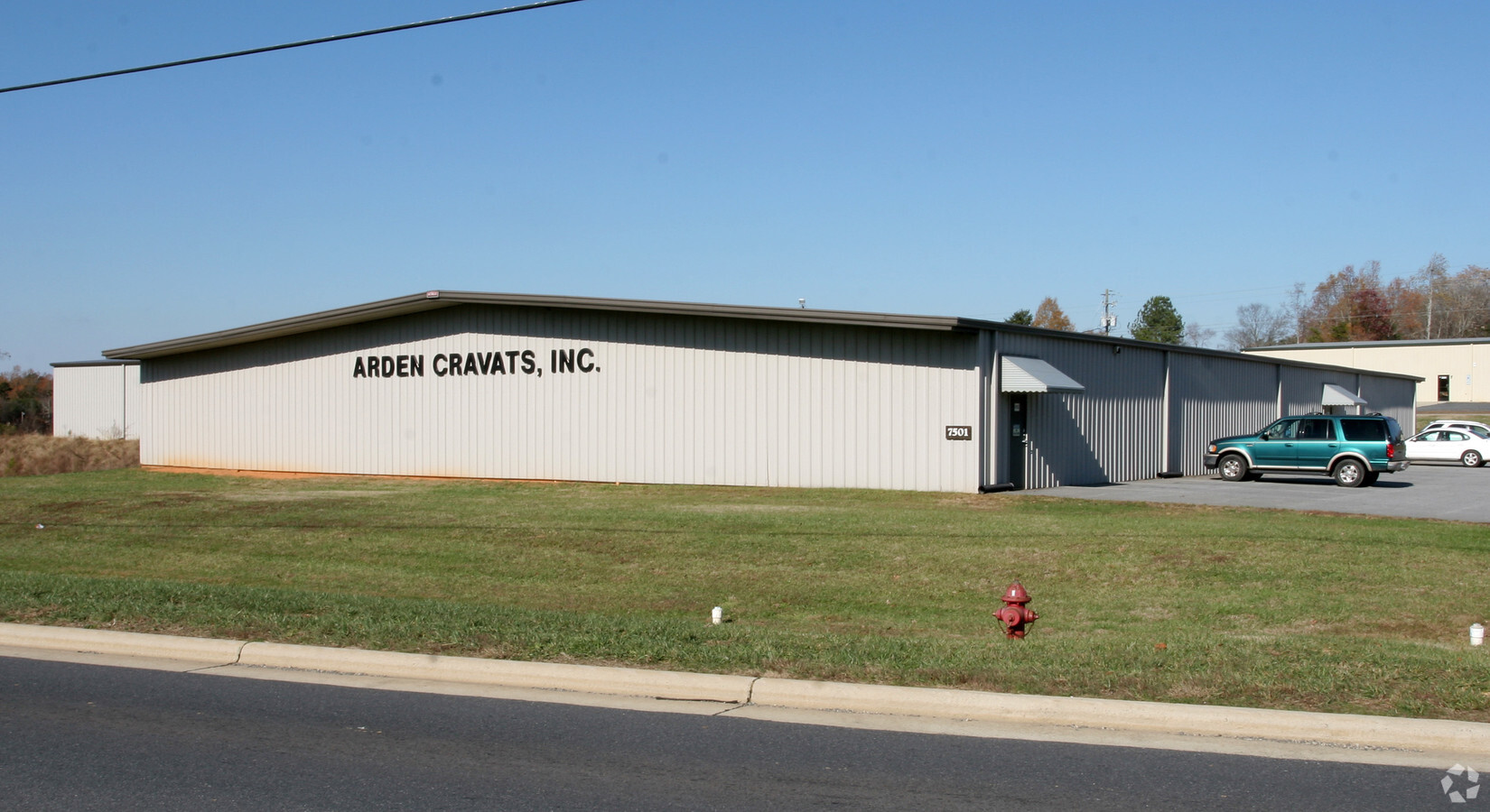
7501 Us Highway 64 E
Greensboro-High Point, NC
Eastern Randolph Ind Pk
8712-16-6672
EASTERN RANDOLPH IND PK;L1-2 PL:PB54-PG21
Warehouse
Randolph
X
North Carolina
3710871200J
1-2
2024
2.96 AC
2024
NE Randolph County
031002
Greensboro/Winston-Salem
11,445 SF
DEMOGRAPHICS near 7501 Us Highway 64 E
1 Mile
3 Mile
5 Mile
2024 Total Population
769
5,316
11,000
2029 Population
796
5,530
11,444
Pop Growth 2024-2029
+ 3.51%
+ 4.03%
+ 4.04%
Average Age
42
41
40
2024 Total Households
298
2,068
4,256
HH Growth 2024-2029
+ 3.36%
+ 4.01%
+ 3.99%
Median Household Inc
$39,761
$45,135
$52,100
Avg Household Size
2.50
2.50
2.50
2024 Avg HH Vehicles
2.00
2.00
2.00
Median Home Value
$142,941
$136,333
$145,762
Median Year Built
1973
1976
1980
Nearby Places
- Restaurants
- Banks
- Shops
- Fitness
- Groceries
PUBLIC TRANSPORTATION
AIRPORT
Piedmont Triad International
DRIVE
WALK
Distance
Piedmont Triad International
54 min
37.3 mi
Freight Ports
Port of Wilmington
DRIVE
WALK
Distance
Port of Wilmington
225 min
163.5 mi
Nearby Properties
Address
Land Use
TOTAL SIZE
Lot Size
Zoning
Address
Land Use
TOTAL SIZE
Lot Size
Zoning
1,388 SF
75.55 AC
RR
Address
Land Use
TOTAL SIZE
Lot Size
Zoning
2,720 SF
138.63 AC
NR
Address
Land Use
TOTAL SIZE
Lot Size
Zoning
1,092 SF
10.60 AC
RA20
Address
Land Use
TOTAL SIZE
Lot Size
Zoning
4.97 AC
I&C
Address
Land Use
TOTAL SIZE
Lot Size
Zoning
82,396 SF
42.04 AC
LI
Address
Land Use
TOTAL SIZE
Lot Size
Zoning
39,200 SF
39.10 AC
RR
Address
Land Use
TOTAL SIZE
Lot Size
Zoning
38,612 SF
3.76 AC
B
Address
Land Use
TOTAL SIZE
Lot Size
Zoning
1,728 SF
3.61 AC
RA
Address
Land Use
TOTAL SIZE
Lot Size
Zoning
54,690 SF
11.78 AC
I
Address
Land Use
TOTAL SIZE
Lot Size
Zoning
6,288 SF
4.30 AC
RA16
Address
Land Use
TOTAL SIZE
Lot Size
Zoning
4,752 SF
4.30 AC
B
Address
Land Use
TOTAL SIZE
Lot Size
Zoning
203,717 SF
72.25 AC
I
Address
Land Use
TOTAL SIZE
Lot Size
Zoning
825 SF
1.95 AC
B
Address
Land Use
TOTAL SIZE
Lot Size
Zoning
10,806 SF
2.72 AC
B
Address
Land Use
TOTAL SIZE
Lot Size
Zoning
16,056 SF
12.92 AC
I
Address
Land Use
TOTAL SIZE
Lot Size
Zoning
20,720 SF
1.57 AC
I&C
Address
Land Use
TOTAL SIZE
Lot Size
Zoning
10,268 SF
0.85 AC
I&C
Address
Land Use
TOTAL SIZE
Lot Size
Zoning
3,938 SF
2.26 AC
B
Address
Land Use
TOTAL SIZE
Lot Size
Zoning
4,800 SF
97.60 AC
RA
Address
Land Use
TOTAL SIZE
Lot Size
Zoning
9,360 SF
10.03 AC
LICD
Address
Land Use
TOTAL SIZE
Lot Size
Zoning
26,920 SF
17.21 AC
I
Address
Land Use
TOTAL SIZE
Lot Size
Zoning
11,200 SF
0.20 AC
I&C
Address
Land Use
TOTAL SIZE
Lot Size
Zoning
9,842 SF
0.87 AC
NB
Address
Land Use
TOTAL SIZE
Lot Size
Zoning
9,000 SF
3.37 AC
B
Address
Land Use
TOTAL SIZE
Lot Size
Zoning
8,368 SF
1.63 AC
B
Address
Land Use
TOTAL SIZE
Lot Size
Zoning
9,843 SF
1.50 AC
B
Address
Land Use
TOTAL SIZE
Lot Size
Zoning
7,684 SF
2.50 AC
B
Address
Land Use
TOTAL SIZE
Lot Size
Zoning
10,652 SF
1.10 AC
I&C
Address
Land Use
TOTAL SIZE
Lot Size
Zoning
6,187 SF
7.05 AC
HC
Address
Land Use
TOTAL SIZE
Lot Size
Zoning
4,227 SF
1.53 AC
B
The World's #1 Commercial Real Estate Marketplace
Connect with us
© 2025 CoStar Group
The information above has been obtained from sources believed reliable. While we do not doubt its accuracy we have not verified it and make no guarantee, warranty or representation about it. It is your responsibility to independently confirm its accuracy and completeness. Any projections, opinions, assumptions, or estimates used are for example only and do not represent the current or future performance of the property. The value of this transaction to you depends on tax and other factors which should be evaluated by your tax, financial, and legal advisors. You and your advisors should conduct a careful, independent investigation of the property to determine to your satisfaction the suitability of the property for your needs.