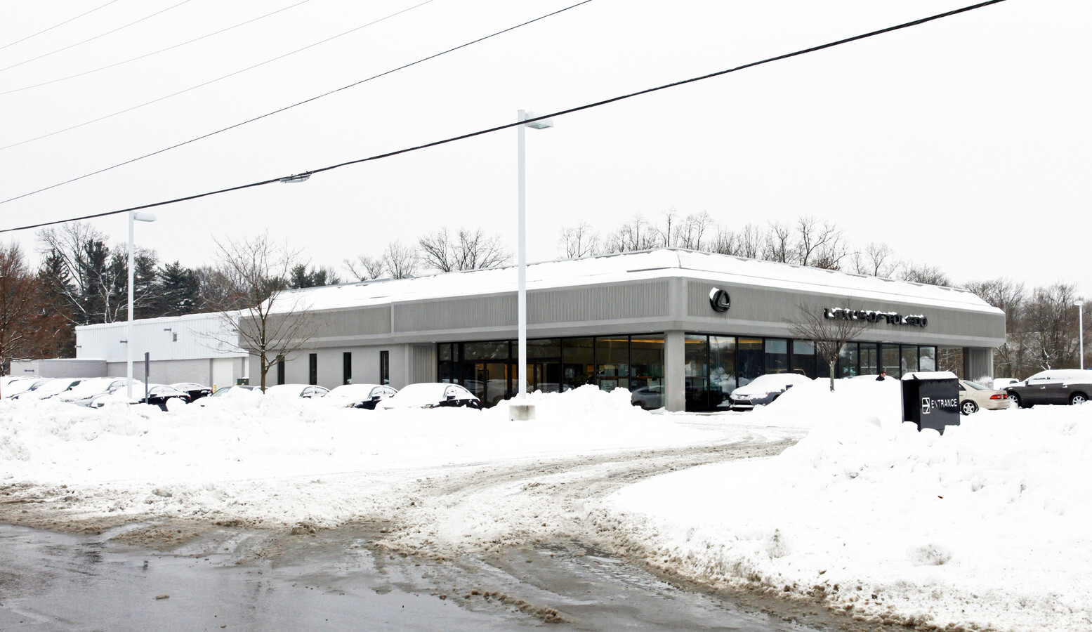
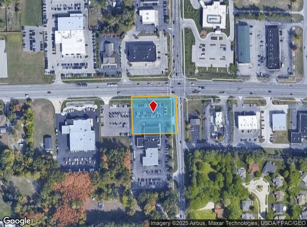
Property Record
7505 W Central Ave, Toledo, OH 43617
NEARBY LISTINGS FOR SALE OR LEASE
Property Detail
7505 W Central Ave
Toledo, OH
Central Acres
78-46434
CENTRAL ACRES LOT 1 EXC PT IN SR 20
Vehiclerentalsvehiclesales
Lucas
X
Ohio
39095C0061F
1
2023
1 AC
2023
West/Sylvania
009203
Toledo
24,820 SF
DEMOGRAPHICS near 7505 W Central Ave
1 Mile
3 Mile
5 Mile
2024 Total Population
4,952
47,621
107,680
2029 Population
4,829
46,966
105,732
Pop Growth 2024-2029
(2.48%)
(1.38%)
(1.81%)
Average Age
42
42
42
2024 Total Households
1,859
20,081
45,227
HH Growth 2024-2029
(2.42%)
(1.18%)
(1.76%)
Median Household Inc
$123,117
$81,306
$74,404
Avg Household Size
2.60
2.30
2.30
2024 Avg HH Vehicles
2.00
2.00
2.00
Median Home Value
$255,177
$215,479
$197,943
Median Year Built
1984
1984
1978
Nearby Places
- Restaurants
- Banks
- Shops
- Fitness
- Groceries
PUBLIC TRANSPORTATION
AIRPORT
Eugene F Kranz Toledo Express
DRIVE
WALK
Distance
Eugene F Kranz Toledo Express
27 min
13.8 mi
Freight Ports
Port of Toledo
DRIVE
WALK
Distance
Port of Toledo
30 min
17.3 mi
Nearby Properties
Address
Land Use
TOTAL SIZE
Lot Size
Zoning
Address
Land Use
TOTAL SIZE
Lot Size
Zoning
607,717 SF
7.39 AC
31-R3
Address
Land Use
TOTAL SIZE
Lot Size
Zoning
460,266 SF
85.36 AC
31-R1
Address
Land Use
TOTAL SIZE
Lot Size
Zoning
209,351 SF
49.06 AC
31-R1
Address
Land Use
TOTAL SIZE
Lot Size
Zoning
238,200 SF
32.90 AC
31-R1
Address
Land Use
TOTAL SIZE
Lot Size
Zoning
260,875 SF
9.91 AC
20-R5
Address
Land Use
TOTAL SIZE
Lot Size
Zoning
78,678 SF
10.20 AC
31-R1
Address
Land Use
TOTAL SIZE
Lot Size
Zoning
51,129 SF
460.05 AC
20-S1
Address
Land Use
TOTAL SIZE
Lot Size
Zoning
101,635 SF
34.34 AC
20-S1
Address
Land Use
TOTAL SIZE
Lot Size
Zoning
169,580 SF
8.98 AC
20-C2
Address
Land Use
TOTAL SIZE
Lot Size
Zoning
174,890 SF
19.86 AC
31-R3
Address
Land Use
TOTAL SIZE
Lot Size
Zoning
67,713 SF
10.24 AC
20-C2
Address
Land Use
TOTAL SIZE
Lot Size
Zoning
90,782 SF
18.24 AC
20-RA
Address
Land Use
TOTAL SIZE
Lot Size
Zoning
130,387 SF
8.50 AC
20-R5
Address
Land Use
TOTAL SIZE
Lot Size
Zoning
217,992 SF
39.78 AC
20-C2
Address
Land Use
TOTAL SIZE
Lot Size
Zoning
142,944 SF
11.66 AC
20-R5PUD
Address
Land Use
TOTAL SIZE
Lot Size
Zoning
70,550 SF
8.25 AC
31-B1
Address
Land Use
TOTAL SIZE
Lot Size
Zoning
214,400 SF
13.07 AC
20-C2
Address
Land Use
TOTAL SIZE
Lot Size
Zoning
218,603 SF
18 AC
10-MX
Address
Land Use
TOTAL SIZE
Lot Size
Zoning
63,445 SF
5.72 AC
20-C4
Address
Land Use
TOTAL SIZE
Lot Size
Zoning
119,804 SF
5.02 AC
31-R4
Address
Land Use
TOTAL SIZE
Lot Size
Zoning
74,418 SF
33.17 AC
20-A3
Address
Land Use
TOTAL SIZE
Lot Size
Zoning
65,182 SF
8.40 AC
19-PO
Address
Land Use
TOTAL SIZE
Lot Size
Zoning
36,153 SF
4.43 AC
20-C2
Address
Land Use
TOTAL SIZE
Lot Size
Zoning
61,404 SF
3.77 AC
31-R1
Address
Land Use
TOTAL SIZE
Lot Size
Zoning
130,168 SF
12 AC
31-R2
Address
Land Use
TOTAL SIZE
Lot Size
Zoning
111,872 SF
3.38 AC
31-R3
Address
Land Use
TOTAL SIZE
Lot Size
Zoning
140,008 SF
10 AC
19-R3
Address
Land Use
TOTAL SIZE
Lot Size
Zoning
50,394 SF
4.64 AC
20-A3
Address
Land Use
TOTAL SIZE
Lot Size
Zoning
122,154 SF
10.62 AC
20-MX
Address
Land Use
TOTAL SIZE
Lot Size
Zoning
50,394 SF
3.79 AC
20-MX
The World's #1 Commercial Real Estate Marketplace
Connect with us
© 2025 CoStar Group
The information above has been obtained from sources believed reliable. While we do not doubt its accuracy we have not verified it and make no guarantee, warranty or representation about it. It is your responsibility to independently confirm its accuracy and completeness. Any projections, opinions, assumptions, or estimates used are for example only and do not represent the current or future performance of the property. The value of this transaction to you depends on tax and other factors which should be evaluated by your tax, financial, and legal advisors. You and your advisors should conduct a careful, independent investigation of the property to determine to your satisfaction the suitability of the property for your needs.