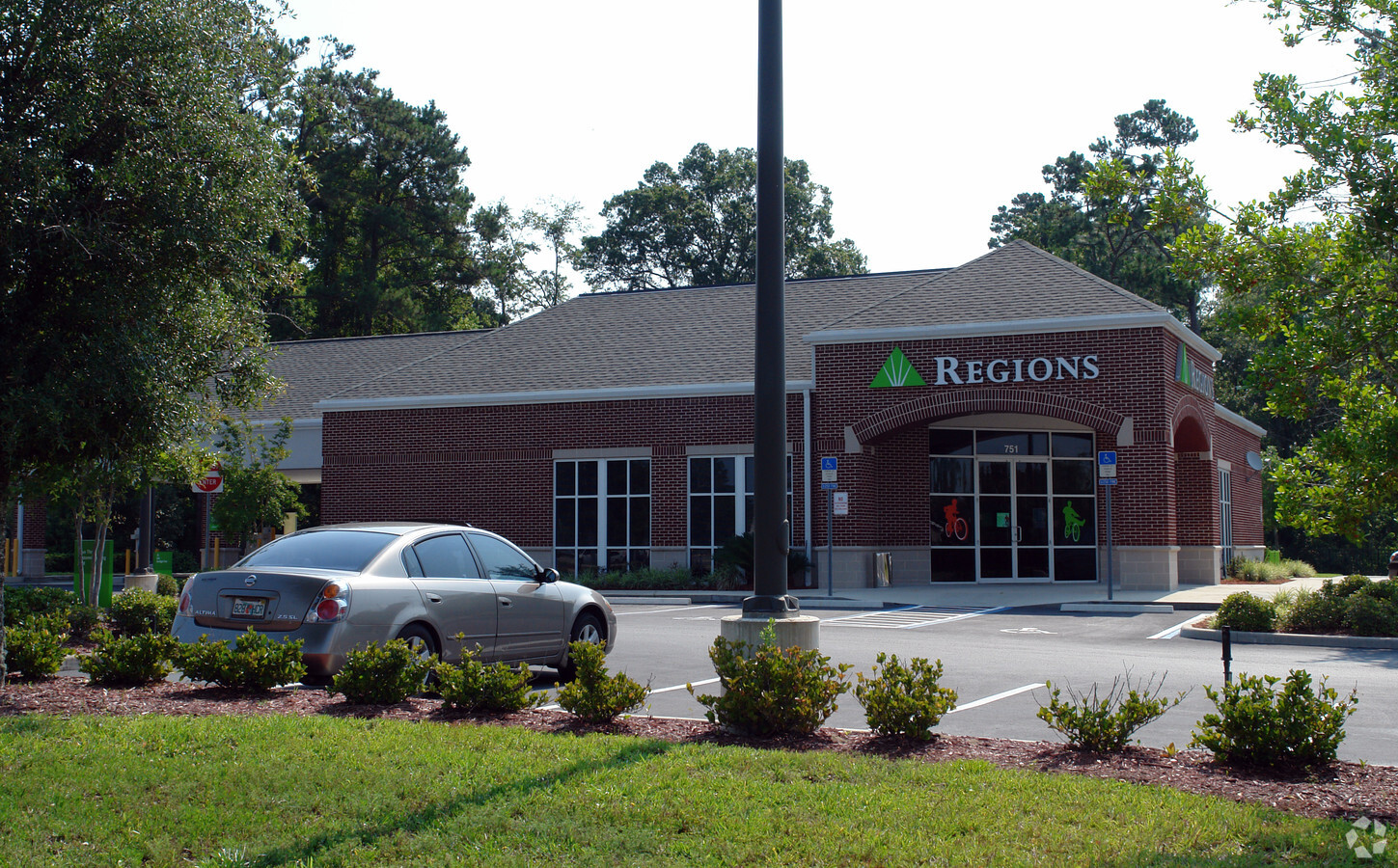
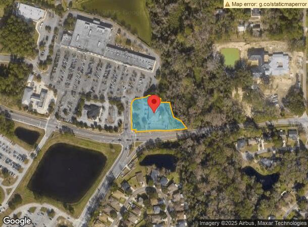
Property Record
751 Duval Station Rd, Jacksonville, FL 32218
NEARBY LISTINGS FOR SALE OR LEASE
Property Detail
751 Duval Station Rd
106606-0150
Broward Grant John S/D
Officebuilding
37-1N-27E 1.43 JOHN BROWARD GRANT PT S1/2 SEC 2 RECD O/R 20967-467
AE
Duval
12031C0201J
Florida
2023
1.44 AC
2024
Northeast Jacksonville
010101
Jacksonville (Florida)
6,647 SF
Jacksonville, FL
DEMOGRAPHICS near 751 Duval Station Rd
1 Mile
3 Mile
5 Mile
2024 Total Population
4,716
34,776
58,475
2029 Population
5,031
36,919
61,754
Pop Growth 2024-2029
+ 6.68%
+ 6.16%
+ 5.61%
Average Age
38
37
38
2024 Total Households
1,658
13,006
21,766
HH Growth 2024-2029
+ 6.82%
+ 6.57%
+ 5.90%
Median Household Inc
$86,961
$76,958
$75,509
Avg Household Size
2.80
2.60
2.60
2024 Avg HH Vehicles
2.00
2.00
2.00
Median Home Value
$259,090
$265,379
$261,752
Median Year Built
2004
2005
2003
Nearby Places
- Restaurants
- Banks
- Shops
- Fitness
- Groceries
PUBLIC TRANSPORTATION
AIRPORT
Jacksonville International
DRIVE
WALK
Distance
Jacksonville International
13 min
5.9 mi
Freight Ports
Jacksonville Port
DRIVE
WALK
Distance
Jacksonville Port
23 min
11.4 mi
SALE & LEASE HISTORY
LISTING DATE
SALE/LEASE

Nov 22, 2023
For Lease
Jul 11, 2021
For Lease
Nearby Properties
Address
Land Use
TOTAL SIZE
Lot Size
Zoning
Address
Land Use
TOTAL SIZE
Lot Size
Zoning
371,466 SF
42.67 AC
PUD
Address
Land Use
TOTAL SIZE
Lot Size
Zoning
189,895 SF
35.11 AC
PUD
Address
Land Use
TOTAL SIZE
Lot Size
Zoning
226,421 SF
1.89 AC
PUD
Address
Land Use
TOTAL SIZE
Lot Size
Zoning
403,103 SF
31.05 AC
PUD
Address
Land Use
TOTAL SIZE
Lot Size
Zoning
307,351 SF
34.25 AC
PUD
Address
Land Use
TOTAL SIZE
Lot Size
Zoning
328,039 SF
18.88 AC
PUD
Address
Land Use
TOTAL SIZE
Lot Size
Zoning
240,988 SF
18.11 AC
PUD
Address
Land Use
TOTAL SIZE
Lot Size
Zoning
237,807 SF
13.52 AC
CRO
Address
Land Use
TOTAL SIZE
Lot Size
Zoning
317,695 SF
15.88 AC
PUD
Address
Land Use
TOTAL SIZE
Lot Size
Zoning
317,815 SF
17.56 AC
PUD
Address
Land Use
TOTAL SIZE
Lot Size
Zoning
163,276 SF
8.39 AC
PUD
Address
Land Use
TOTAL SIZE
Lot Size
Zoning
353,240 SF
26.17 AC
PUD
Address
Land Use
TOTAL SIZE
Lot Size
Zoning
324,922 SF
19.11 AC
PUD
Address
Land Use
TOTAL SIZE
Lot Size
Zoning
117,647 SF
10.17 AC
PUD
Address
Land Use
TOTAL SIZE
Lot Size
Zoning
264,117 SF
22.48 AC
PUD
Address
Land Use
TOTAL SIZE
Lot Size
Zoning
181,545 SF
15.02 AC
PUD
Address
Land Use
TOTAL SIZE
Lot Size
Zoning
235,864 SF
18.14 AC
PUD
Address
Land Use
TOTAL SIZE
Lot Size
Zoning
317,321 SF
110.85 AC
PBF-1
Address
Land Use
TOTAL SIZE
Lot Size
Zoning
90,363 SF
11.12 AC
PUD
Address
Land Use
TOTAL SIZE
Lot Size
Zoning
110,059 SF
51.24 AC
PBF-2
Address
Land Use
TOTAL SIZE
Lot Size
Zoning
110,968 SF
5.75 AC
PUD
Address
Land Use
TOTAL SIZE
Lot Size
Zoning
505,376 SF
85.82 AC
IH
Address
Land Use
TOTAL SIZE
Lot Size
Zoning
28,653 SF
2.89 AC
PUD
Address
Land Use
TOTAL SIZE
Lot Size
Zoning
86,637 SF
8.09 AC
CCG-1
Address
Land Use
TOTAL SIZE
Lot Size
Zoning
36,288 SF
2.24 AC
CCG-1
Address
Land Use
TOTAL SIZE
Lot Size
Zoning
77,745 SF
10.92 AC
PUD
Address
Land Use
TOTAL SIZE
Lot Size
Zoning
81,802 SF
9.34 AC
PUD
Address
Land Use
TOTAL SIZE
Lot Size
Zoning
107,625 SF
9.08 AC
PUD
Address
Land Use
TOTAL SIZE
Lot Size
Zoning
28,377 SF
2.30 AC
CCG-1
Address
Land Use
TOTAL SIZE
Lot Size
Zoning
32,744 SF
3.68 AC
CCG-1
The World's #1 Commercial Real Estate Marketplace
Connect with us
© 2025 CoStar Group
The information above has been obtained from sources believed reliable. While we do not doubt its accuracy we have not verified it and make no guarantee, warranty or representation about it. It is your responsibility to independently confirm its accuracy and completeness. Any projections, opinions, assumptions, or estimates used are for example only and do not represent the current or future performance of the property. The value of this transaction to you depends on tax and other factors which should be evaluated by your tax, financial, and legal advisors. You and your advisors should conduct a careful, independent investigation of the property to determine to your satisfaction the suitability of the property for your needs.