Property Record
751 Paul Rd, Rochester, NY 14624
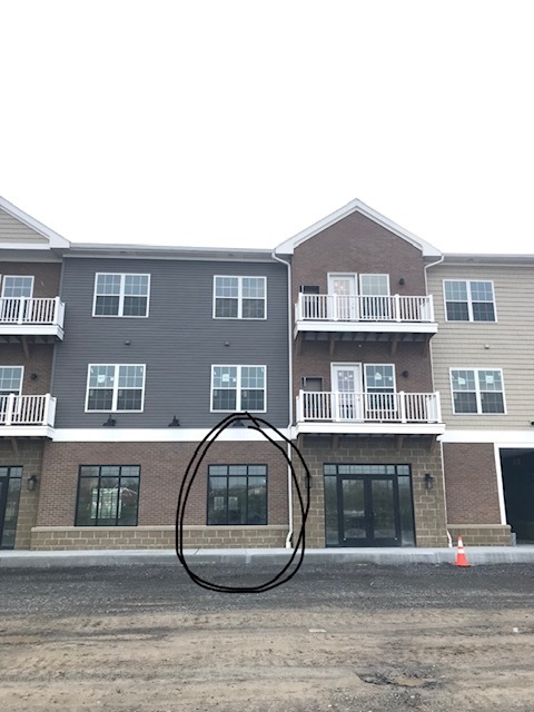


Current Lease Availabilities
NEARBY LISTINGS FOR SALE OR LEASE
Property Detail
751 Paul Rd
262200-146-100-0003-002-000
John Smith Allotment
Apartment
Monroe
X
New York
36055C0326G
2.000
2024
7.46 AC
2023
Southwest
014202
Rochester
63,134 SF
Rochester, NY
DEMOGRAPHICS near 751 Paul Rd
1 Mile
3 Mile
5 Mile
2024 Total Population
6,370
31,302
79,078
2029 Population
6,269
30,834
78,072
Pop Growth 2024-2029
(1.59%)
(1.50%)
(1.27%)
Average Age
43
43
40
2024 Total Households
2,678
13,082
30,398
HH Growth 2024-2029
(1.72%)
(1.61%)
(1.41%)
Median Household Inc
$76,027
$79,828
$72,693
Avg Household Size
2.30
2.30
2.30
2024 Avg HH Vehicles
2.00
2.00
2.00
Median Home Value
$162,337
$164,798
$161,508
Median Year Built
1974
1974
1973
Nearby Places
- Restaurants
- Banks
- Shops
- Fitness
- Groceries
PUBLIC TRANSPORTATION
COMMUTER RAIL
Rochester (Empire Service - VIA Rail, Lake Shore Limited - VIA Rail, Maple Leaf - VIA Rail, Toronto - New York - VIA Rail)
DRIVE
WALK
Distance
Rochester (Empire Service - VIA Rail, Lake Shore Limited - VIA Rail, Maple Leaf - VIA Rail, Toronto - New York - VIA Rail)
12 min
8.0 mi
AIRPORT
Frederick Douglass/Greater Rochester International
DRIVE
WALK
Distance
Frederick Douglass/Greater Rochester International
9 min
5.6 mi
Freight Ports
Albany, NY Port
DRIVE
WALK
Distance
Albany, NY Port
275 min
231.2 mi
Nearby Properties
Address
Land Use
TOTAL SIZE
Lot Size
Zoning
Address
Land Use
TOTAL SIZE
Lot Size
Zoning
796,051 SF
100.85 AC
06 - INDUS
Address
Land Use
TOTAL SIZE
Lot Size
Zoning
Address
Land Use
TOTAL SIZE
Lot Size
Zoning
628,572 SF
134.14 AC
06 - INDUS
Address
Land Use
TOTAL SIZE
Lot Size
Zoning
Address
Land Use
TOTAL SIZE
Lot Size
Zoning
348,895 SF
76.07 AC
06 - INDUS
Address
Land Use
TOTAL SIZE
Lot Size
Zoning
11,408 SF
98.28 AC
02 - SINGL
Address
Land Use
TOTAL SIZE
Lot Size
Zoning
383,426 SF
95.70 AC
06 - INDUS
Address
Land Use
TOTAL SIZE
Lot Size
Zoning
540,000 SF
39.70 AC
06 - INDUS
Address
Land Use
TOTAL SIZE
Lot Size
Zoning
671,599 SF
33.10 AC
06 - INDUS
Address
Land Use
TOTAL SIZE
Lot Size
Zoning
109,772 SF
10.42 AC
06 - INDUS
Address
Land Use
TOTAL SIZE
Lot Size
Zoning
97,320 SF
19.54 AC
05 - COMME
Address
Land Use
TOTAL SIZE
Lot Size
Zoning
201,774 SF
17.17 AC
05 - COMME
Address
Land Use
TOTAL SIZE
Lot Size
Zoning
3,780 SF
33.10 AC
02 - SINGL
Address
Land Use
TOTAL SIZE
Lot Size
Zoning
1,440 SF
5.40 AC
02 - SINGL
Address
Land Use
TOTAL SIZE
Lot Size
Zoning
119,706 SF
16.43 AC
05 - COMME
Address
Land Use
TOTAL SIZE
Lot Size
Zoning
22,116 SF
42.83 AC
02 - SINGL
Address
Land Use
TOTAL SIZE
Lot Size
Zoning
2,080 SF
14.39 AC
03 - MULTI
Address
Land Use
TOTAL SIZE
Lot Size
Zoning
6,960 SF
20.31 AC
02 - SINGL
Address
Land Use
TOTAL SIZE
Lot Size
Zoning
127,786 SF
11.31 AC
05 - COMME
Address
Land Use
TOTAL SIZE
Lot Size
Zoning
290 AC
06 - INDUS
Address
Land Use
TOTAL SIZE
Lot Size
Zoning
14,268 SF
36.20 AC
MFR
Address
Land Use
TOTAL SIZE
Lot Size
Zoning
18,496 SF
19.38 AC
03 - MULTI
Address
Land Use
TOTAL SIZE
Lot Size
Zoning
44,132 SF
30.45 AC
06 - INDUS
Address
Land Use
TOTAL SIZE
Lot Size
Zoning
4,448 SF
18.78 AC
05 - COMME
Address
Land Use
TOTAL SIZE
Lot Size
Zoning
62,915 SF
6.77 AC
02 - SINGL
Address
Land Use
TOTAL SIZE
Lot Size
Zoning
7,490 SF
50.50 AC
06 - INDUS
Address
Land Use
TOTAL SIZE
Lot Size
Zoning
116,193 SF
12.23 AC
05 - COMME
Address
Land Use
TOTAL SIZE
Lot Size
Zoning
0.91 AC
06 - INDUS
Address
Land Use
TOTAL SIZE
Lot Size
Zoning
56,848 SF
28.90 AC
06 - INDUS
The World's #1 Commercial Real Estate Marketplace
Connect with us
© 2025 CoStar Group
The information above has been obtained from sources believed reliable. While we do not doubt its accuracy we have not verified it and make no guarantee, warranty or representation about it. It is your responsibility to independently confirm its accuracy and completeness. Any projections, opinions, assumptions, or estimates used are for example only and do not represent the current or future performance of the property. The value of this transaction to you depends on tax and other factors which should be evaluated by your tax, financial, and legal advisors. You and your advisors should conduct a careful, independent investigation of the property to determine to your satisfaction the suitability of the property for your needs.