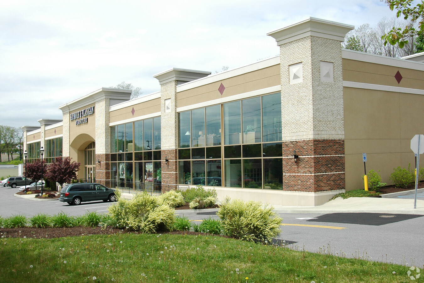
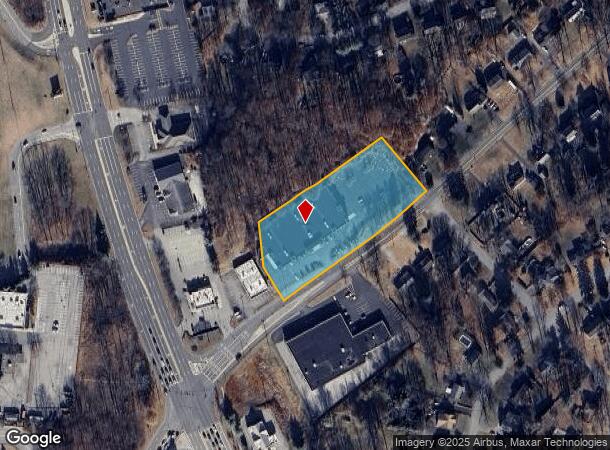
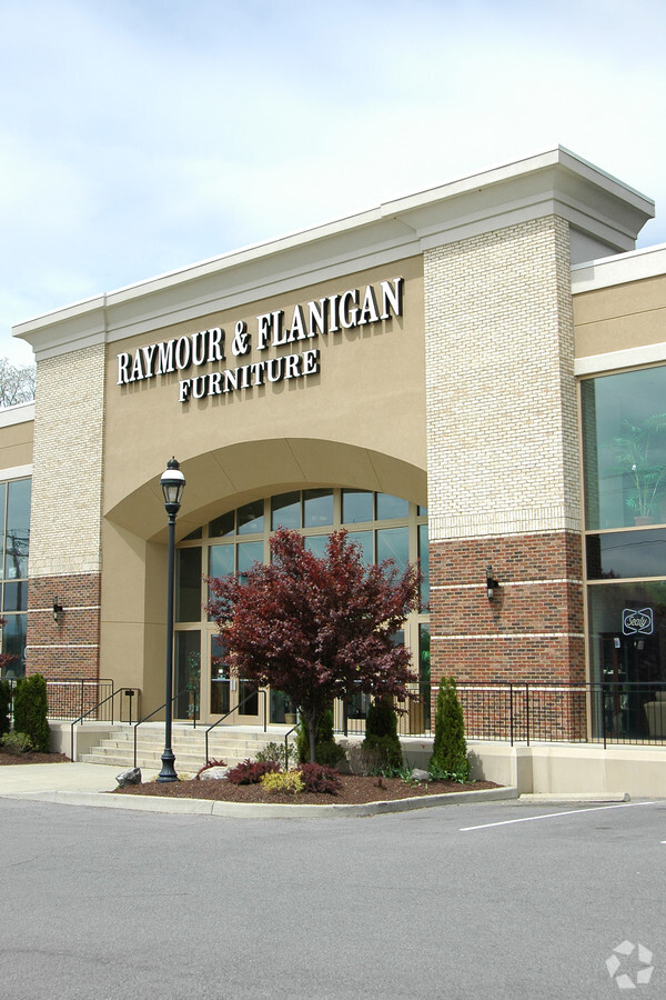
Property Record
756 Vassar Rd, Poughkeepsie, NY 12603
NEARBY LISTINGS FOR SALE OR LEASE
Property Detail
756 Vassar Rd
134689-6158-01-450973-0000
2.5 AC 1574 0147 1207 0158
Commercialnec
Dutchess
X
New York
36027C0456E
450
2024
2.50 AC
2023
Fishkill
140700
Westchester/So Connecticut
60,000 SF
Dutchess County-Putnam County, NY
DEMOGRAPHICS near 756 Vassar Rd
1 Mile
3 Mile
5 Mile
2024 Total Population
4,957
32,573
71,011
2029 Population
4,986
32,522
70,862
Pop Growth 2024-2029
+ 0.59%
(0.16%)
(0.21%)
Average Age
44
42
43
2024 Total Households
1,993
12,256
27,535
HH Growth 2024-2029
+ 0.55%
(0.17%)
(0.23%)
Median Household Inc
$98,693
$99,486
$102,355
Avg Household Size
2.50
2.60
2.50
2024 Avg HH Vehicles
2.00
2.00
2.00
Median Home Value
$327,717
$339,420
$341,097
Median Year Built
1966
1965
1968
Nearby Places
- Restaurants
- Banks
- Shops
- Fitness
- Groceries
PUBLIC TRANSPORTATION
COMMUTER RAIL
New Hamburg Station (Hudson Line - Metro-North Commuter Railroad Company (Metro-North))
DRIVE
WALK
Distance
New Hamburg Station (Hudson Line - Metro-North Commuter Railroad Company (Metro-North))
7 min
3.0 mi
Poughkeepsie Station (Hudson Line - Metro-North Commuter Railroad Company (Metro-North))
DRIVE
WALK
Distance
Poughkeepsie Station (Hudson Line - Metro-North Commuter Railroad Company (Metro-North))
10 min
6.8 mi
AIRPORT
New York Stewart International
DRIVE
WALK
Distance
New York Stewart International
30 min
20.0 mi
Freight Ports
Port of New Haven
DRIVE
WALK
Distance
Port of New Haven
99 min
74.0 mi
Nearby Properties
Address
Land Use
TOTAL SIZE
Lot Size
Zoning
Address
Land Use
TOTAL SIZE
Lot Size
Zoning
180.09 AC
IH
Address
Land Use
TOTAL SIZE
Lot Size
Zoning
802,007 SF
78.21 AC
BH
Address
Land Use
TOTAL SIZE
Lot Size
Zoning
11.76 AC
R4A
Address
Land Use
TOTAL SIZE
Lot Size
Zoning
11,803 SF
104.52 AC
IH
Address
Land Use
TOTAL SIZE
Lot Size
Zoning
50,363 SF
47.88 AC
IH/R1
Address
Land Use
TOTAL SIZE
Lot Size
Zoning
16,947 SF
6.40 AC
IH
Address
Land Use
TOTAL SIZE
Lot Size
Zoning
293,984 SF
47.95 AC
RMF5
Address
Land Use
TOTAL SIZE
Lot Size
Zoning
197,820 SF
56.20 AC
R20
Address
Land Use
TOTAL SIZE
Lot Size
Zoning
535,543 SF
72.62 AC
BSC
Address
Land Use
TOTAL SIZE
Lot Size
Zoning
143,274 SF
31.04 AC
R20/40
Address
Land Use
TOTAL SIZE
Lot Size
Zoning
104,800 SF
17.20 AC
R20
Address
Land Use
TOTAL SIZE
Lot Size
Zoning
126,616 SF
25.57 AC
R20
Address
Land Use
TOTAL SIZE
Lot Size
Zoning
6.70 AC
R-1.5A
Address
Land Use
TOTAL SIZE
Lot Size
Zoning
151,698 SF
22.50 AC
PI
Address
Land Use
TOTAL SIZE
Lot Size
Zoning
40,030 SF
4.50 AC
HB
Address
Land Use
TOTAL SIZE
Lot Size
Zoning
211,760 SF
86.81 AC
SC
Address
Land Use
TOTAL SIZE
Lot Size
Zoning
32,920 SF
21.55 AC
CB-30
Address
Land Use
TOTAL SIZE
Lot Size
Zoning
114,443 SF
43.60 AC
IN
Address
Land Use
TOTAL SIZE
Lot Size
Zoning
98,700 SF
10 AC
BSC
Address
Land Use
TOTAL SIZE
Lot Size
Zoning
92,574 SF
9.31 AC
BH
Address
Land Use
TOTAL SIZE
Lot Size
Zoning
128,806 SF
11.93 AC
BSC
Address
Land Use
TOTAL SIZE
Lot Size
Zoning
128,883 SF
8.63 AC
BH
Address
Land Use
TOTAL SIZE
Lot Size
Zoning
160,214 SF
17.47 AC
R20
Address
Land Use
TOTAL SIZE
Lot Size
Zoning
Address
Land Use
TOTAL SIZE
Lot Size
Zoning
52,807 SF
10.87 AC
R20
Address
Land Use
TOTAL SIZE
Lot Size
Zoning
100 SF
5.70 AC
IN
Address
Land Use
TOTAL SIZE
Lot Size
Zoning
65,100 SF
1.31 AC
BH
Address
Land Use
TOTAL SIZE
Lot Size
Zoning
512,000 SF
67 AC
AI
Address
Land Use
TOTAL SIZE
Lot Size
Zoning
510.80 AC
AI
Address
Land Use
TOTAL SIZE
Lot Size
Zoning
The World's #1 Commercial Real Estate Marketplace
Connect with us
© 2025 CoStar Group
The information above has been obtained from sources believed reliable. While we do not doubt its accuracy we have not verified it and make no guarantee, warranty or representation about it. It is your responsibility to independently confirm its accuracy and completeness. Any projections, opinions, assumptions, or estimates used are for example only and do not represent the current or future performance of the property. The value of this transaction to you depends on tax and other factors which should be evaluated by your tax, financial, and legal advisors. You and your advisors should conduct a careful, independent investigation of the property to determine to your satisfaction the suitability of the property for your needs.