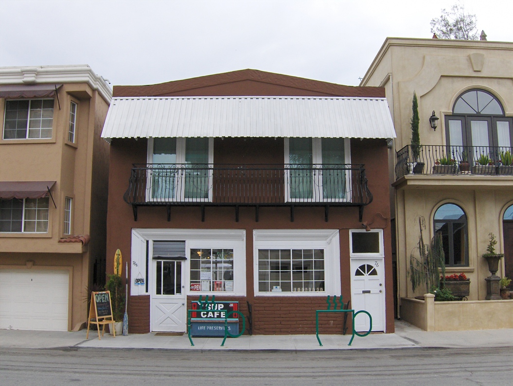
Property Record
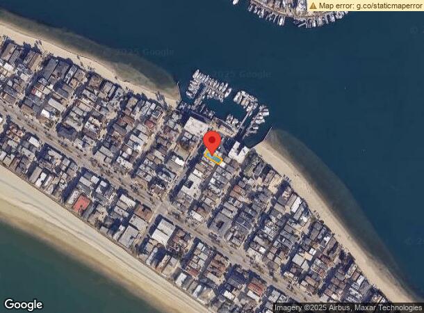
76 62Nd Pl, Long Beach, CA 90803

NEARBY LISTINGS FOR SALE OR LEASE
Property Detail
76 62Nd Pl
Los Angeles-Long Beach-Glendale, CA
Alamitos Bay Tract
7245-022-025
ALAMITOS BAY TRACT LOT/SEC 28 BLK/DIV/TWN 11
Retailwithmorethanonenonretailuse
Los Angeles
AE
California
06037C2076G
28
2024
0.05 AC
2024
Long Beach: Downtown
577504
Los Angeles
2,374 SF
DEMOGRAPHICS near 76 62Nd Pl
1 Mile
3 Mile
5 Mile
2024 Total Population
12,004
102,605
321,355
2029 Population
11,755
100,047
313,351
Pop Growth 2024-2029
(2.07%)
(2.49%)
(2.49%)
Average Age
48
45
41
2024 Total Households
6,355
49,305
133,885
HH Growth 2024-2029
(2.27%)
(2.62%)
(2.55%)
Median Household Inc
$102,663
$86,815
$79,471
Avg Household Size
1.90
2.00
2.30
2024 Avg HH Vehicles
2.00
2.00
2.00
Median Home Value
$1,091,283
$842,683
$801,806
Median Year Built
1963
1962
1963
Nearby Places
- Restaurants
- Banks
- Shops
- Fitness
- Groceries
PUBLIC TRANSPORTATION
AIRPORT
Long Beach (Daugherty Field)
DRIVE
WALK
Distance
Long Beach (Daugherty Field)
16 min
7.3 mi
John Wayne/Orange County
DRIVE
WALK
Distance
John Wayne/Orange County
28 min
18.4 mi
Los Angeles International
DRIVE
WALK
Distance
Los Angeles International
40 min
26.6 mi
Freight Ports
Port of Long Beach
DRIVE
WALK
Distance
Port of Long Beach
11 min
4.1 mi
SALE & LEASE HISTORY
LISTING DATE
SALE/LEASE

Sep 23, 2016
For Sale
Nearby Properties
Address
Land Use
TOTAL SIZE
Lot Size
Zoning
Address
Land Use
TOTAL SIZE
Lot Size
Zoning
225,557 SF
10.81 AC
LBPD1
Address
Land Use
TOTAL SIZE
Lot Size
Zoning
454,844 SF
11.37 AC
Address
Land Use
TOTAL SIZE
Lot Size
Zoning
735.20 AC
Address
Land Use
TOTAL SIZE
Lot Size
Zoning
650.36 AC
Address
Land Use
TOTAL SIZE
Lot Size
Zoning
74,318 SF
18.19 AC
NEW SHOP C
Address
Land Use
TOTAL SIZE
Lot Size
Zoning
140,236 SF
9.21 AC
LBR4N
Address
Land Use
TOTAL SIZE
Lot Size
Zoning
199,137 SF
6.39 AC
LBR4R
Address
Land Use
TOTAL SIZE
Lot Size
Zoning
256,538 SF
6.17 AC
NEW SHOPIN
Address
Land Use
TOTAL SIZE
Lot Size
Zoning
135,666 SF
LAM3
Address
Land Use
TOTAL SIZE
Lot Size
Zoning
414,067 SF
9.31 AC
LBCCA
Address
Land Use
TOTAL SIZE
Lot Size
Zoning
16.18 AC
Address
Land Use
TOTAL SIZE
Lot Size
Zoning
54,112 SF
15.43 AC
LBPD1
Address
Land Use
TOTAL SIZE
Lot Size
Zoning
73,076 SF
2.53 AC
LBPD1
Address
Land Use
TOTAL SIZE
Lot Size
Zoning
320.34 AC
Address
Land Use
TOTAL SIZE
Lot Size
Zoning
11.97 AC
Address
Land Use
TOTAL SIZE
Lot Size
Zoning
3.32 AC
Address
Land Use
TOTAL SIZE
Lot Size
Zoning
200,280 SF
13.17 AC
LBPD1
Address
Land Use
TOTAL SIZE
Lot Size
Zoning
58,174 SF
0.80 AC
LBPD2
Address
Land Use
TOTAL SIZE
Lot Size
Zoning
11.93 AC
Address
Land Use
TOTAL SIZE
Lot Size
Zoning
116,184 SF
1.17 AC
LBCCA
Address
Land Use
TOTAL SIZE
Lot Size
Zoning
110,432 SF
7.16 AC
LBCCA
Address
Land Use
TOTAL SIZE
Lot Size
Zoning
Address
Land Use
TOTAL SIZE
Lot Size
Zoning
60,652 SF
0.91 AC
LBR1N
Address
Land Use
TOTAL SIZE
Lot Size
Zoning
318,008 SF
11.75 AC
LBR4R
Address
Land Use
TOTAL SIZE
Lot Size
Zoning
9.24 AC
Address
Land Use
TOTAL SIZE
Lot Size
Zoning
Address
Land Use
TOTAL SIZE
Lot Size
Zoning
Address
Land Use
TOTAL SIZE
Lot Size
Zoning
5.50 AC
Address
Land Use
TOTAL SIZE
Lot Size
Zoning
3.22 AC
Address
Land Use
TOTAL SIZE
Lot Size
Zoning
5.41 AC
The World's #1 Commercial Real Estate Marketplace
Connect with us
© 2025 CoStar Group
The information above has been obtained from sources believed reliable. While we do not doubt its accuracy we have not verified it and make no guarantee, warranty or representation about it. It is your responsibility to independently confirm its accuracy and completeness. Any projections, opinions, assumptions, or estimates used are for example only and do not represent the current or future performance of the property. The value of this transaction to you depends on tax and other factors which should be evaluated by your tax, financial, and legal advisors. You and your advisors should conduct a careful, independent investigation of the property to determine to your satisfaction the suitability of the property for your needs.