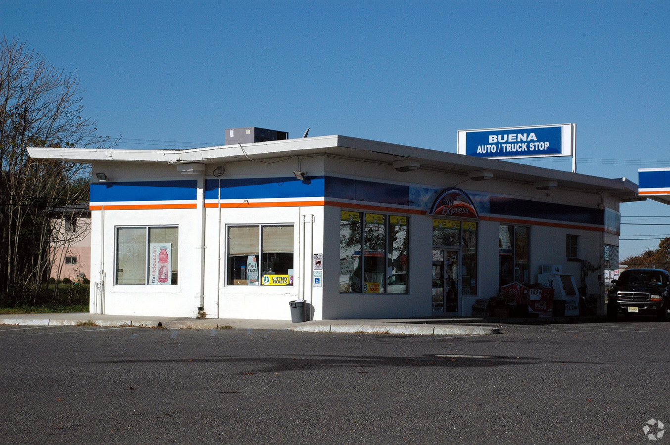
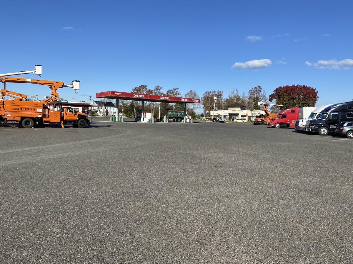
Property Record
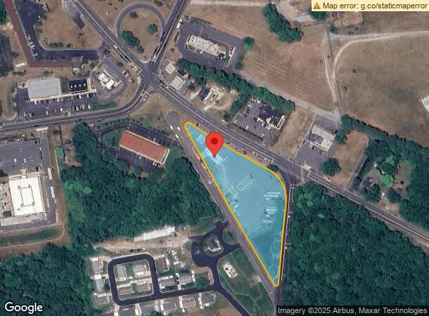
760 S Harding Hwy, Buena, NJ 08310
NEARBY LISTINGS FOR SALE OR LEASE
Property Detail
760 S Harding Hwy
Atlantic City-Hammonton, NJ
Buena Vista
05-05401-0000-00001
GAS STATION
Servicestation
Atlantic
X
New Jersey
34001C0095F
1
2024
2.62 AC
2024
Atlantic City/Hammonton
011300
Philadelphia
DEMOGRAPHICS near 760 S Harding Hwy
1 Mile
3 Mile
5 Mile
2024 Total Population
1,703
7,261
29,110
2029 Population
1,659
7,121
28,679
Pop Growth 2024-2029
(2.58%)
(1.93%)
(1.48%)
Average Age
44
42
42
2024 Total Households
674
2,834
11,094
HH Growth 2024-2029
(3.26%)
(2.47%)
(1.73%)
Median Household Inc
$64,945
$72,523
$77,060
Avg Household Size
2.50
2.50
2.60
2024 Avg HH Vehicles
2.00
2.00
2.00
Median Home Value
$187,583
$216,776
$225,238
Median Year Built
1968
1969
1971
Nearby Places
- Restaurants
- Banks
- Shops
- Fitness
- Groceries
PUBLIC TRANSPORTATION
AIRPORT
Atlantic City International
DRIVE
WALK
Distance
Atlantic City International
54 min
23.8 mi
Freight Ports
Broadway Terminal - Pier 5
DRIVE
WALK
Distance
Broadway Terminal - Pier 5
47 min
37.0 mi
SALE & LEASE HISTORY
LISTING DATE
SALE/LEASE

Mar 16, 2023
For Sale
Nearby Properties
Address
Land Use
TOTAL SIZE
Lot Size
Zoning
Address
Land Use
TOTAL SIZE
Lot Size
Zoning
286.98 AC
RDR1
Address
Land Use
TOTAL SIZE
Lot Size
Zoning
21.61 AC
PVR2
Address
Land Use
TOTAL SIZE
Lot Size
Zoning
8.53 AC
R-3
Address
Land Use
TOTAL SIZE
Lot Size
Zoning
32.41 AC
A
Address
Land Use
TOTAL SIZE
Lot Size
Zoning
11.44 AC
RA/B
Address
Land Use
TOTAL SIZE
Lot Size
Zoning
11.67 AC
Address
Land Use
TOTAL SIZE
Lot Size
Zoning
22.81 AC
R-4
Address
Land Use
TOTAL SIZE
Lot Size
Zoning
13.23 AC
Address
Land Use
TOTAL SIZE
Lot Size
Zoning
14.07 AC
AP
Address
Land Use
TOTAL SIZE
Lot Size
Zoning
3.48 AC
B3
Address
Land Use
TOTAL SIZE
Lot Size
Zoning
103.71 AC
RDR1
Address
Land Use
TOTAL SIZE
Lot Size
Zoning
6.16 AC
B1
Address
Land Use
TOTAL SIZE
Lot Size
Zoning
32.34 AC
Address
Land Use
TOTAL SIZE
Lot Size
Zoning
3.07 AC
R-2
Address
Land Use
TOTAL SIZE
Lot Size
Zoning
5.86 AC
A
Address
Land Use
TOTAL SIZE
Lot Size
Zoning
7.94 AC
R2
Address
Land Use
TOTAL SIZE
Lot Size
Zoning
4.28 AC
R-3
Address
Land Use
TOTAL SIZE
Lot Size
Zoning
21.04 AC
FA1
Address
Land Use
TOTAL SIZE
Lot Size
Zoning
0.60 AC
R-2
Address
Land Use
TOTAL SIZE
Lot Size
Zoning
0.67 AC
Address
Land Use
TOTAL SIZE
Lot Size
Zoning
8.25 AC
A
Address
Land Use
TOTAL SIZE
Lot Size
Zoning
4.74 AC
Address
Land Use
TOTAL SIZE
Lot Size
Zoning
414 SF
4.94 AC
Address
Land Use
TOTAL SIZE
Lot Size
Zoning
4.98 AC
A
Address
Land Use
TOTAL SIZE
Lot Size
Zoning
10.58 AC
Address
Land Use
TOTAL SIZE
Lot Size
Zoning
7,680 SF
81.88 AC
FA1
Address
Land Use
TOTAL SIZE
Lot Size
Zoning
11.59 AC
R-4
Address
Land Use
TOTAL SIZE
Lot Size
Zoning
18.80 AC
R-3
Address
Land Use
TOTAL SIZE
Lot Size
Zoning
1.75 AC
R-2
Address
Land Use
TOTAL SIZE
Lot Size
Zoning
6.21 AC
The World's #1 Commercial Real Estate Marketplace
Connect with us
© 2025 CoStar Group
The information above has been obtained from sources believed reliable. While we do not doubt its accuracy we have not verified it and make no guarantee, warranty or representation about it. It is your responsibility to independently confirm its accuracy and completeness. Any projections, opinions, assumptions, or estimates used are for example only and do not represent the current or future performance of the property. The value of this transaction to you depends on tax and other factors which should be evaluated by your tax, financial, and legal advisors. You and your advisors should conduct a careful, independent investigation of the property to determine to your satisfaction the suitability of the property for your needs.