Property Record
761 Route 40, Monroeville, NJ 08343

NEARBY LISTINGS FOR SALE OR LEASE
-
-
View all Monroeville listings for sale on LoopNet.com
Property Detail
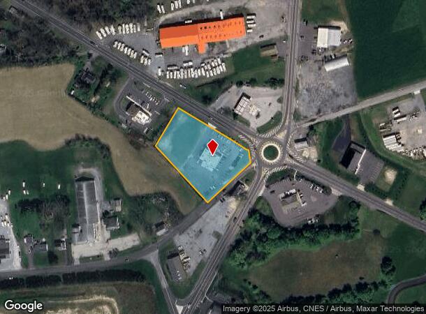
761 Route 40
14-00061-0000-00020
Salem
Restaurantbuilding
New Jersey
X
20
34033C0205C
2.01 AC
2023
Salem County
2024
Philadelphia
020900
Philadelphia-Camden-Wilmington, PA-NJ-DE-MD
4,404 SF
DEMOGRAPHICS near 761 Route 40
1 Mile
3 Mile
5 Mile
2024 Total Population
227
1,495
8,345
2029 Population
222
1,457
8,361
Pop Growth 2024-2029
(2.20%)
(2.54%)
+ 0.19%
Average Age
45
44
43
2024 Total Households
85
568
3,106
HH Growth 2024-2029
(2.35%)
(2.64%)
+ 0.10%
Median Household Inc
$101,389
$93,631
$107,618
Avg Household Size
2.50
2.50
2.60
2024 Avg HH Vehicles
3.00
3.00
2.00
Median Home Value
$303,704
$301,471
$305,815
Median Year Built
1970
1970
1974
Nearby Places
- Restaurants
- Banks
- Shops
- Fitness
- Groceries
PUBLIC TRANSPORTATION
AIRPORT
Philadelphia International
DRIVE
WALK
Distance
Philadelphia International
47 min
27.8 mi
Freight Ports
Port of Wilmington, RI
DRIVE
WALK
Distance
Port of Wilmington, RI
34 min
22.3 mi
Nearby Properties
Address
Land Use
TOTAL SIZE
Lot Size
Zoning
Address
Land Use
TOTAL SIZE
Lot Size
Zoning
29.41 AC
Address
Land Use
TOTAL SIZE
Lot Size
Zoning
5.85 AC
Address
Land Use
TOTAL SIZE
Lot Size
Zoning
7,610 SF
60 AC
Address
Land Use
TOTAL SIZE
Lot Size
Zoning
Address
Land Use
TOTAL SIZE
Lot Size
Zoning
17.25 AC
Address
Land Use
TOTAL SIZE
Lot Size
Zoning
13.64 AC
Address
Land Use
TOTAL SIZE
Lot Size
Zoning
43.98 AC
Address
Land Use
TOTAL SIZE
Lot Size
Zoning
2,440 SF
61 AC
Address
Land Use
TOTAL SIZE
Lot Size
Zoning
9,216 SF
7.38 AC
Address
Land Use
TOTAL SIZE
Lot Size
Zoning
1.95 AC
Address
Land Use
TOTAL SIZE
Lot Size
Zoning
7.04 AC
Address
Land Use
TOTAL SIZE
Lot Size
Zoning
5.72 AC
Address
Land Use
TOTAL SIZE
Lot Size
Zoning
Address
Land Use
TOTAL SIZE
Lot Size
Zoning
16,488 SF
16.40 AC
Address
Land Use
TOTAL SIZE
Lot Size
Zoning
32,240 SF
5 AC
Address
Land Use
TOTAL SIZE
Lot Size
Zoning
Address
Land Use
TOTAL SIZE
Lot Size
Zoning
5,192 SF
2 AC
Address
Land Use
TOTAL SIZE
Lot Size
Zoning
30,744 SF
8.36 AC
Address
Land Use
TOTAL SIZE
Lot Size
Zoning
1.51 AC
Address
Land Use
TOTAL SIZE
Lot Size
Zoning
2.12 AC
Address
Land Use
TOTAL SIZE
Lot Size
Zoning
Address
Land Use
TOTAL SIZE
Lot Size
Zoning
Address
Land Use
TOTAL SIZE
Lot Size
Zoning
3.98 AC
Address
Land Use
TOTAL SIZE
Lot Size
Zoning
1.79 AC
Address
Land Use
TOTAL SIZE
Lot Size
Zoning
3,476 SF
1 AC
Address
Land Use
TOTAL SIZE
Lot Size
Zoning
2,466 SF
1 AC
Address
Land Use
TOTAL SIZE
Lot Size
Zoning
Address
Land Use
TOTAL SIZE
Lot Size
Zoning
4,138 SF
6.08 AC
Address
Land Use
TOTAL SIZE
Lot Size
Zoning
3,648 SF
1 AC
The World's #1 Commercial Real Estate Marketplace
Connect with us
© 2025 CoStar Group
The information above has been obtained from sources believed reliable. While we do not doubt its accuracy we have not verified it and make no guarantee, warranty or representation about it. It is your responsibility to independently confirm its accuracy and completeness. Any projections, opinions, assumptions, or estimates used are for example only and do not represent the current or future performance of the property. The value of this transaction to you depends on tax and other factors which should be evaluated by your tax, financial, and legal advisors. You and your advisors should conduct a careful, independent investigation of the property to determine to your satisfaction the suitability of the property for your needs.