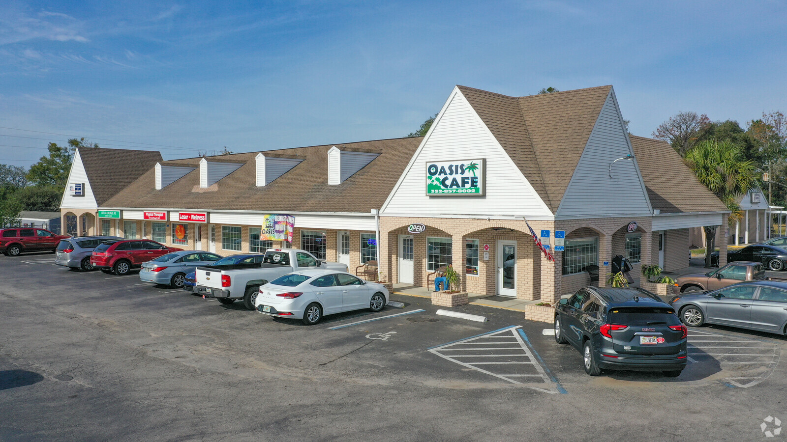
Property Record
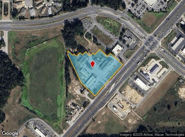
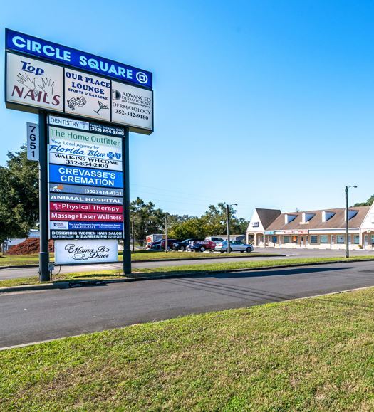
7651 Sw Highway 200 Rd, Ocala, FL 34476
NEARBY LISTINGS FOR SALE OR LEASE
Property Detail
7651 Sw Highway 200 Rd
35694-005-00
SEC 19 TWP 16 RGE 21 COM AT NW COR OF NE 1/4 OF NW 1/4 S 88-45-45 E 125.84 FT S 47-35 E 477.64 FT TO POB TH CONT S 47-35 E 232.10 FT TO SR 200 S 42-39 W 468.38 FT ALG NLY ROW N 47-21 W 254.41 FT N 25-36-06 W 349.48 FT N 47.63 FT S 47-21 E 80 FT N 42-
Regionalshoppingcenterormallwithanchorstore
Marion
X
Florida
12083C0703E
4.13 AC
2023
Outlying Marion County
2023
Ocala
002505
Ocala, FL
30,371 SF
DEMOGRAPHICS near 7651 Sw Highway 200 Rd
1 Mile
3 Mile
5 Mile
2024 Total Population
3,602
37,133
59,367
2029 Population
4,055
42,117
67,385
Pop Growth 2024-2029
+ 12.58%
+ 13.42%
+ 13.51%
Average Age
66
62
55
2024 Total Households
1,906
19,066
27,855
HH Growth 2024-2029
+ 12.59%
+ 13.32%
+ 13.36%
Median Household Inc
$45,451
$56,192
$59,544
Avg Household Size
1.80
1.90
2.10
2024 Avg HH Vehicles
1.00
1.00
2.00
Median Home Value
$186,269
$199,651
$206,943
Median Year Built
1994
1997
1999
Nearby Places
- Restaurants
- Banks
- Shops
- Fitness
- Groceries
SALE & LEASE HISTORY
LISTING DATE
SALE/LEASE

Sep 25, 2016
For Lease
Dec 06, 2021
For Sale
Nearby Properties
Address
Land Use
TOTAL SIZE
Lot Size
Zoning
Address
Land Use
TOTAL SIZE
Lot Size
Zoning
124,557 SF
39.04 AC
GU
Address
Land Use
TOTAL SIZE
Lot Size
Zoning
62,253 SF
6.52 AC
PUD
Address
Land Use
TOTAL SIZE
Lot Size
Zoning
96,094 SF
13.66 AC
B2
Address
Land Use
TOTAL SIZE
Lot Size
Zoning
74,928 SF
7.80 AC
PUD
Address
Land Use
TOTAL SIZE
Lot Size
Zoning
203,356 SF
27.08 AC
B4
Address
Land Use
TOTAL SIZE
Lot Size
Zoning
28,813 SF
70.30 AC
B4
Address
Land Use
TOTAL SIZE
Lot Size
Zoning
18,035 SF
3.33 AC
B2
Address
Land Use
TOTAL SIZE
Lot Size
Zoning
101,312 SF
5,419.05 AC
A1
Address
Land Use
TOTAL SIZE
Lot Size
Zoning
139,728 SF
22.86 AC
B4
Address
Land Use
TOTAL SIZE
Lot Size
Zoning
7,677 SF
26.27 AC
B2
Address
Land Use
TOTAL SIZE
Lot Size
Zoning
98,205 SF
13.41 AC
B2
Address
Land Use
TOTAL SIZE
Lot Size
Zoning
65,060 SF
11.90 AC
B2
Address
Land Use
TOTAL SIZE
Lot Size
Zoning
69,278 SF
7.52 AC
B4
Address
Land Use
TOTAL SIZE
Lot Size
Zoning
42,159 SF
5.95 AC
B2
Address
Land Use
TOTAL SIZE
Lot Size
Zoning
42,673 SF
13.72 AC
A1
Address
Land Use
TOTAL SIZE
Lot Size
Zoning
48,518 SF
84.49 AC
A1
Address
Land Use
TOTAL SIZE
Lot Size
Zoning
58,381 SF
5.12 AC
R3
Address
Land Use
TOTAL SIZE
Lot Size
Zoning
68,180 SF
5.40 AC
B5
Address
Land Use
TOTAL SIZE
Lot Size
Zoning
27,563 SF
3.03 AC
B4
Address
Land Use
TOTAL SIZE
Lot Size
Zoning
82,465 SF
6.13 AC
B2
Address
Land Use
TOTAL SIZE
Lot Size
Zoning
47,600 SF
735.53 AC
PD
Address
Land Use
TOTAL SIZE
Lot Size
Zoning
47,378 SF
23.26 AC
A1
Address
Land Use
TOTAL SIZE
Lot Size
Zoning
25,128 SF
4.38 AC
PD
Address
Land Use
TOTAL SIZE
Lot Size
Zoning
501 SF
520 AC
A1
Address
Land Use
TOTAL SIZE
Lot Size
Zoning
13,943 SF
0.43 AC
B2
Address
Land Use
TOTAL SIZE
Lot Size
Zoning
286.80 AC
PUD
Address
Land Use
TOTAL SIZE
Lot Size
Zoning
27,862 SF
17.04 AC
A1
Address
Land Use
TOTAL SIZE
Lot Size
Zoning
37,213 SF
14.54 AC
A1
Address
Land Use
TOTAL SIZE
Lot Size
Zoning
38,062 SF
3.07 AC
B2
The World's #1 Commercial Real Estate Marketplace
Connect with us
© 2025 CoStar Group
The information above has been obtained from sources believed reliable. While we do not doubt its accuracy we have not verified it and make no guarantee, warranty or representation about it. It is your responsibility to independently confirm its accuracy and completeness. Any projections, opinions, assumptions, or estimates used are for example only and do not represent the current or future performance of the property. The value of this transaction to you depends on tax and other factors which should be evaluated by your tax, financial, and legal advisors. You and your advisors should conduct a careful, independent investigation of the property to determine to your satisfaction the suitability of the property for your needs.