Property Record
7665 Highway 70 S, Nashville, TN 37221
NEARBY LISTINGS FOR SALE OR LEASE
Property Detail
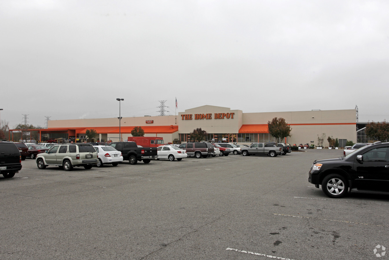
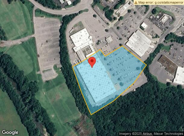
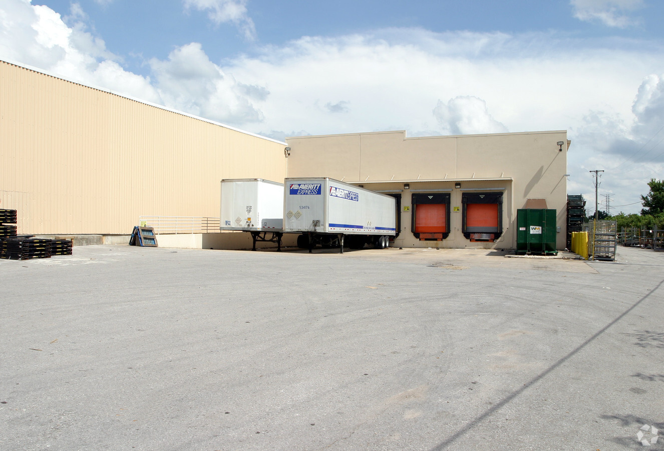
7665 Highway 70 S
142-00-0-310
PT LOT 3 GALLERIES AT BELLEVUE RE-SUB LOTS 3&4
Wholesaleoutletdiscountstore
Davidson
AE
Tennessee
47037C0329H
3-4
2024
7.71 AC
2024
Bellevue/W Nashville
018409
Nashville
104,385 SF
Nashville-Davidson--Murfreesboro--Franklin, TN
DEMOGRAPHICS near 7665 Highway 70 S
1 Mile
3 Mile
5 Mile
2024 Total Population
7,312
36,141
61,060
2029 Population
7,103
35,465
61,094
Pop Growth 2024-2029
(2.86%)
(1.87%)
+ 0.06%
Average Age
45
41
41
2024 Total Households
3,608
16,139
26,299
HH Growth 2024-2029
(3.24%)
(2.65%)
(0.80%)
Median Household Inc
$85,358
$87,988
$96,102
Avg Household Size
2.00
2.20
2.30
2024 Avg HH Vehicles
2.00
2.00
2.00
Median Home Value
$298,652
$371,617
$416,208
Median Year Built
1986
1990
1991
Nearby Places
- Restaurants
- Banks
- Shops
- Fitness
- Groceries
PUBLIC TRANSPORTATION
AIRPORT
Nashville International
DRIVE
WALK
Distance
Nashville International
30 min
22.8 mi
Freight Ports
Port of Mobile
DRIVE
WALK
Distance
Port of Mobile
491 min
447.1 mi
Nearby Properties
Address
Land Use
TOTAL SIZE
Lot Size
Zoning
Address
Land Use
TOTAL SIZE
Lot Size
Zoning
1,473 SF
125.10 AC
RM4
Address
Land Use
TOTAL SIZE
Lot Size
Zoning
46,528 SF
45.95 AC
SCR
Address
Land Use
TOTAL SIZE
Lot Size
Zoning
82,660 SF
14.85 AC
MULTIZONE
Address
Land Use
TOTAL SIZE
Lot Size
Zoning
22,986 SF
16.04 AC
SCR
Address
Land Use
TOTAL SIZE
Lot Size
Zoning
27,510 SF
30.56 AC
SP
Address
Land Use
TOTAL SIZE
Lot Size
Zoning
2,193 SF
27.08 AC
RM4
Address
Land Use
TOTAL SIZE
Lot Size
Zoning
2,704 SF
30.75 AC
RM9
Address
Land Use
TOTAL SIZE
Lot Size
Zoning
224,590 SF
5.66 AC
MULTIZONE
Address
Land Use
TOTAL SIZE
Lot Size
Zoning
189,503 SF
8.50 AC
AR2A
Address
Land Use
TOTAL SIZE
Lot Size
Zoning
26,145 SF
24.18 AC
RM4
Address
Land Use
TOTAL SIZE
Lot Size
Zoning
8,156 SF
27.77 AC
RM9
Address
Land Use
TOTAL SIZE
Lot Size
Zoning
25,350 SF
36.11 AC
RM4
Address
Land Use
TOTAL SIZE
Lot Size
Zoning
7,989 SF
41.26 AC
RM4
Address
Land Use
TOTAL SIZE
Lot Size
Zoning
139,993 SF
17.39 AC
SP
Address
Land Use
TOTAL SIZE
Lot Size
Zoning
20,655 SF
21.79 AC
RM4
Address
Land Use
TOTAL SIZE
Lot Size
Zoning
7,548 SF
44.59 AC
RM4
Address
Land Use
TOTAL SIZE
Lot Size
Zoning
32,987 SF
10.77 AC
RM20
Address
Land Use
TOTAL SIZE
Lot Size
Zoning
2,850 SF
16.84 AC
R15
Address
Land Use
TOTAL SIZE
Lot Size
Zoning
4,362 SF
51.91 AC
MULTI-ZONE
Address
Land Use
TOTAL SIZE
Lot Size
Zoning
12,602 SF
23.46 AC
RM4
Address
Land Use
TOTAL SIZE
Lot Size
Zoning
2,295 SF
5.69 AC
RS15
Address
Land Use
TOTAL SIZE
Lot Size
Zoning
55,156 SF
6.50 AC
RM9
Address
Land Use
TOTAL SIZE
Lot Size
Zoning
14,040 SF
24.73 AC
R15
Address
Land Use
TOTAL SIZE
Lot Size
Zoning
2,056 SF
15.88 AC
RM9
Address
Land Use
TOTAL SIZE
Lot Size
Zoning
17,264 SF
15.39 AC
RM9
Address
Land Use
TOTAL SIZE
Lot Size
Zoning
27,732 SF
22.48 AC
RM4
Address
Land Use
TOTAL SIZE
Lot Size
Zoning
46,936 SF
6.11 AC
RS15
Address
Land Use
TOTAL SIZE
Lot Size
Zoning
46,312 SF
9.28 AC
MULTI-ZONE
Address
Land Use
TOTAL SIZE
Lot Size
Zoning
4,960 SF
26.64 AC
R15
Address
Land Use
TOTAL SIZE
Lot Size
Zoning
125,419 SF
5.08 AC
SP
The World's #1 Commercial Real Estate Marketplace
Connect with us
© 2025 CoStar Group
The information above has been obtained from sources believed reliable. While we do not doubt its accuracy we have not verified it and make no guarantee, warranty or representation about it. It is your responsibility to independently confirm its accuracy and completeness. Any projections, opinions, assumptions, or estimates used are for example only and do not represent the current or future performance of the property. The value of this transaction to you depends on tax and other factors which should be evaluated by your tax, financial, and legal advisors. You and your advisors should conduct a careful, independent investigation of the property to determine to your satisfaction the suitability of the property for your needs.