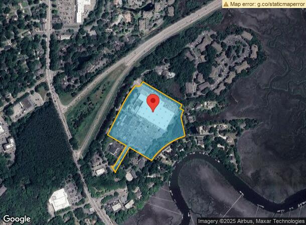
Property Record
770 Daniel Ellis Dr, Charleston, SC 29412

NEARBY LISTINGS FOR SALE OR LEASE
Property Detail
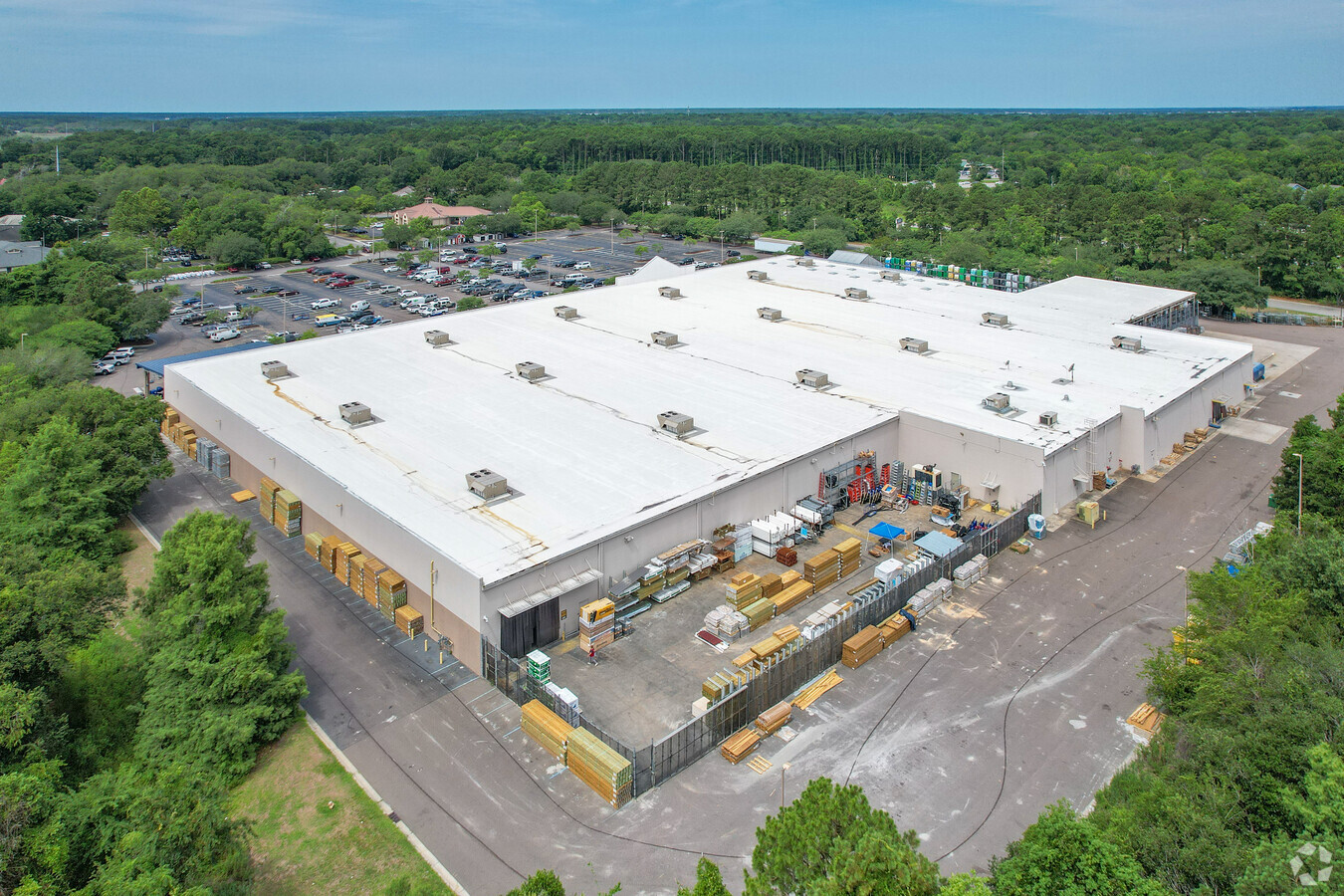
770 Daniel Ellis Dr
340-00-00-085
Old Town
Storebuilding
LEGAL DESCRIPTION SUBDIVISION NAME -OLD TOWN DESCRIPTION -PARCEL SITE NAME -LOWES PLATSUFFIX EB-647 POLTWP 009
AE
Charleston
45019C0677K
South Carolina
2023
14.95 AC
2023
James Island/Folly Beach
001902
Charleston/N Charleston
119,883 SF
Charleston-North Charleston, SC
DEMOGRAPHICS near 770 Daniel Ellis Dr
1 Mile
3 Mile
5 Mile
2024 Total Population
5,983
49,689
111,672
2029 Population
6,463
53,105
120,048
Pop Growth 2024-2029
+ 8.02%
+ 6.87%
+ 7.50%
Average Age
39
41
39
2024 Total Households
3,013
22,955
50,106
HH Growth 2024-2029
+ 7.90%
+ 6.82%
+ 7.49%
Median Household Inc
$69,033
$86,632
$75,058
Avg Household Size
2.00
2.10
2.10
2024 Avg HH Vehicles
2.00
2.00
2.00
Median Home Value
$332,232
$441,437
$429,644
Median Year Built
1988
1977
1975
Nearby Places
- Restaurants
- Banks
- Shops
- Fitness
- Groceries
PUBLIC TRANSPORTATION
AIRPORT
Charleston AFB/International
DRIVE
WALK
Distance
Charleston AFB/International
28 min
16.1 mi
Freight Ports
Columbus Street Terminal
DRIVE
WALK
Distance
Columbus Street Terminal
9 min
5.3 mi
Nearby Properties
Address
Land Use
TOTAL SIZE
Lot Size
Zoning
Address
Land Use
TOTAL SIZE
Lot Size
Zoning
0.62 AC
Address
Land Use
TOTAL SIZE
Lot Size
Zoning
3,780 SF
14.35 AC
Address
Land Use
TOTAL SIZE
Lot Size
Zoning
17,459 SF
4.16 AC
Address
Land Use
TOTAL SIZE
Lot Size
Zoning
8,714 SF
1.60 AC
Address
Land Use
TOTAL SIZE
Lot Size
Zoning
Address
Land Use
TOTAL SIZE
Lot Size
Zoning
Address
Land Use
TOTAL SIZE
Lot Size
Zoning
22,825 SF
4.36 AC
Address
Land Use
TOTAL SIZE
Lot Size
Zoning
Address
Land Use
TOTAL SIZE
Lot Size
Zoning
257,500 SF
4.72 AC
Address
Land Use
TOTAL SIZE
Lot Size
Zoning
12,766 SF
1.72 AC
Address
Land Use
TOTAL SIZE
Lot Size
Zoning
Address
Land Use
TOTAL SIZE
Lot Size
Zoning
Address
Land Use
TOTAL SIZE
Lot Size
Zoning
7.09 AC
Address
Land Use
TOTAL SIZE
Lot Size
Zoning
1,056 SF
1.65 AC
Address
Land Use
TOTAL SIZE
Lot Size
Zoning
0.84 AC
Address
Land Use
TOTAL SIZE
Lot Size
Zoning
Address
Land Use
TOTAL SIZE
Lot Size
Zoning
0.60 AC
Address
Land Use
TOTAL SIZE
Lot Size
Zoning
25,860 SF
0.78 AC
Address
Land Use
TOTAL SIZE
Lot Size
Zoning
172,224 SF
7.35 AC
Address
Land Use
TOTAL SIZE
Lot Size
Zoning
0.25 AC
Address
Land Use
TOTAL SIZE
Lot Size
Zoning
3,208 SF
1.48 AC
Address
Land Use
TOTAL SIZE
Lot Size
Zoning
0.41 AC
Address
Land Use
TOTAL SIZE
Lot Size
Zoning
0.18 AC
Address
Land Use
TOTAL SIZE
Lot Size
Zoning
16,775 SF
5.93 AC
Address
Land Use
TOTAL SIZE
Lot Size
Zoning
Address
Land Use
TOTAL SIZE
Lot Size
Zoning
20,845 SF
1.28 AC
Address
Land Use
TOTAL SIZE
Lot Size
Zoning
563 SF
0.91 AC
Address
Land Use
TOTAL SIZE
Lot Size
Zoning
63,968 SF
1.66 AC
Address
Land Use
TOTAL SIZE
Lot Size
Zoning
105,816 SF
16.34 AC
Address
Land Use
TOTAL SIZE
Lot Size
Zoning
7,722 SF
20.48 AC
The World's #1 Commercial Real Estate Marketplace
Connect with us
© 2025 CoStar Group
The information above has been obtained from sources believed reliable. While we do not doubt its accuracy we have not verified it and make no guarantee, warranty or representation about it. It is your responsibility to independently confirm its accuracy and completeness. Any projections, opinions, assumptions, or estimates used are for example only and do not represent the current or future performance of the property. The value of this transaction to you depends on tax and other factors which should be evaluated by your tax, financial, and legal advisors. You and your advisors should conduct a careful, independent investigation of the property to determine to your satisfaction the suitability of the property for your needs.