Property Record
7700 Krefeld Dr, Charlotte, NC 28227


NEARBY LISTINGS FOR SALE OR LEASE
Property Detail
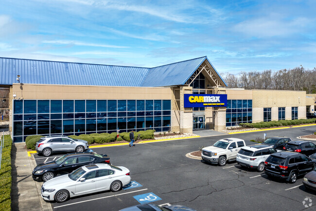
7700 Krefeld Dr
Charlotte-Concord-Gastonia, NC-SC
Circuit City Stores
193-073-01
P1 & L7 M26-467
Commercialnec
Mecklenburg
AE
North Carolina
3710458100K
7
0
15.70 AC
2025
East
005723
Charlotte
68,689 SF
DEMOGRAPHICS near 7700 Krefeld Dr
1 Mile
3 Mile
5 Mile
2024 Total Population
12,680
80,232
213,803
2029 Population
13,317
84,296
225,121
Pop Growth 2024-2029
+ 5.02%
+ 5.07%
+ 5.29%
Average Age
35
38
39
2024 Total Households
5,670
32,191
84,344
HH Growth 2024-2029
+ 5.08%
+ 5.18%
+ 5.39%
Median Household Inc
$55,203
$63,842
$71,084
Avg Household Size
2.20
2.40
2.50
2024 Avg HH Vehicles
1.00
2.00
2.00
Median Home Value
$218,583
$289,430
$345,749
Median Year Built
1988
1984
1984
Nearby Places
Map Layers
Map Styles
 Street
 Aerial
- Restaurants
- Banks
- Shops
- Fitness
- Groceries
PUBLIC TRANSPORTATION
COMMUTER RAIL
DRIVE
WALK
Distance
15 min
9.3 mi
AIRPORT
Charlotte/Douglas International
DRIVE
WALK
Distance
Charlotte/Douglas International
29 min
16.6 mi
Concord-Padgett Regional
DRIVE
WALK
Distance
Concord-Padgett Regional
32 min
20.7 mi
Nearby Properties
Address
Land Use
TOTAL SIZE
Lot Size
Zoning
Address
Land Use
TOTAL SIZE
Lot Size
Zoning
466,084 SF
42.13 AC
C
Address
Land Use
TOTAL SIZE
Lot Size
Zoning
382,175 SF
31.67 AC
R12MFCD
Address
Land Use
TOTAL SIZE
Lot Size
Zoning
362,388 SF
26.88 AC
R12MFCD
Address
Land Use
TOTAL SIZE
Lot Size
Zoning
282,780 SF
21.75 AC
R17MF
Address
Land Use
TOTAL SIZE
Lot Size
Zoning
333,218 SF
22.86 AC
R17MF
Address
Land Use
TOTAL SIZE
Lot Size
Zoning
294,525 SF
24.80 AC
C
Address
Land Use
TOTAL SIZE
Lot Size
Zoning
292,066 SF
2.67 AC
R15MF
Address
Land Use
TOTAL SIZE
Lot Size
Zoning
232,858 SF
21.74 AC
R15MF
Address
Land Use
TOTAL SIZE
Lot Size
Zoning
258,272 SF
22.10 AC
R9MFCD
Address
Land Use
TOTAL SIZE
Lot Size
Zoning
325,177 SF
43.11 AC
R12MFCD
Address
Land Use
TOTAL SIZE
Lot Size
Zoning
256,498 SF
23.52 AC
C
Address
Land Use
TOTAL SIZE
Lot Size
Zoning
347,952 SF
28.37 AC
OACUD
Address
Land Use
TOTAL SIZE
Lot Size
Zoning
300,346 SF
45.50 AC
R3
Address
Land Use
TOTAL SIZE
Lot Size
Zoning
254,369 SF
43.75 AC
B1SCD
Address
Land Use
TOTAL SIZE
Lot Size
Zoning
218,876 SF
14.82 AC
R6MFCD
Address
Land Use
TOTAL SIZE
Lot Size
Zoning
316,763 SF
21.18 AC
R17MF
Address
Land Use
TOTAL SIZE
Lot Size
Zoning
231,072 SF
17.52 AC
R15MFCD
Address
Land Use
TOTAL SIZE
Lot Size
Zoning
254,671 SF
16.10 AC
R12MFCD
Address
Land Use
TOTAL SIZE
Lot Size
Zoning
227,750 SF
25.53 AC
C
Address
Land Use
TOTAL SIZE
Lot Size
Zoning
246,624 SF
24.06 AC
R17MF
Address
Land Use
TOTAL SIZE
Lot Size
Zoning
258,047 SF
64.31 AC
I-CUD
Address
Land Use
TOTAL SIZE
Lot Size
Zoning
255,404 SF
17.76 AC
R12MFCD
Address
Land Use
TOTAL SIZE
Lot Size
Zoning
208,960 SF
7.33 AC
MUDDO
Address
Land Use
TOTAL SIZE
Lot Size
Zoning
197,180 SF
4.89 AC
Address
Land Use
TOTAL SIZE
Lot Size
Zoning
211,146 SF
18.83 AC
R15MFCD
Address
Land Use
TOTAL SIZE
Lot Size
Zoning
208,846 SF
14.99 AC
R17MF
Address
Land Use
TOTAL SIZE
Lot Size
Zoning
215,246 SF
14.49 AC
R3
Address
Land Use
TOTAL SIZE
Lot Size
Zoning
197,367 SF
6.07 AC
Address
Land Use
TOTAL SIZE
Lot Size
Zoning
142,300 SF
5.50 AC
Address
Land Use
TOTAL SIZE
Lot Size
Zoning
205,701 SF
13.73 AC
OACUD
The World's #1 Commercial Real Estate Marketplace
Connect with us
© 2025 CoStar Group
The information above has been obtained from sources believed reliable. While we do not doubt its accuracy we have not verified it and make no guarantee, warranty or representation about it. It is your responsibility to independently confirm its accuracy and completeness. Any projections, opinions, assumptions, or estimates used are for example only and do not represent the current or future performance of the property. The value of this transaction to you depends on tax and other factors which should be evaluated by your tax, financial, and legal advisors. You and your advisors should conduct a careful, independent investigation of the property to determine to your satisfaction the suitability of the property for your needs.