Property Record
7700 Newcastle Rd, Oklahoma City, OK 73169

NEARBY LISTINGS FOR SALE OR LEASE
-
-
View all Oklahoma City listings for sale on LoopNet.com
Property Detail
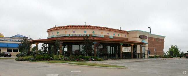
7700 Newcastle Rd
Oklahoma City, OK
Unpltd Pt Sec 29 11N 4W
141411765
SILVER SPRINGS CROSSING 000 000 PT LOT 1 BLK 3 SILVER SPRINGS CROSSING BEG NW/C OF LOT 1 BLK 3 TH 59.20FT SELY TO PT OF BEG TH SELY169.80FT SELY 35.83FT SWLY175.23FT NWLY200FT NELY200FT TO BEG
Lightindustrial
Oklahoma
X
Oklahoma
40027C0025J
1
2023
1.54 AC
2024
Northwest
108521
Oklahoma City
1,684 SF
DEMOGRAPHICS near 7700 Newcastle Rd
1 Mile
3 Mile
5 Mile
2024 Total Population
11,421
74,106
164,404
2029 Population
11,586
77,458
174,355
Pop Growth 2024-2029
+ 1.44%
+ 4.52%
+ 6.05%
Average Age
41
39
39
2024 Total Households
5,079
29,894
67,323
HH Growth 2024-2029
+ 1.58%
+ 4.28%
+ 5.59%
Median Household Inc
$54,181
$67,654
$68,333
Avg Household Size
2.20
2.40
2.40
2024 Avg HH Vehicles
2.00
2.00
2.00
Median Home Value
$162,053
$204,566
$209,362
Median Year Built
1982
1983
1980
Nearby Places
Map Layers
Map Styles
 Street
 Aerial
- Restaurants
- Banks
- Shops
- Fitness
- Groceries
PUBLIC TRANSPORTATION
AIRPORT
Will Rogers World
DRIVE
WALK
Distance
Will Rogers World
8 min
4.3 mi
Freight Ports
Port of Shreveport
DRIVE
WALK
Distance
Port of Shreveport
1 min
312.3 mi
Nearby Properties
Address
Land Use
TOTAL SIZE
Lot Size
Zoning
Address
Land Use
TOTAL SIZE
Lot Size
Zoning
1,976,300 SF
217.95 AC
I-2
Address
Land Use
TOTAL SIZE
Lot Size
Zoning
1,953,545 SF
111.96 AC
PUD
Address
Land Use
TOTAL SIZE
Lot Size
Zoning
1,563,794 SF
127.94 AC
PUD
Address
Land Use
TOTAL SIZE
Lot Size
Zoning
2,141,947 SF
98.48 AC
I-2
Address
Land Use
TOTAL SIZE
Lot Size
Zoning
653,359 SF
142.11 AC
I-2
Address
Land Use
TOTAL SIZE
Lot Size
Zoning
1,013,603 SF
66.29 AC
PUD
Address
Land Use
TOTAL SIZE
Lot Size
Zoning
647,520 SF
28.23 AC
PUD
Address
Land Use
TOTAL SIZE
Lot Size
Zoning
784,972 SF
68.99 AC
I-2
Address
Land Use
TOTAL SIZE
Lot Size
Zoning
720,640 SF
52.69 AC
PUD
Address
Land Use
TOTAL SIZE
Lot Size
Zoning
192,771 SF
11.20 AC
I-3
Address
Land Use
TOTAL SIZE
Lot Size
Zoning
143,450 SF
21.45 AC
Address
Land Use
TOTAL SIZE
Lot Size
Zoning
305,154 SF
33.30 AC
I-2
Address
Land Use
TOTAL SIZE
Lot Size
Zoning
538,787 SF
34.39 AC
I-2
Address
Land Use
TOTAL SIZE
Lot Size
Zoning
215,392 SF
63.71 AC
I-2
Address
Land Use
TOTAL SIZE
Lot Size
Zoning
9,928 SF
2.25 AC
Address
Land Use
TOTAL SIZE
Lot Size
Zoning
9.28 AC
I-2
Address
Land Use
TOTAL SIZE
Lot Size
Zoning
615,435 SF
35.60 AC
I-3
Address
Land Use
TOTAL SIZE
Lot Size
Zoning
256,500 SF
19.46 AC
I-3
Address
Land Use
TOTAL SIZE
Lot Size
Zoning
257,100 SF
33.19 AC
I-2
Address
Land Use
TOTAL SIZE
Lot Size
Zoning
223,600 SF
25.57 AC
I-2
Address
Land Use
TOTAL SIZE
Lot Size
Zoning
124,208 SF
21.48 AC
I-2
Address
Land Use
TOTAL SIZE
Lot Size
Zoning
89,152 SF
29.84 AC
PUD
Address
Land Use
TOTAL SIZE
Lot Size
Zoning
422,608 SF
24.97 AC
I-3
Address
Land Use
TOTAL SIZE
Lot Size
Zoning
1 SF
74.72 AC
PUD
Address
Land Use
TOTAL SIZE
Lot Size
Zoning
4,588 SF
3.90 AC
Address
Land Use
TOTAL SIZE
Lot Size
Zoning
1,291,806 SF
53.08 AC
I-3
Address
Land Use
TOTAL SIZE
Lot Size
Zoning
87,086 SF
25.58 AC
I-2
Address
Land Use
TOTAL SIZE
Lot Size
Zoning
435,908 SF
26.79 AC
Address
Land Use
TOTAL SIZE
Lot Size
Zoning
1.69 AC
Address
Land Use
TOTAL SIZE
Lot Size
Zoning
10,000 SF
4.78 AC
The World's #1 Commercial Real Estate Marketplace
Connect with us
© 2026 CoStar Group
The information above has been obtained from sources believed reliable. While we do not doubt its accuracy we have not verified it and make no guarantee, warranty or representation about it. It is your responsibility to independently confirm its accuracy and completeness. Any projections, opinions, assumptions, or estimates used are for example only and do not represent the current or future performance of the property. The value of this transaction to you depends on tax and other factors which should be evaluated by your tax, financial, and legal advisors. You and your advisors should conduct a careful, independent investigation of the property to determine to your satisfaction the suitability of the property for your needs.