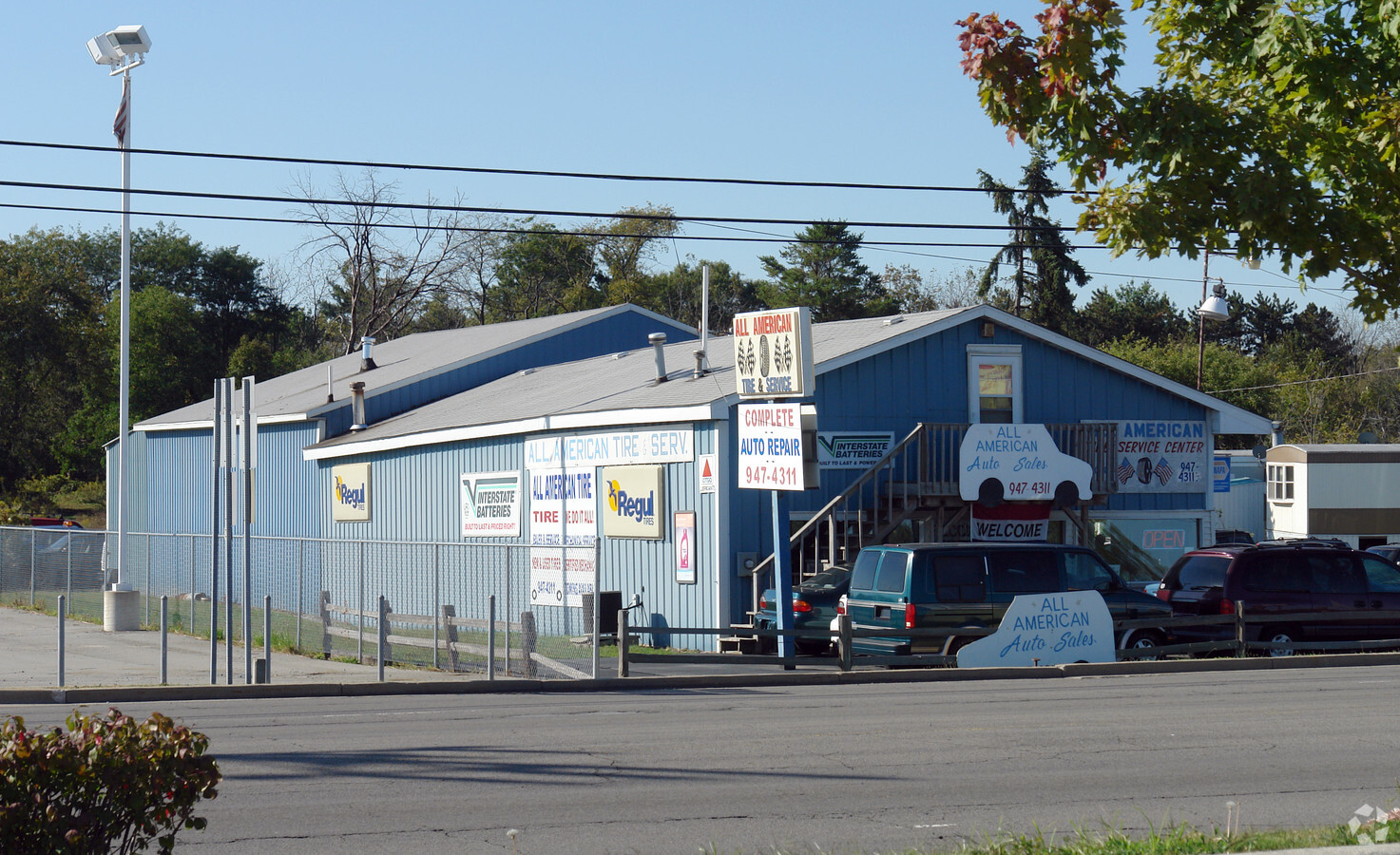
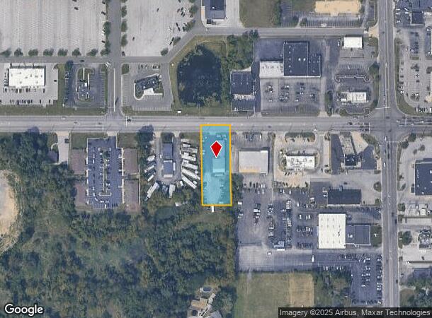
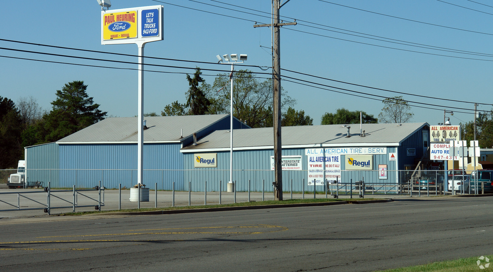
Property Record
7799 E Ridge Rd, Hobart, IN 46342
NEARBY LISTINGS FOR SALE OR LEASE
Property Detail
7799 E Ridge Rd
45-09-29-226-008.000-018
E120FT OF N.330FT OF E1/2 NW NE NE S29 T36 R7 .909AC
Autorepair
Lake
X
Indiana
18127C0111D
1
2023
0.91 AC
2024
Indiana
041900
Chicago
5,016 SF
Chicago-Naperville-Elgin, IL-IN-WI
DEMOGRAPHICS near 7799 E Ridge Rd
1 Mile
3 Mile
5 Mile
2024 Total Population
5,242
49,523
106,591
2029 Population
5,289
49,681
108,735
Pop Growth 2024-2029
+ 0.90%
+ 0.32%
+ 2.01%
Average Age
39
40
40
2024 Total Households
2,078
19,356
42,300
HH Growth 2024-2029
+ 0.91%
+ 0.34%
+ 2.03%
Median Household Inc
$65,122
$58,503
$51,411
Avg Household Size
2.50
2.50
2.50
2024 Avg HH Vehicles
2.00
2.00
2.00
Median Home Value
$182,137
$157,745
$157,888
Median Year Built
1973
1969
1967
Nearby Places
- Restaurants
- Banks
- Shops
- Fitness
- Groceries
PUBLIC TRANSPORTATION
COMMUTER RAIL
Miller (Gary) Station (South Shore Line - Northern Indiana Commuter Transportation District (South Shore Line))
DRIVE
WALK
Distance
Miller (Gary) Station (South Shore Line - Northern Indiana Commuter Transportation District (South Shore Line))
10 min
4.8 mi
Ogden Dunes (Portage) Station (South Shore Line - Northern Indiana Commuter Transportation District (South Shore Line))
DRIVE
WALK
Distance
Ogden Dunes (Portage) Station (South Shore Line - Northern Indiana Commuter Transportation District (South Shore Line))
14 min
8.2 mi
Freight Ports
Port Milwaukee
DRIVE
WALK
Distance
Port Milwaukee
159 min
124.9 mi
Nearby Properties
Address
Land Use
TOTAL SIZE
Lot Size
Zoning
Address
Land Use
TOTAL SIZE
Lot Size
Zoning
862,805 SF
36.93 AC
R33
Address
Land Use
TOTAL SIZE
Lot Size
Zoning
83,904 SF
15.47 AC
Address
Land Use
TOTAL SIZE
Lot Size
Zoning
159,954 SF
8.49 AC
Address
Land Use
TOTAL SIZE
Lot Size
Zoning
161,118 SF
22.13 AC
R33
Address
Land Use
TOTAL SIZE
Lot Size
Zoning
169,427 SF
8.70 AC
Address
Land Use
TOTAL SIZE
Lot Size
Zoning
212,330 SF
10.70 AC
Address
Land Use
TOTAL SIZE
Lot Size
Zoning
102,255 SF
3.96 AC
R33
Address
Land Use
TOTAL SIZE
Lot Size
Zoning
64,619 SF
4.21 AC
Address
Land Use
TOTAL SIZE
Lot Size
Zoning
48,955 SF
14.50 AC
Address
Land Use
TOTAL SIZE
Lot Size
Zoning
37,351 SF
13.74 AC
Address
Land Use
TOTAL SIZE
Lot Size
Zoning
31,884 SF
23.22 AC
Address
Land Use
TOTAL SIZE
Lot Size
Zoning
100,690 SF
15.44 AC
Address
Land Use
TOTAL SIZE
Lot Size
Zoning
46,093 SF
4.66 AC
Address
Land Use
TOTAL SIZE
Lot Size
Zoning
105,865 SF
9.09 AC
Address
Land Use
TOTAL SIZE
Lot Size
Zoning
48,228 SF
4.53 AC
Address
Land Use
TOTAL SIZE
Lot Size
Zoning
16,300 SF
2.31 AC
Address
Land Use
TOTAL SIZE
Lot Size
Zoning
124,160 SF
20.84 AC
Address
Land Use
TOTAL SIZE
Lot Size
Zoning
65,216 SF
7.61 AC
R33
Address
Land Use
TOTAL SIZE
Lot Size
Zoning
29,251 SF
25.96 AC
Address
Land Use
TOTAL SIZE
Lot Size
Zoning
37,252 SF
5.72 AC
Address
Land Use
TOTAL SIZE
Lot Size
Zoning
96,488 SF
10.21 AC
Address
Land Use
TOTAL SIZE
Lot Size
Zoning
52,442 SF
4.48 AC
Address
Land Use
TOTAL SIZE
Lot Size
Zoning
6,880 SF
6.71 AC
Address
Land Use
TOTAL SIZE
Lot Size
Zoning
50,712 SF
2.59 AC
Address
Land Use
TOTAL SIZE
Lot Size
Zoning
52,478 SF
12.18 AC
Address
Land Use
TOTAL SIZE
Lot Size
Zoning
41,211 SF
1.89 AC
R33
Address
Land Use
TOTAL SIZE
Lot Size
Zoning
67,072 SF
6.70 AC
Address
Land Use
TOTAL SIZE
Lot Size
Zoning
15,568 SF
6.63 AC
R33
Address
Land Use
TOTAL SIZE
Lot Size
Zoning
17,421 SF
8.70 AC
R33
Address
Land Use
TOTAL SIZE
Lot Size
Zoning
70,294 SF
5.42 AC
The World's #1 Commercial Real Estate Marketplace
Connect with us
© 2025 CoStar Group
The information above has been obtained from sources believed reliable. While we do not doubt its accuracy we have not verified it and make no guarantee, warranty or representation about it. It is your responsibility to independently confirm its accuracy and completeness. Any projections, opinions, assumptions, or estimates used are for example only and do not represent the current or future performance of the property. The value of this transaction to you depends on tax and other factors which should be evaluated by your tax, financial, and legal advisors. You and your advisors should conduct a careful, independent investigation of the property to determine to your satisfaction the suitability of the property for your needs.