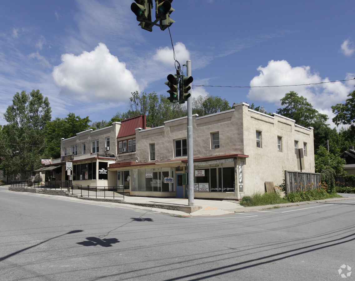
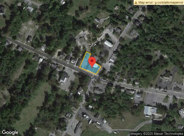
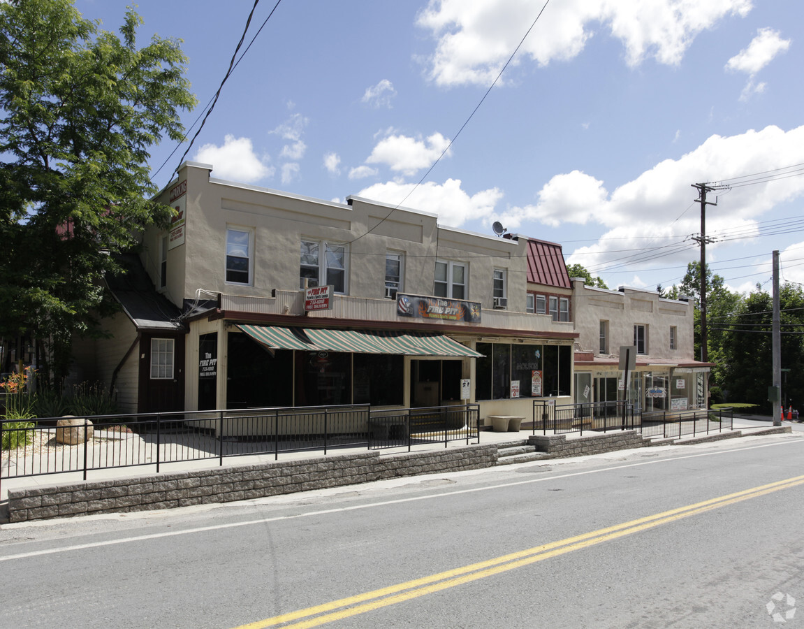
Property Record
78 Munn Rd, Wurtsboro, NY 12790

NEARBY LISTINGS FOR SALE OR LEASE
Property Detail
78 Munn Rd
Commercialofficeresidentialmixeduse
Sullivan
X
New York
36105C0662F
43.000
2024
0.37 AC
2023
Hudson Valley Area
951302
Other Market Areas
14,769 SF
4001-201-0-0004-043-000
DEMOGRAPHICS near 78 Munn Rd
1 Mile
3 Mile
5 Mile
2024 Total Population
1,957
8,015
16,870
2029 Population
2,054
8,139
17,092
Pop Growth 2024-2029
+ 4.96%
+ 1.55%
+ 1.32%
Average Age
28
38
40
2024 Total Households
503
2,673
5,956
HH Growth 2024-2029
+ 5.17%
+ 1.31%
+ 1.33%
Median Household Inc
$32,200
$77,016
$90,939
Avg Household Size
3.60
2.90
2.70
2024 Avg HH Vehicles
1.00
2.00
2.00
Median Home Value
$252,112
$257,590
$280,741
Median Year Built
1974
1981
1978
Nearby Places
- Restaurants
- Banks
- Shops
- Fitness
- Groceries
PUBLIC TRANSPORTATION
COMMUTER RAIL
Middletown New York (Bergen County/Port Jervis Line - NJ Transit Commuter Rail (NJ Transit), Main/Port Jervis Line - NJ Transit Commuter Rail (NJ Transit))
DRIVE
WALK
Distance
Middletown New York (Bergen County/Port Jervis Line - NJ Transit Commuter Rail (NJ Transit), Main/Port Jervis Line - NJ Transit Commuter Rail (NJ Transit))
14 min
8.4 mi
Otisville (Bergen County/Port Jervis Line - NJ Transit Commuter Rail (NJ Transit), Main/Port Jervis Line - NJ Transit Commuter Rail (NJ Transit))
DRIVE
WALK
Distance
Otisville (Bergen County/Port Jervis Line - NJ Transit Commuter Rail (NJ Transit), Main/Port Jervis Line - NJ Transit Commuter Rail (NJ Transit))
20 min
8.5 mi
AIRPORT
New York Stewart International
DRIVE
WALK
Distance
New York Stewart International
31 min
20.6 mi
Freight Ports
Port Newark Container Terminal
DRIVE
WALK
Distance
Port Newark Container Terminal
99 min
77.4 mi
Nearby Properties
Address
Land Use
TOTAL SIZE
Lot Size
Zoning
Address
Land Use
TOTAL SIZE
Lot Size
Zoning
505,953 SF
89.17 AC
I
Address
Land Use
TOTAL SIZE
Lot Size
Zoning
4,219 SF
86.85 AC
RAG1
Address
Land Use
TOTAL SIZE
Lot Size
Zoning
28,000 SF
16.50 AC
R1
Address
Land Use
TOTAL SIZE
Lot Size
Zoning
2.35 AC
Address
Land Use
TOTAL SIZE
Lot Size
Zoning
4,893 SF
0.53 AC
C1
Address
Land Use
TOTAL SIZE
Lot Size
Zoning
17,135 SF
3.26 AC
Address
Land Use
TOTAL SIZE
Lot Size
Zoning
30,657 SF
135.40 AC
RA07
Address
Land Use
TOTAL SIZE
Lot Size
Zoning
6,210 SF
45.16 AC
RAG2
Address
Land Use
TOTAL SIZE
Lot Size
Zoning
57,942 SF
14.60 AC
R2
Address
Land Use
TOTAL SIZE
Lot Size
Zoning
9,026 SF
1.71 AC
Address
Land Use
TOTAL SIZE
Lot Size
Zoning
9,000 SF
17.67 AC
RAG2
Address
Land Use
TOTAL SIZE
Lot Size
Zoning
247.69 AC
RAG1
Address
Land Use
TOTAL SIZE
Lot Size
Zoning
Address
Land Use
TOTAL SIZE
Lot Size
Zoning
1,608 SF
1.20 AC
Address
Land Use
TOTAL SIZE
Lot Size
Zoning
1.41 AC
Address
Land Use
TOTAL SIZE
Lot Size
Zoning
4,978 SF
9.90 AC
ENT-L
Address
Land Use
TOTAL SIZE
Lot Size
Zoning
3,440 SF
1.16 AC
Address
Land Use
TOTAL SIZE
Lot Size
Zoning
1,624 SF
17.75 AC
Address
Land Use
TOTAL SIZE
Lot Size
Zoning
1,500 SF
56.20 AC
R1
Address
Land Use
TOTAL SIZE
Lot Size
Zoning
2,400 SF
25.30 AC
ENT-L
Address
Land Use
TOTAL SIZE
Lot Size
Zoning
29,588 SF
17.90 AC
ENT-L
Address
Land Use
TOTAL SIZE
Lot Size
Zoning
6,846 SF
6.30 AC
RAG2
Address
Land Use
TOTAL SIZE
Lot Size
Zoning
1,008 SF
3.95 AC
R4C
Address
Land Use
TOTAL SIZE
Lot Size
Zoning
12.60 AC
Address
Land Use
TOTAL SIZE
Lot Size
Zoning
8,382 SF
1.10 AC
Address
Land Use
TOTAL SIZE
Lot Size
Zoning
Address
Land Use
TOTAL SIZE
Lot Size
Zoning
9,056 SF
0.79 AC
C1
Address
Land Use
TOTAL SIZE
Lot Size
Zoning
2,042 SF
6 AC
R1
Address
Land Use
TOTAL SIZE
Lot Size
Zoning
58.61 AC
RAG2
Address
Land Use
TOTAL SIZE
Lot Size
Zoning
1,870 SF
0.72 AC
The World's #1 Commercial Real Estate Marketplace
Connect with us
© 2025 CoStar Group
The information above has been obtained from sources believed reliable. While we do not doubt its accuracy we have not verified it and make no guarantee, warranty or representation about it. It is your responsibility to independently confirm its accuracy and completeness. Any projections, opinions, assumptions, or estimates used are for example only and do not represent the current or future performance of the property. The value of this transaction to you depends on tax and other factors which should be evaluated by your tax, financial, and legal advisors. You and your advisors should conduct a careful, independent investigation of the property to determine to your satisfaction the suitability of the property for your needs.