Property Record
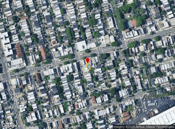
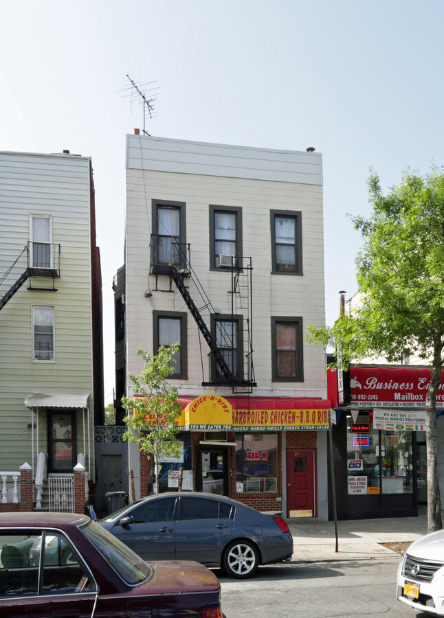
780 Morris Park Ave, Bronx, NY 10462


NEARBY LISTINGS FOR SALE OR LEASE
Property Detail
780 Morris Park Ave
04036-0003
Bronx
Commercialofficeresidentialmixeduse
New York
X
3
3604970101F
0.06 AC
2024
Bronx
2024
Westchester/So Connecticut
023800
New York-Jersey City-White Plains, NY-NJ
3,024 SF
DEMOGRAPHICS near 780 Morris Park Ave
1 Mile
3 Mile
5 Mile
2024 Total Population
116,231
1,006,740
1,774,435
2029 Population
105,000
928,438
1,642,125
Pop Growth 2024-2029
(9.66%)
(7.78%)
(7.46%)
Average Age
38
38
39
2024 Total Households
41,761
349,150
643,957
HH Growth 2024-2029
(10.39%)
(8.55%)
(8.03%)
Median Household Inc
$53,313
$42,515
$45,952
Avg Household Size
2.70
2.70
2.60
2024 Avg HH Vehicles
1.00
1.00
1.00
Median Home Value
$548,642
$505,146
$540,159
Median Year Built
1948
1952
1951
Nearby Places
- Restaurants
- Banks
- Shops
- Fitness
- Groceries
PUBLIC TRANSPORTATION
TRANSIT/SUBWAY
Bronx Park East (2 - New York MTA Subway (The Subway), 5 - New York MTA Subway (The Subway))
DRIVE
WALK
Distance
Bronx Park East (2 - New York MTA Subway (The Subway), 5 - New York MTA Subway (The Subway))
1 min
9 min
0.5 mi
East 180 Street (2 - New York MTA Subway (The Subway), 5 - New York MTA Subway (The Subway))
DRIVE
WALK
Distance
East 180 Street (2 - New York MTA Subway (The Subway), 5 - New York MTA Subway (The Subway))
2 min
13 min
0.7 mi
Morris Park (5 - New York MTA Subway (The Subway))
DRIVE
WALK
Distance
Morris Park (5 - New York MTA Subway (The Subway))
4 min
16 min
0.9 mi
Pelham Parkway (2,5 Line) (2 - New York MTA Subway (The Subway), 5 - New York MTA Subway (The Subway))
DRIVE
WALK
Distance
Pelham Parkway (2,5 Line) (2 - New York MTA Subway (The Subway), 5 - New York MTA Subway (The Subway))
2 min
17 min
0.9 mi
Parkchester (6 - New York MTA Subway (The Subway))
DRIVE
WALK
Distance
Parkchester (6 - New York MTA Subway (The Subway))
4 min
20 min
1.0 mi
COMMUTER RAIL
Botanical Garden Station (Harlem Line - Metro-North Commuter Railroad Company (Metro-North))
DRIVE
WALK
Distance
Botanical Garden Station (Harlem Line - Metro-North Commuter Railroad Company (Metro-North))
6 min
2.7 mi
Fordham Station (Harlem Line - Metro-North Commuter Railroad Company (Metro-North), New Haven Line - Metro-North Commuter Railroad Company (Metro-North))
DRIVE
WALK
Distance
Fordham Station (Harlem Line - Metro-North Commuter Railroad Company (Metro-North), New Haven Line - Metro-North Commuter Railroad Company (Metro-North))
8 min
3.0 mi
AIRPORT
Laguardia
DRIVE
WALK
Distance
Laguardia
20 min
10.1 mi
John F Kennedy International
DRIVE
WALK
Distance
John F Kennedy International
26 min
17.7 mi
Westchester County
DRIVE
WALK
Distance
Westchester County
35 min
22.2 mi
Freight Ports
NY - Red Hook Container Terminal
DRIVE
WALK
Distance
NY - Red Hook Container Terminal
33 min
17.9 mi
SALE & LEASE HISTORY
LISTING DATE
SALE/LEASE

Sep 25, 2018
For Sale
Nearby Properties
Address
Land Use
TOTAL SIZE
Lot Size
Zoning
Address
Land Use
TOTAL SIZE
Lot Size
Zoning
1,299,700 SF
29.82 AC
R6
Address
Land Use
TOTAL SIZE
Lot Size
Zoning
550,000 SF
8.75 AC
M1-1
Address
Land Use
TOTAL SIZE
Lot Size
Zoning
1,743,584 SF
77.87 AC
R6
Address
Land Use
TOTAL SIZE
Lot Size
Zoning
1,453,318 SF
39.94 AC
R4
Address
Land Use
TOTAL SIZE
Lot Size
Zoning
481,172 SF
205.58 AC
PARK
Address
Land Use
TOTAL SIZE
Lot Size
Zoning
485,484 SF
39.63 AC
R5
Address
Land Use
TOTAL SIZE
Lot Size
Zoning
1,132,500 SF
62.44 AC
R6
Address
Land Use
TOTAL SIZE
Lot Size
Zoning
895,256 SF
8.32 AC
R7-1
Address
Land Use
TOTAL SIZE
Lot Size
Zoning
5,000 SF
363.58 AC
PARK
Address
Land Use
TOTAL SIZE
Lot Size
Zoning
1,237,424 SF
21.25 AC
R6
Address
Land Use
TOTAL SIZE
Lot Size
Zoning
204,200 SF
1.68 AC
R7-1
Address
Land Use
TOTAL SIZE
Lot Size
Zoning
1,012,000 SF
7.79 AC
R6
Address
Land Use
TOTAL SIZE
Lot Size
Zoning
959,880 SF
5.51 AC
R6
Address
Land Use
TOTAL SIZE
Lot Size
Zoning
726,051 SF
33.66 AC
R5
Address
Land Use
TOTAL SIZE
Lot Size
Zoning
390,750 SF
265 AC
PARK
Address
Land Use
TOTAL SIZE
Lot Size
Zoning
545,388 SF
29.07 AC
C4-3
Address
Land Use
TOTAL SIZE
Lot Size
Zoning
537,208 SF
4.73 AC
C4-3
Address
Land Use
TOTAL SIZE
Lot Size
Zoning
631,237 SF
30.93 AC
R5
Address
Land Use
TOTAL SIZE
Lot Size
Zoning
480,769 SF
1.21 AC
R8
Address
Land Use
TOTAL SIZE
Lot Size
Zoning
707,353 SF
29.34 AC
R6
Address
Land Use
TOTAL SIZE
Lot Size
Zoning
851,821 SF
7.95 AC
R4
Address
Land Use
TOTAL SIZE
Lot Size
Zoning
426,172 SF
14.30 AC
M3-1
Address
Land Use
TOTAL SIZE
Lot Size
Zoning
14,681 SF
97 AC
PARK
Address
Land Use
TOTAL SIZE
Lot Size
Zoning
735,520 SF
19.18 AC
C8-1
Address
Land Use
TOTAL SIZE
Lot Size
Zoning
269,100 SF
1.63 AC
R4
Address
Land Use
TOTAL SIZE
Lot Size
Zoning
607,855 SF
C4-2
Address
Land Use
TOTAL SIZE
Lot Size
Zoning
480,600 SF
2.80 AC
M1-1
Address
Land Use
TOTAL SIZE
Lot Size
Zoning
510 SF
68.73 AC
PARK
Address
Land Use
TOTAL SIZE
Lot Size
Zoning
601,260 SF
3.27 AC
R4
Address
Land Use
TOTAL SIZE
Lot Size
Zoning
1,172,005 SF
128.83 AC
M1-1
The World's #1 Commercial Real Estate Marketplace
Connect with us
© 2025 CoStar Group
The information above has been obtained from sources believed reliable. While we do not doubt its accuracy we have not verified it and make no guarantee, warranty or representation about it. It is your responsibility to independently confirm its accuracy and completeness. Any projections, opinions, assumptions, or estimates used are for example only and do not represent the current or future performance of the property. The value of this transaction to you depends on tax and other factors which should be evaluated by your tax, financial, and legal advisors. You and your advisors should conduct a careful, independent investigation of the property to determine to your satisfaction the suitability of the property for your needs.