Property Record
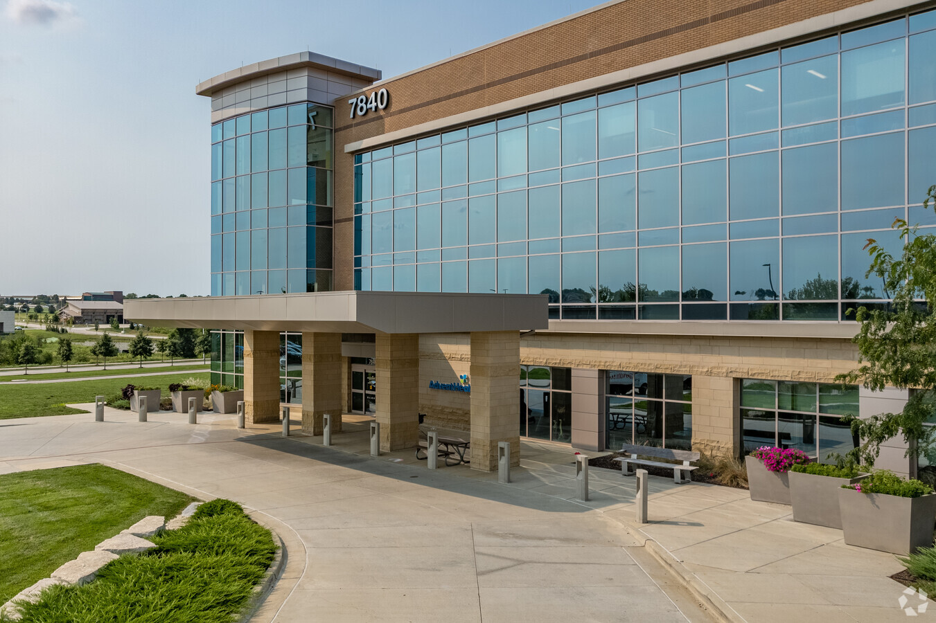
7820 W 165Th St, Overland Park, KS 66223

Current Lease Availabilities
NEARBY LISTINGS FOR SALE OR LEASE
Property Detail
7820 W 165Th St
NP78270000-0004
Shawnee Mission Health - Blue Valley Thi
Hospitalpublic
18-14-25 NW1/4 EX 6.98 AC IN HWY EX .258 AC IN ST EX .33 ACIN ST EX 5.802 AC IN ST EX 3.23 AC IN ST EX 3 TRS PLATTED 1.8225 AC 4.2786 AC & 1.119 AC EX 5.366AC EX 12.3067 AC EX 1.440 AC IN HWY EX 18.9603 AC EX .624 AC EX .0393 AC IN RD EX 12.768AC EX
X
Johnson
20091C0113G
Kansas
2023
20.88 AC
2023
South Johnson County
053418
Kansas City
195,983 SF
Kansas City, MO-KS
DEMOGRAPHICS near 7820 W 165Th St
1 Mile
3 Mile
5 Mile
2024 Total Population
6,103
51,981
126,314
2029 Population
6,353
54,562
132,137
Pop Growth 2024-2029
+ 4.10%
+ 4.97%
+ 4.61%
Average Age
37
38
39
2024 Total Households
2,079
17,203
45,725
HH Growth 2024-2029
+ 4.23%
+ 4.98%
+ 4.77%
Median Household Inc
$146,281
$156,655
$135,151
Avg Household Size
2.90
3.00
2.70
2024 Avg HH Vehicles
2.00
2.00
2.00
Median Home Value
$464,778
$489,466
$456,136
Median Year Built
2007
2001
2000
Nearby Places
- Restaurants
- Banks
- Shops
- Fitness
- Groceries
Nearby Properties
Address
Land Use
TOTAL SIZE
Lot Size
Zoning
Address
Land Use
TOTAL SIZE
Lot Size
Zoning
320,892 SF
74.65 AC
R-1
Address
Land Use
TOTAL SIZE
Lot Size
Zoning
316,630 SF
62.18 AC
RE
Address
Land Use
TOTAL SIZE
Lot Size
Zoning
199,247 SF
50.19 AC
R-1
Address
Land Use
TOTAL SIZE
Lot Size
Zoning
239,520 SF
35.28 AC
R-1BJ
Address
Land Use
TOTAL SIZE
Lot Size
Zoning
122,491 SF
19.30 AC
R-1
Address
Land Use
TOTAL SIZE
Lot Size
Zoning
254,535 SF
11.97 AC
RN1
Address
Land Use
TOTAL SIZE
Lot Size
Zoning
185,906 SF
34.09 AC
R-1
Address
Land Use
TOTAL SIZE
Lot Size
Zoning
84,719 SF
16.12 AC
RURJ
Address
Land Use
TOTAL SIZE
Lot Size
Zoning
86,095 SF
16.95 AC
R-1
Address
Land Use
TOTAL SIZE
Lot Size
Zoning
119,299 SF
43.14 AC
RE
Address
Land Use
TOTAL SIZE
Lot Size
Zoning
76,942 SF
15.10 AC
R-1
Address
Land Use
TOTAL SIZE
Lot Size
Zoning
69,077 SF
17.90 AC
R-1
Address
Land Use
TOTAL SIZE
Lot Size
Zoning
65,388 SF
19.09 AC
RURJ
Address
Land Use
TOTAL SIZE
Lot Size
Zoning
56,287 SF
7.88 AC
R-1
Address
Land Use
TOTAL SIZE
Lot Size
Zoning
115,263 SF
23.66 AC
R-1
Address
Land Use
TOTAL SIZE
Lot Size
Zoning
59,770 SF
8.88 AC
CP-2
Address
Land Use
TOTAL SIZE
Lot Size
Zoning
69,455 SF
18.26 AC
RE
Address
Land Use
TOTAL SIZE
Lot Size
Zoning
69,540 SF
6.87 AC
R-1
Address
Land Use
TOTAL SIZE
Lot Size
Zoning
67,523 SF
11.95 AC
R-1
Address
Land Use
TOTAL SIZE
Lot Size
Zoning
54,585 SF
10.52 AC
RRJ
Address
Land Use
TOTAL SIZE
Lot Size
Zoning
73,251 SF
29.96 AC
RP-3
Address
Land Use
TOTAL SIZE
Lot Size
Zoning
32,158 SF
3.07 AC
RRJ
Address
Land Use
TOTAL SIZE
Lot Size
Zoning
31,890 SF
2.38 AC
R-1
Address
Land Use
TOTAL SIZE
Lot Size
Zoning
64,529 SF
11.46 AC
R-1
Address
Land Use
TOTAL SIZE
Lot Size
Zoning
62,380 SF
7.67 AC
R-1
Address
Land Use
TOTAL SIZE
Lot Size
Zoning
22,962 SF
5.37 AC
CP-2
Address
Land Use
TOTAL SIZE
Lot Size
Zoning
26,403 SF
3.60 AC
RLDJ
Address
Land Use
TOTAL SIZE
Lot Size
Zoning
70,417 SF
25.70 AC
RP-3
Address
Land Use
TOTAL SIZE
Lot Size
Zoning
50,835 SF
5.79 AC
R-1BJ
The World's #1 Commercial Real Estate Marketplace
Connect with us
© 2025 CoStar Group
The information above has been obtained from sources believed reliable. While we do not doubt its accuracy we have not verified it and make no guarantee, warranty or representation about it. It is your responsibility to independently confirm its accuracy and completeness. Any projections, opinions, assumptions, or estimates used are for example only and do not represent the current or future performance of the property. The value of this transaction to you depends on tax and other factors which should be evaluated by your tax, financial, and legal advisors. You and your advisors should conduct a careful, independent investigation of the property to determine to your satisfaction the suitability of the property for your needs.