Property Record
7821-7827 Arab Dr Se, Tumwater, WA 98501
NEARBY LISTINGS FOR SALE OR LEASE
-
-
View all Tumwater listings for sale on LoopNet.com
Property Detail
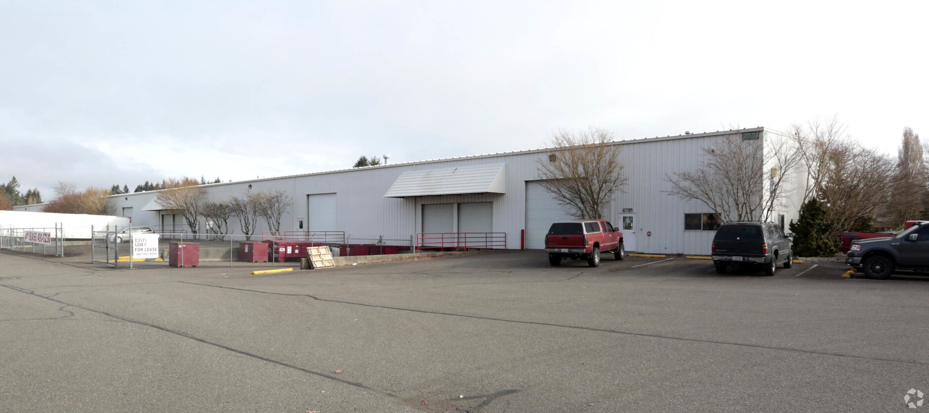
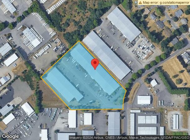
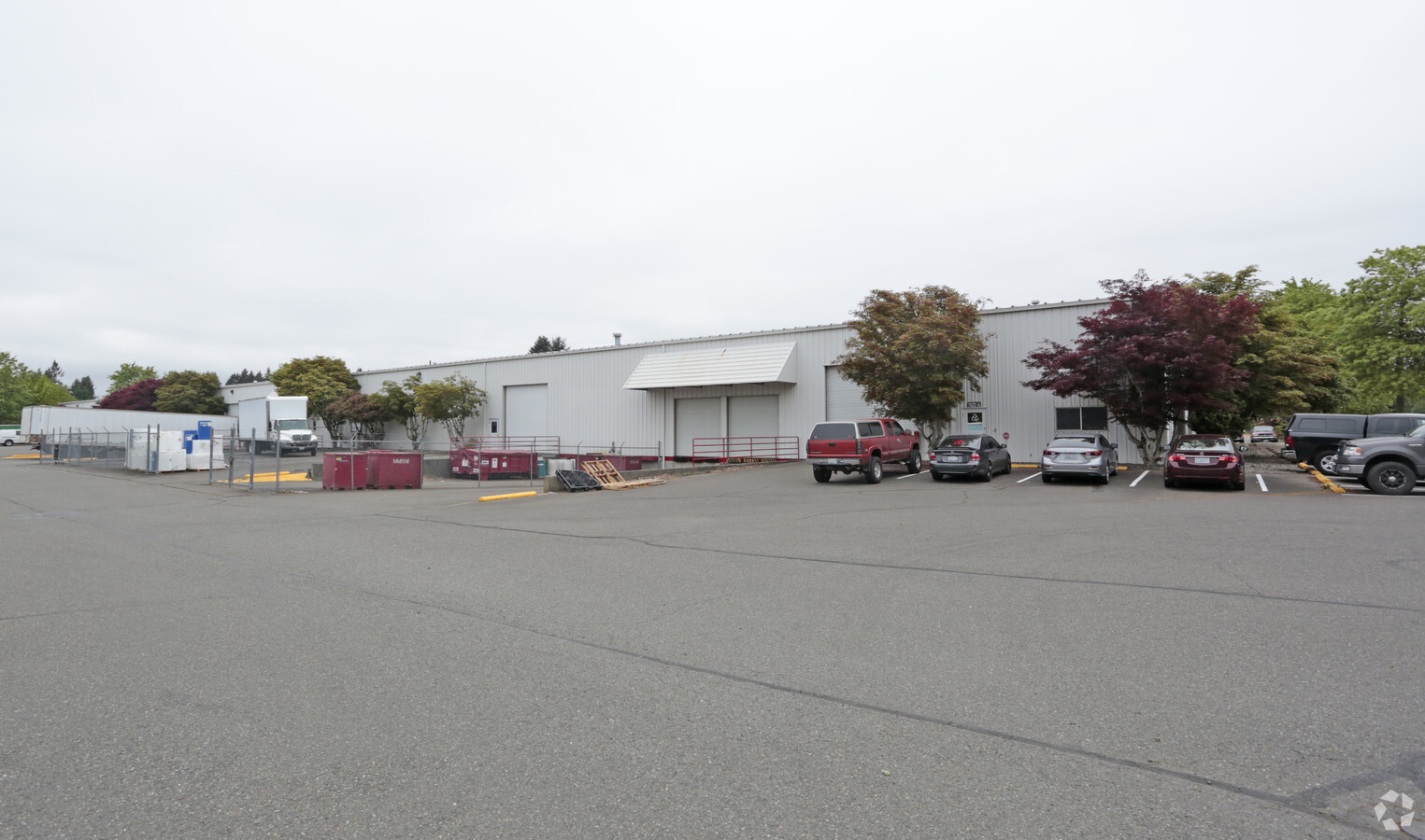
7821-7827 Arab Dr Se
Olympia-Tumwater, WA
Bush Prairie Industrial Park
38030000100
SECTION 11 TOWNSHIP 17 RANGE 2W QUARTER SE NE & NE SE PLAT BUSH PRAIRIE INDUSTRIAL PARK BLA04119639TC TR B DOCUMENT 3729577
Commercialnec
Thurston
X
Washington
53067C0282G
1
2024
5.90 AC
2024
Tumwater/S Olympia
011720
Olympia
99,000 SF
DEMOGRAPHICS near 7821-7827 Arab Dr Se
1 Mile
3 Mile
5 Mile
2024 Total Population
3,575
35,762
106,068
2029 Population
3,827
38,019
112,089
Pop Growth 2024-2029
+ 7.05%
+ 6.31%
+ 5.68%
Average Age
39
41
41
2024 Total Households
1,295
14,331
43,673
HH Growth 2024-2029
+ 7.10%
+ 6.36%
+ 5.81%
Median Household Inc
$99,209
$85,143
$76,606
Avg Household Size
2.80
2.50
2.40
2024 Avg HH Vehicles
2.00
2.00
2.00
Median Home Value
$404,709
$423,993
$412,727
Median Year Built
2005
1992
1990
Nearby Places
- Restaurants
- Banks
- Shops
- Fitness
- Groceries
PUBLIC TRANSPORTATION
COMMUTER RAIL
Olympia-Lacey Amtrak Station (Amtrak Cascades - Amtrak, Coast Starlight - Amtrak)
Drive
Walk
Distance
Olympia-Lacey Amtrak Station (Amtrak Cascades - Amtrak, Coast Starlight - Amtrak)
17 min
7.2 mi
Freight Ports
Port of Tacoma
Drive
Walk
Distance
Port of Tacoma
49 min
36.0 mi
Nearby Properties
Address
Land Use
TOTAL SIZE
Lot Size
Zoning
Address
Land Use
TOTAL SIZE
Lot Size
Zoning
1099200
79.09 AC
LI
Address
Land Use
TOTAL SIZE
Lot Size
Zoning
395355
35.74 AC
TC
Address
Land Use
TOTAL SIZE
Lot Size
Zoning
184887
41 AC
SFM1
Address
Land Use
TOTAL SIZE
Lot Size
Zoning
Address
Land Use
TOTAL SIZE
Lot Size
Zoning
Address
Land Use
TOTAL SIZE
Lot Size
Zoning
163487
34.49 AC
CS
Address
Land Use
TOTAL SIZE
Lot Size
Zoning
199920
14.38 AC
Address
Land Use
TOTAL SIZE
Lot Size
Zoning
199880
14.54 AC
Address
Land Use
TOTAL SIZE
Lot Size
Zoning
120284
118 AC
ARI2
Address
Land Use
TOTAL SIZE
Lot Size
Zoning
155386
6.88 AC
CBC
Address
Land Use
TOTAL SIZE
Lot Size
Zoning
80956
20.97 AC
SFL
Address
Land Use
TOTAL SIZE
Lot Size
Zoning
140850
5.73 AC
MFH
Address
Land Use
TOTAL SIZE
Lot Size
Zoning
123538
6.36 AC
RM-18
Address
Land Use
TOTAL SIZE
Lot Size
Zoning
151654
6.75 AC
CBC
Address
Land Use
TOTAL SIZE
Lot Size
Zoning
157625
1.46 AC
TC2
Address
Land Use
TOTAL SIZE
Lot Size
Zoning
110064
3.47 AC
UV
Address
Land Use
TOTAL SIZE
Lot Size
Zoning
78580
21.38 AC
ARI
Address
Land Use
TOTAL SIZE
Lot Size
Zoning
105464
3.06 AC
UV
Address
Land Use
TOTAL SIZE
Lot Size
Zoning
131905
1.30 AC
TC
Address
Land Use
TOTAL SIZE
Lot Size
Zoning
Address
Land Use
TOTAL SIZE
Lot Size
Zoning
99736
6.76 AC
GC
Address
Land Use
TOTAL SIZE
Lot Size
Zoning
76142
11.94 AC
TC
Address
Land Use
TOTAL SIZE
Lot Size
Zoning
75158
19.15 AC
SFM
Address
Land Use
TOTAL SIZE
Lot Size
Zoning
161068
2.90 AC
Address
Land Use
TOTAL SIZE
Lot Size
Zoning
97399
4.06 AC
MFH
Address
Land Use
TOTAL SIZE
Lot Size
Zoning
93672
3.43 AC
CBC2
Address
Land Use
TOTAL SIZE
Lot Size
Zoning
139988
9.50 AC
MFH
Address
Land Use
TOTAL SIZE
Lot Size
Zoning
99696
1.14 AC
TC
Address
Land Use
TOTAL SIZE
Lot Size
Zoning
166148
16 AC
GC
Address
Land Use
TOTAL SIZE
Lot Size
Zoning
167807
12.15 AC
GC
Start a new search to find other properties for sale or lease
Connect with us
© 2024 CoStar Group
The information above has been obtained from sources believed reliable. While we do not doubt its accuracy we have not verified it and make no guarantee, warranty or representation about it. It is your responsibility to independently confirm its accuracy and completeness. Any projections, opinions, assumptions, or estimates used are for example only and do not represent the current or future performance of the property. The value of this transaction to you depends on tax and other factors which should be evaluated by your tax, financial, and legal advisors. You and your advisors should conduct a careful, independent investigation of the property to determine to your satisfaction the suitability of the property for your needs.