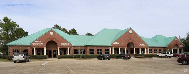
Property Record
7825 Highway 6 N, Houston, TX 77095

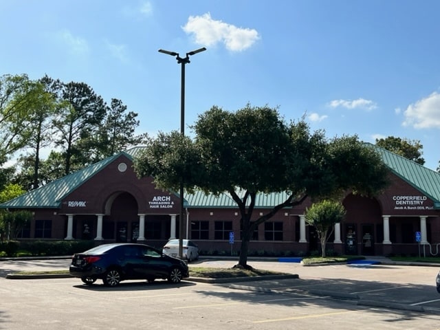
NEARBY LISTINGS FOR SALE OR LEASE
Property Detail
7825 Highway 6 N
1167890000003
Copperfield Southdown Village Copperfiel
Medicalbuilding
RES C & RES G COPPERFIELD SOUTHDOWN VILLAGE COPPERFIELD SOUTHDOWN VILLAGE SEC 1 R/P
X
Harris
48201C0420P
Texas
2024
2.48 AC
2025
FM 1960/Hwy 249
541100
Houston
19,496 SF
Houston-The Woodlands-Sugar Land, TX
DEMOGRAPHICS near 7825 Highway 6 N
1 Mile
3 Mile
5 Mile
2024 Total Population
13,825
130,328
308,248
2029 Population
13,929
131,595
311,781
Pop Growth 2024-2029
+ 0.75%
+ 0.97%
+ 1.15%
Average Age
40
37
37
2024 Total Households
5,249
44,564
102,555
HH Growth 2024-2029
+ 0.67%
+ 0.93%
+ 1.08%
Median Household Inc
$85,675
$76,493
$83,019
Avg Household Size
2.60
2.90
2.90
2024 Avg HH Vehicles
2.00
2.00
2.00
Median Home Value
$243,674
$229,065
$237,736
Median Year Built
1986
1993
1996
Nearby Places
Map Layers
Map Styles
 Street
 Aerial
- Restaurants
- Banks
- Shops
- Fitness
- Groceries
PUBLIC TRANSPORTATION
AIRPORT
George Bush Intcntl/Houston
DRIVE
WALK
Distance
George Bush Intcntl/Houston
33 min
23.2 mi
William P Hobby
DRIVE
WALK
Distance
William P Hobby
55 min
35.6 mi
SALE & LEASE HISTORY
LISTING DATE
SALE/LEASE

May 27, 2021
For Lease
Mar 07, 2024
For Lease
Mar 05, 2018
For Lease
Jun 26, 2022
For Lease
Jul 01, 2020
For Lease
Feb 05, 2018
For Lease
Nearby Properties
Address
Land Use
TOTAL SIZE
Lot Size
Zoning
Address
Land Use
TOTAL SIZE
Lot Size
Zoning
311,285 SF
14.47 AC
Address
Land Use
TOTAL SIZE
Lot Size
Zoning
697,158 SF
Address
Land Use
TOTAL SIZE
Lot Size
Zoning
386,642 SF
14.45 AC
Address
Land Use
TOTAL SIZE
Lot Size
Zoning
466,299 SF
23.82 AC
Address
Land Use
TOTAL SIZE
Lot Size
Zoning
120.78 AC
Address
Land Use
TOTAL SIZE
Lot Size
Zoning
560,725 SF
31.41 AC
Address
Land Use
TOTAL SIZE
Lot Size
Zoning
373,516 SF
18.63 AC
Address
Land Use
TOTAL SIZE
Lot Size
Zoning
1,353,057 SF
224.60 AC
Address
Land Use
TOTAL SIZE
Lot Size
Zoning
266,802 SF
3.14 AC
Address
Land Use
TOTAL SIZE
Lot Size
Zoning
408,710 SF
4.49 AC
Address
Land Use
TOTAL SIZE
Lot Size
Zoning
358,713 SF
19.91 AC
Address
Land Use
TOTAL SIZE
Lot Size
Zoning
320,084 SF
8.01 AC
Address
Land Use
TOTAL SIZE
Lot Size
Zoning
471,800 SF
27.03 AC
Address
Land Use
TOTAL SIZE
Lot Size
Zoning
55.82 AC
Address
Land Use
TOTAL SIZE
Lot Size
Zoning
307,698 SF
13.12 AC
Address
Land Use
TOTAL SIZE
Lot Size
Zoning
449,032 SF
23.46 AC
Address
Land Use
TOTAL SIZE
Lot Size
Zoning
387,245 SF
18.18 AC
Address
Land Use
TOTAL SIZE
Lot Size
Zoning
151,314 SF
3.88 AC
Address
Land Use
TOTAL SIZE
Lot Size
Zoning
408,144 SF
26.13 AC
Address
Land Use
TOTAL SIZE
Lot Size
Zoning
418,572 SF
24.76 AC
Address
Land Use
TOTAL SIZE
Lot Size
Zoning
392,185 SF
30.73 AC
Address
Land Use
TOTAL SIZE
Lot Size
Zoning
375,251 SF
14.85 AC
Address
Land Use
TOTAL SIZE
Lot Size
Zoning
401,107 SF
33.90 AC
Address
Land Use
TOTAL SIZE
Lot Size
Zoning
491,051 SF
50 AC
Address
Land Use
TOTAL SIZE
Lot Size
Zoning
388,223 SF
14.99 AC
Address
Land Use
TOTAL SIZE
Lot Size
Zoning
384,280 SF
27.19 AC
Address
Land Use
TOTAL SIZE
Lot Size
Zoning
363,896 SF
21.69 AC
Address
Land Use
TOTAL SIZE
Lot Size
Zoning
371,729 SF
18.73 AC
Address
Land Use
TOTAL SIZE
Lot Size
Zoning
412,250 SF
45.79 AC
Address
Land Use
TOTAL SIZE
Lot Size
Zoning
364,057 SF
22.03 AC
The World's #1 Commercial Real Estate Marketplace
Connect with us
© 2025 CoStar Group
The information above has been obtained from sources believed reliable. While we do not doubt its accuracy we have not verified it and make no guarantee, warranty or representation about it. It is your responsibility to independently confirm its accuracy and completeness. Any projections, opinions, assumptions, or estimates used are for example only and do not represent the current or future performance of the property. The value of this transaction to you depends on tax and other factors which should be evaluated by your tax, financial, and legal advisors. You and your advisors should conduct a careful, independent investigation of the property to determine to your satisfaction the suitability of the property for your needs.