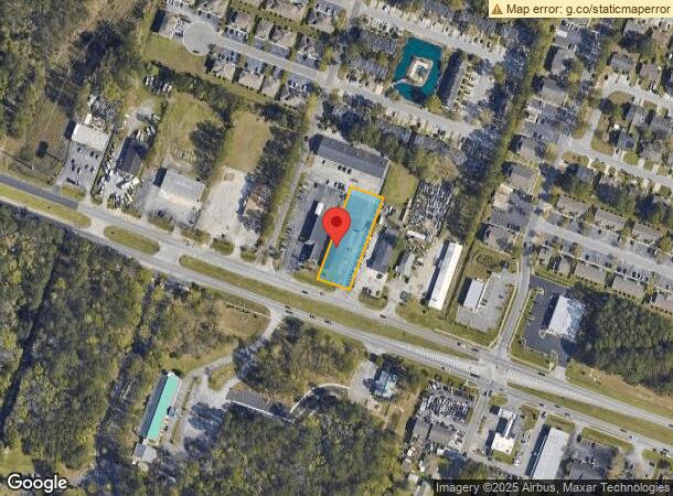
Property Record
7880 Dorchester Rd, North Charleston, SC 29418
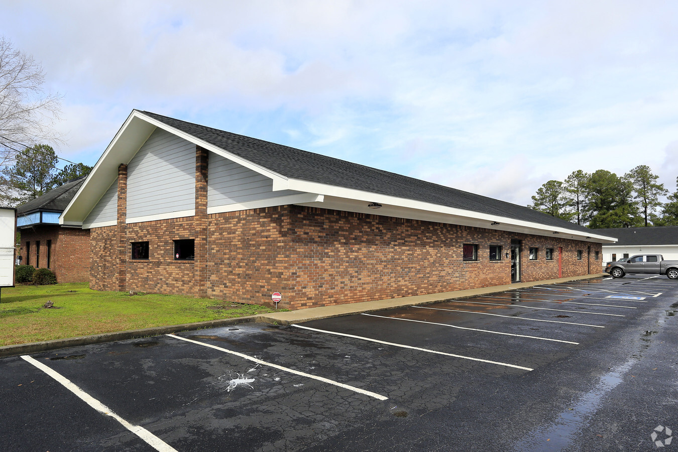
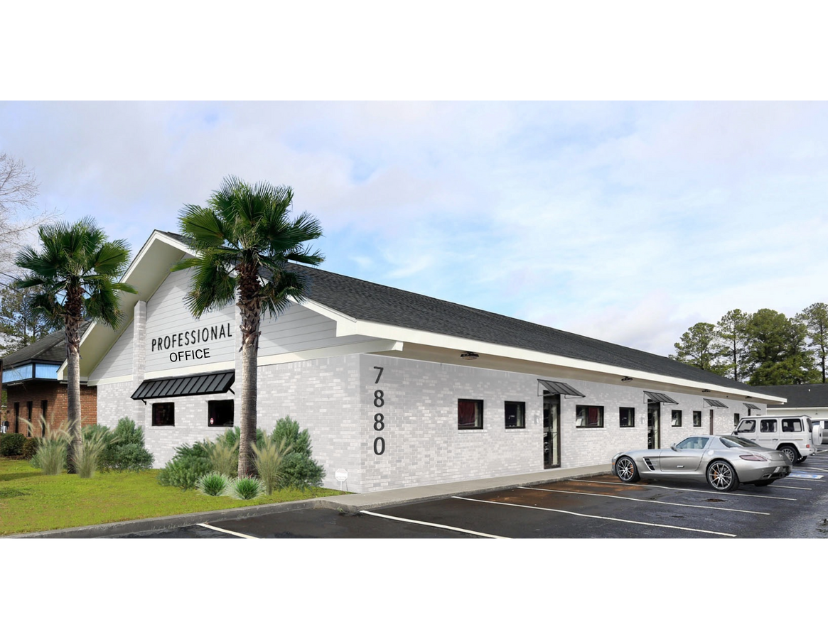
This Property Is For Sale
Current Lease Availabilities
NEARBY LISTINGS FOR SALE OR LEASE
Property Detail
7880 Dorchester Rd
Charleston-North Charleston, SC
City/North Charleston
397-00-00-060
LEGAL DESCRIPTION DESCRIPTION -LOT 2-A SITE NAME -WILLIE'S PLATSUFFIX DA-106 POLTWP 006
Commercialnec
Charleston
X
South Carolina
45019C0289K
2
2024
0.93 AC
2023
North Charleston
003108
Charleston/N Charleston
6,576 SF
DEMOGRAPHICS near 7880 Dorchester Rd
1 Mile
3 Mile
5 Mile
2024 Total Population
9,267
45,424
119,996
2029 Population
10,008
48,640
129,317
Pop Growth 2024-2029
+ 8.00%
+ 7.08%
+ 7.77%
Average Age
39
37
37
2024 Total Households
3,960
17,315
47,228
HH Growth 2024-2029
+ 8.03%
+ 7.04%
+ 7.60%
Median Household Inc
$55,627
$58,710
$61,549
Avg Household Size
2.30
2.50
2.50
2024 Avg HH Vehicles
2.00
2.00
2.00
Median Home Value
$186,042
$227,085
$251,713
Median Year Built
1990
1993
1994
Nearby Places
- Restaurants
- Banks
- Shops
- Fitness
- Groceries
PUBLIC TRANSPORTATION
COMMUTER RAIL
Charleston Amtrak Station (Palmetto - Amtrak, Silver Meteor - Amtrak)
DRIVE
WALK
Distance
Charleston Amtrak Station (Palmetto - Amtrak, Silver Meteor - Amtrak)
12 min
8.2 mi
AIRPORT
Charleston AFB/International
DRIVE
WALK
Distance
Charleston AFB/International
6 min
3.2 mi
Freight Ports
North Charleston Terminal
DRIVE
WALK
Distance
North Charleston Terminal
14 min
9.3 mi
Nearby Properties
Address
Land Use
TOTAL SIZE
Lot Size
Zoning
Address
Land Use
TOTAL SIZE
Lot Size
Zoning
Address
Land Use
TOTAL SIZE
Lot Size
Zoning
7,200 SF
8.73 AC
Address
Land Use
TOTAL SIZE
Lot Size
Zoning
199,300 SF
13.28 AC
Address
Land Use
TOTAL SIZE
Lot Size
Zoning
126,385 SF
13.45 AC
Address
Land Use
TOTAL SIZE
Lot Size
Zoning
48,400 SF
5.76 AC
Address
Land Use
TOTAL SIZE
Lot Size
Zoning
33.88 AC
Address
Land Use
TOTAL SIZE
Lot Size
Zoning
Address
Land Use
TOTAL SIZE
Lot Size
Zoning
44,300 SF
2.34 AC
Address
Land Use
TOTAL SIZE
Lot Size
Zoning
1.26 AC
Address
Land Use
TOTAL SIZE
Lot Size
Zoning
332,013 SF
74.26 AC
R3_NC
Address
Land Use
TOTAL SIZE
Lot Size
Zoning
105,600 SF
7.22 AC
Address
Land Use
TOTAL SIZE
Lot Size
Zoning
Address
Land Use
TOTAL SIZE
Lot Size
Zoning
189,648 SF
40.49 AC
R1_NC
Address
Land Use
TOTAL SIZE
Lot Size
Zoning
194,994 SF
21.28 AC
R4_DC
Address
Land Use
TOTAL SIZE
Lot Size
Zoning
1,842 SF
17.11 AC
Address
Land Use
TOTAL SIZE
Lot Size
Zoning
256,996 SF
29.96 AC
PDD_NC
Address
Land Use
TOTAL SIZE
Lot Size
Zoning
228,432 SF
12.96 AC
B2_NC
Address
Land Use
TOTAL SIZE
Lot Size
Zoning
3,200 SF
45.22 AC
Address
Land Use
TOTAL SIZE
Lot Size
Zoning
Address
Land Use
TOTAL SIZE
Lot Size
Zoning
199,035 SF
45.85 AC
B2_NC
Address
Land Use
TOTAL SIZE
Lot Size
Zoning
54,966 SF
4.54 AC
R1_NC
Address
Land Use
TOTAL SIZE
Lot Size
Zoning
Address
Land Use
TOTAL SIZE
Lot Size
Zoning
236,448 SF
12.66 AC
R2_NC
Address
Land Use
TOTAL SIZE
Lot Size
Zoning
184,860 SF
46.80 AC
I_DC
Address
Land Use
TOTAL SIZE
Lot Size
Zoning
Address
Land Use
TOTAL SIZE
Lot Size
Zoning
45,404 SF
67.87 AC
I_DC
Address
Land Use
TOTAL SIZE
Lot Size
Zoning
6,300 SF
0.75 AC
Address
Land Use
TOTAL SIZE
Lot Size
Zoning
Address
Land Use
TOTAL SIZE
Lot Size
Zoning
88,739 SF
30.72 AC
R1_NC
Address
Land Use
TOTAL SIZE
Lot Size
Zoning
The World's #1 Commercial Real Estate Marketplace
Connect with us
© 2025 CoStar Group
The information above has been obtained from sources believed reliable. While we do not doubt its accuracy we have not verified it and make no guarantee, warranty or representation about it. It is your responsibility to independently confirm its accuracy and completeness. Any projections, opinions, assumptions, or estimates used are for example only and do not represent the current or future performance of the property. The value of this transaction to you depends on tax and other factors which should be evaluated by your tax, financial, and legal advisors. You and your advisors should conduct a careful, independent investigation of the property to determine to your satisfaction the suitability of the property for your needs.