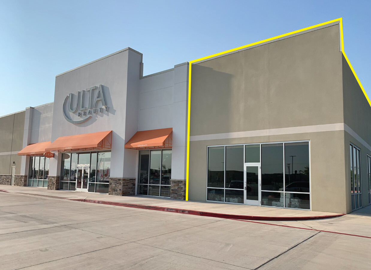
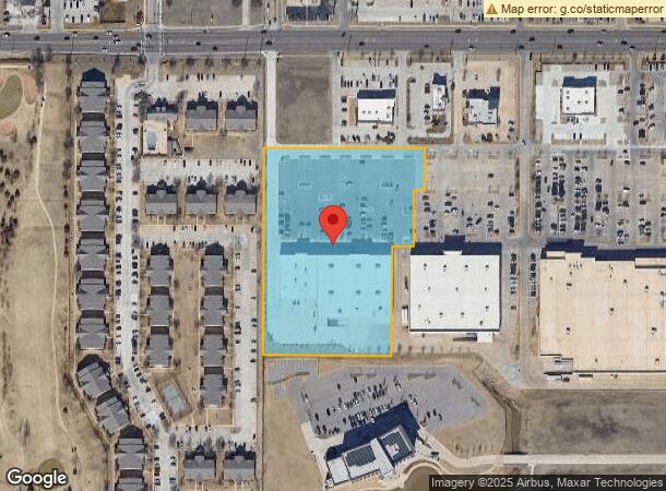
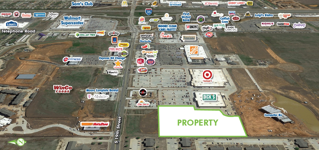
Property Record
790 Sw 19Th St, Moore, OK 73160
NEARBY LISTINGS FOR SALE OR LEASE
Property Detail
790 Sw 19Th St
Oklahoma City, OK
Fritts Farm 2
R0166065
FRITTS FARM 2 LOT 1 BLOCK 1
Regionalshoppingcenterormallwithanchorstore
Cleveland
X
Oklahoma
40027C0160K
1
2023
5.52 AC
2023
Norman
202207
Oklahoma City
54,150 SF
DEMOGRAPHICS near 790 Sw 19Th St
1 Mile
3 Mile
5 Mile
2024 Total Population
10,690
71,876
135,821
2029 Population
11,063
74,401
141,008
Pop Growth 2024-2029
+ 3.49%
+ 3.51%
+ 3.82%
Average Age
36
37
38
2024 Total Households
4,253
27,300
52,129
HH Growth 2024-2029
+ 3.64%
+ 3.68%
+ 4.04%
Median Household Inc
$64,828
$71,076
$72,871
Avg Household Size
2.50
2.60
2.50
2024 Avg HH Vehicles
2.00
2.00
2.00
Median Home Value
$172,132
$168,582
$188,710
Median Year Built
2003
1993
1994
Nearby Places
- Restaurants
- Banks
- Shops
- Fitness
- Groceries
PUBLIC TRANSPORTATION
COMMUTER RAIL
Norman Amtrak Station (Heartland Flyer - Amtrak)
DRIVE
WALK
Distance
Norman Amtrak Station (Heartland Flyer - Amtrak)
16 min
8.7 mi
AIRPORT
Will Rogers World
DRIVE
WALK
Distance
Will Rogers World
26 min
14.4 mi
Freight Ports
Tulsa Port Of Catoosa
DRIVE
WALK
Distance
Tulsa Port Of Catoosa
148 min
133.7 mi
SALE & LEASE HISTORY
LISTING DATE
SALE/LEASE

Sep 25, 2016
For Lease
Oct 22, 2020
For Lease
Nov 12, 2019
For Lease
Mar 19, 2021
For Sale
Jul 30, 2021
For Lease
Nearby Properties
Address
Land Use
TOTAL SIZE
Lot Size
Zoning
Address
Land Use
TOTAL SIZE
Lot Size
Zoning
210,816 SF
10.45 AC
Address
Land Use
TOTAL SIZE
Lot Size
Zoning
Address
Land Use
TOTAL SIZE
Lot Size
Zoning
29.38 AC
Address
Land Use
TOTAL SIZE
Lot Size
Zoning
Address
Land Use
TOTAL SIZE
Lot Size
Zoning
0.16 AC
C6
Address
Land Use
TOTAL SIZE
Lot Size
Zoning
40.15 AC
AA
Address
Land Use
TOTAL SIZE
Lot Size
Zoning
Address
Land Use
TOTAL SIZE
Lot Size
Zoning
11.36 AC
C4
Address
Land Use
TOTAL SIZE
Lot Size
Zoning
5.14 AC
Address
Land Use
TOTAL SIZE
Lot Size
Zoning
44,478 SF
2.44 AC
Address
Land Use
TOTAL SIZE
Lot Size
Zoning
31,216 SF
10 AC
Address
Land Use
TOTAL SIZE
Lot Size
Zoning
554,068 SF
71.81 AC
Address
Land Use
TOTAL SIZE
Lot Size
Zoning
14,714 SF
14.41 AC
Address
Land Use
TOTAL SIZE
Lot Size
Zoning
2,200 SF
12.41 AC
Address
Land Use
TOTAL SIZE
Lot Size
Zoning
Address
Land Use
TOTAL SIZE
Lot Size
Zoning
0.77 AC
Address
Land Use
TOTAL SIZE
Lot Size
Zoning
1.28 AC
Address
Land Use
TOTAL SIZE
Lot Size
Zoning
10.81 AC
Address
Land Use
TOTAL SIZE
Lot Size
Zoning
33,780 SF
17.24 AC
Address
Land Use
TOTAL SIZE
Lot Size
Zoning
18.41 AC
Address
Land Use
TOTAL SIZE
Lot Size
Zoning
23,026 SF
8.53 AC
Address
Land Use
TOTAL SIZE
Lot Size
Zoning
3.54 AC
Address
Land Use
TOTAL SIZE
Lot Size
Zoning
4,656 SF
14.96 AC
Address
Land Use
TOTAL SIZE
Lot Size
Zoning
29,174 SF
16.62 AC
Address
Land Use
TOTAL SIZE
Lot Size
Zoning
Address
Land Use
TOTAL SIZE
Lot Size
Zoning
191,355 SF
13.41 AC
Address
Land Use
TOTAL SIZE
Lot Size
Zoning
1.34 AC
Address
Land Use
TOTAL SIZE
Lot Size
Zoning
12,000 SF
9.99 AC
Address
Land Use
TOTAL SIZE
Lot Size
Zoning
10,947 SF
1 AC
Address
Land Use
TOTAL SIZE
Lot Size
Zoning
3.15 AC
The World's #1 Commercial Real Estate Marketplace
Connect with us
© 2025 CoStar Group
The information above has been obtained from sources believed reliable. While we do not doubt its accuracy we have not verified it and make no guarantee, warranty or representation about it. It is your responsibility to independently confirm its accuracy and completeness. Any projections, opinions, assumptions, or estimates used are for example only and do not represent the current or future performance of the property. The value of this transaction to you depends on tax and other factors which should be evaluated by your tax, financial, and legal advisors. You and your advisors should conduct a careful, independent investigation of the property to determine to your satisfaction the suitability of the property for your needs.