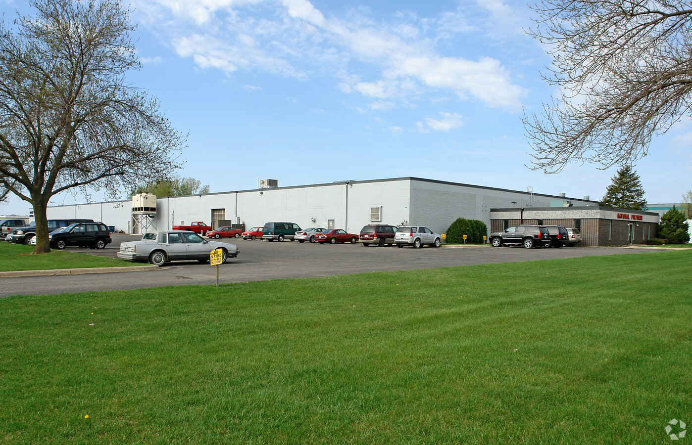
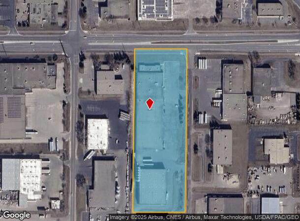
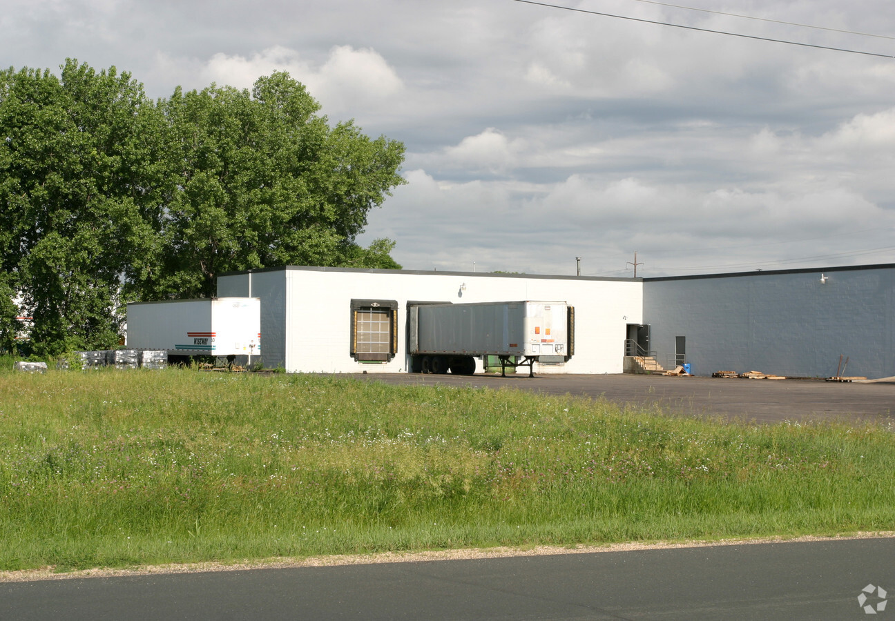
Property Record
7920 215Th St W, Lakeville, MN 55044
NEARBY LISTINGS FOR SALE OR LEASE
Property Detail
7920 215Th St W
Minneapolis-St. Paul-Bloomington, MN-WI
Airlake Ind Pk 1St Add
22-11100-02-111
AIRLAKE IND PK 1ST ADD 11 2 LOTS 10 & 11 BLK 2 SUBJ TO RD OVER N 52 FT
Industrialgeneral
Dakota
X
Minnesota
27037C0213E
111
2024
6.32 AC
2023
South Central
060836
Minneapolis/St Paul
105,147 SF
DEMOGRAPHICS near 7920 215Th St W
1 Mile
3 Mile
5 Mile
2024 Total Population
3,013
22,723
77,729
2029 Population
3,180
23,516
80,059
Pop Growth 2024-2029
+ 5.54%
+ 3.49%
+ 3.00%
Average Age
35
35
36
2024 Total Households
1,012
7,506
25,997
HH Growth 2024-2029
+ 5.43%
+ 3.44%
+ 3.10%
Median Household Inc
$82,683
$119,545
$116,825
Avg Household Size
2.90
3.00
2.90
2024 Avg HH Vehicles
2.00
2.00
2.00
Median Home Value
$363,999
$399,536
$371,080
Median Year Built
2003
2002
1998
Nearby Places
- Restaurants
- Banks
- Shops
- Fitness
- Groceries
PUBLIC TRANSPORTATION
AIRPORT
Minneapolis-St Paul International/Wold-Chamberlain
DRIVE
WALK
Distance
Minneapolis-St Paul International/Wold-Chamberlain
30 min
18.6 mi
Freight Ports
Port Milwaukee
DRIVE
WALK
Distance
Port Milwaukee
381 min
342.3 mi
Nearby Properties
Address
Land Use
TOTAL SIZE
Lot Size
Zoning
Address
Land Use
TOTAL SIZE
Lot Size
Zoning
749,550 SF
71.74 AC
Address
Land Use
TOTAL SIZE
Lot Size
Zoning
179,859 SF
43.48 AC
Address
Land Use
TOTAL SIZE
Lot Size
Zoning
282,100 SF
18.86 AC
Address
Land Use
TOTAL SIZE
Lot Size
Zoning
359,914 SF
18.86 AC
Address
Land Use
TOTAL SIZE
Lot Size
Zoning
374,622 SF
18.74 AC
Address
Land Use
TOTAL SIZE
Lot Size
Zoning
187,993 SF
21.88 AC
Address
Land Use
TOTAL SIZE
Lot Size
Zoning
121,600 SF
27.55 AC
Address
Land Use
TOTAL SIZE
Lot Size
Zoning
275,666 SF
23.58 AC
Address
Land Use
TOTAL SIZE
Lot Size
Zoning
151,200 SF
17.20 AC
Address
Land Use
TOTAL SIZE
Lot Size
Zoning
94,592 SF
14.30 AC
Address
Land Use
TOTAL SIZE
Lot Size
Zoning
276,560 SF
20.11 AC
Address
Land Use
TOTAL SIZE
Lot Size
Zoning
12.51 AC
Address
Land Use
TOTAL SIZE
Lot Size
Zoning
93,883 SF
4.17 AC
Address
Land Use
TOTAL SIZE
Lot Size
Zoning
56,950 SF
27.71 AC
Address
Land Use
TOTAL SIZE
Lot Size
Zoning
130,180 SF
9.01 AC
Address
Land Use
TOTAL SIZE
Lot Size
Zoning
78,220 SF
5.96 AC
Address
Land Use
TOTAL SIZE
Lot Size
Zoning
109,440 SF
8.92 AC
Address
Land Use
TOTAL SIZE
Lot Size
Zoning
102,664 SF
3.82 AC
Address
Land Use
TOTAL SIZE
Lot Size
Zoning
112,730 SF
5.73 AC
Address
Land Use
TOTAL SIZE
Lot Size
Zoning
131,634 SF
10.76 AC
Address
Land Use
TOTAL SIZE
Lot Size
Zoning
49,460 SF
14.65 AC
Address
Land Use
TOTAL SIZE
Lot Size
Zoning
84,582 SF
14.20 AC
Address
Land Use
TOTAL SIZE
Lot Size
Zoning
54,378 SF
6.48 AC
Address
Land Use
TOTAL SIZE
Lot Size
Zoning
75,411 SF
1.12 AC
Address
Land Use
TOTAL SIZE
Lot Size
Zoning
61,674 SF
10.30 AC
Address
Land Use
TOTAL SIZE
Lot Size
Zoning
137,542 SF
11.85 AC
Address
Land Use
TOTAL SIZE
Lot Size
Zoning
87,670 SF
1.84 AC
Address
Land Use
TOTAL SIZE
Lot Size
Zoning
99,365 SF
0.50 AC
The World's #1 Commercial Real Estate Marketplace
Connect with us
© 2025 CoStar Group
The information above has been obtained from sources believed reliable. While we do not doubt its accuracy we have not verified it and make no guarantee, warranty or representation about it. It is your responsibility to independently confirm its accuracy and completeness. Any projections, opinions, assumptions, or estimates used are for example only and do not represent the current or future performance of the property. The value of this transaction to you depends on tax and other factors which should be evaluated by your tax, financial, and legal advisors. You and your advisors should conduct a careful, independent investigation of the property to determine to your satisfaction the suitability of the property for your needs.