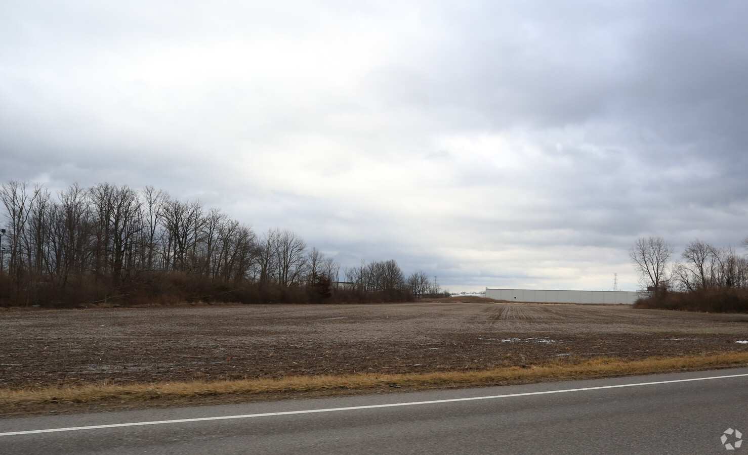
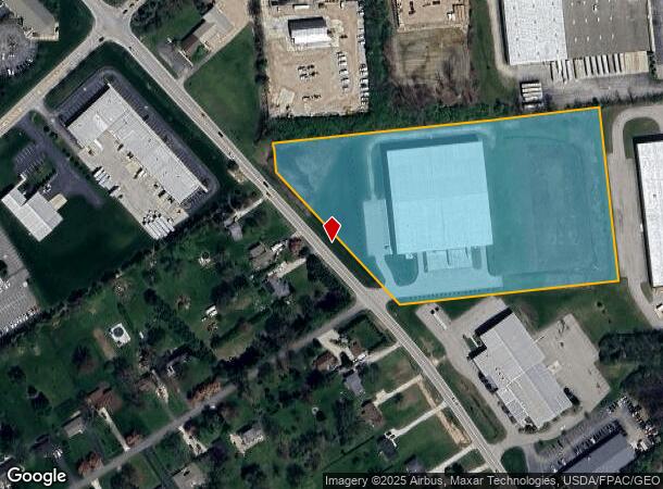
Property Record
7920 Industrial Pkwy, Plain City, OH 43064
NEARBY LISTINGS FOR SALE OR LEASE
-
-
View all Plain City listings for sale on LoopNet.com
Property Detail
7920 Industrial Pkwy
15-0028008-0000
Vms #6595
Publicstorage
VMS 6595 201708170006720
X
Union
39159C0390D
Ohio
2024
3.50 AC
2023
Union County
050601
Columbus
75,790 SF
Columbus, OH
DEMOGRAPHICS near 7920 Industrial Pkwy
1 Mile
3 Mile
5 Mile
2024 Total Population
1,016
27,168
75,776
2029 Population
1,243
29,726
80,632
Pop Growth 2024-2029
+ 22.34%
+ 9.42%
+ 6.41%
Average Age
35
39
39
2024 Total Households
321
8,959
27,428
HH Growth 2024-2029
+ 22.43%
+ 9.18%
+ 5.78%
Median Household Inc
$188,067
$165,919
$128,827
Avg Household Size
3.20
3.00
2.70
2024 Avg HH Vehicles
2.00
2.00
2.00
Median Home Value
$531,250
$461,794
$423,836
Median Year Built
2011
2000
1999
Nearby Places
- Restaurants
- Banks
- Shops
- Fitness
- Groceries
PUBLIC TRANSPORTATION
AIRPORT
John Glenn Columbus International
DRIVE
WALK
Distance
John Glenn Columbus International
36 min
26.2 mi
Rickenbacker International
DRIVE
WALK
Distance
Rickenbacker International
42 min
31.6 mi
Freight Ports
Port of Toledo
DRIVE
WALK
Distance
Port of Toledo
166 min
120.8 mi
SALE & LEASE HISTORY
LISTING DATE
SALE/LEASE

Sep 25, 2016
For Lease
Sep 24, 2016
For Sale
Jan 19, 2017
For Sale
Nearby Properties
Address
Land Use
TOTAL SIZE
Lot Size
Zoning
Address
Land Use
TOTAL SIZE
Lot Size
Zoning
1,392,264 SF
45.57 AC
Address
Land Use
TOTAL SIZE
Lot Size
Zoning
256,984 SF
10.49 AC
Address
Land Use
TOTAL SIZE
Lot Size
Zoning
486,569 SF
96.85 AC
Address
Land Use
TOTAL SIZE
Lot Size
Zoning
139,776 SF
15.54 AC
Address
Land Use
TOTAL SIZE
Lot Size
Zoning
131,940 SF
34.46 AC
Address
Land Use
TOTAL SIZE
Lot Size
Zoning
399,273 SF
15 AC
Address
Land Use
TOTAL SIZE
Lot Size
Zoning
59,144 SF
87.61 AC
Address
Land Use
TOTAL SIZE
Lot Size
Zoning
105,542 SF
14.50 AC
Address
Land Use
TOTAL SIZE
Lot Size
Zoning
98,049 SF
19.88 AC
Address
Land Use
TOTAL SIZE
Lot Size
Zoning
55,622 SF
8.98 AC
Address
Land Use
TOTAL SIZE
Lot Size
Zoning
130,839 SF
13.35 AC
Address
Land Use
TOTAL SIZE
Lot Size
Zoning
50,238 SF
5 AC
Address
Land Use
TOTAL SIZE
Lot Size
Zoning
44,648 SF
38.47 AC
Address
Land Use
TOTAL SIZE
Lot Size
Zoning
103,368 SF
13.48 AC
Address
Land Use
TOTAL SIZE
Lot Size
Zoning
1,642 SF
92.77 AC
Address
Land Use
TOTAL SIZE
Lot Size
Zoning
480 SF
52.07 AC
Address
Land Use
TOTAL SIZE
Lot Size
Zoning
66,134 SF
8 AC
Address
Land Use
TOTAL SIZE
Lot Size
Zoning
16.85 AC
Address
Land Use
TOTAL SIZE
Lot Size
Zoning
18,325 SF
19.45 AC
Address
Land Use
TOTAL SIZE
Lot Size
Zoning
246,087 SF
5.33 AC
Address
Land Use
TOTAL SIZE
Lot Size
Zoning
239,277 SF
18.87 AC
Address
Land Use
TOTAL SIZE
Lot Size
Zoning
146,867 SF
9.16 AC
Address
Land Use
TOTAL SIZE
Lot Size
Zoning
56,852 SF
16.26 AC
Address
Land Use
TOTAL SIZE
Lot Size
Zoning
37,858 SF
5.86 AC
Address
Land Use
TOTAL SIZE
Lot Size
Zoning
65,842 SF
10.21 AC
Address
Land Use
TOTAL SIZE
Lot Size
Zoning
439,194 SF
8.38 AC
Address
Land Use
TOTAL SIZE
Lot Size
Zoning
49,399 SF
3.46 AC
Address
Land Use
TOTAL SIZE
Lot Size
Zoning
22,080 SF
11.95 AC
Address
Land Use
TOTAL SIZE
Lot Size
Zoning
42,911 SF
9.43 AC
Address
Land Use
TOTAL SIZE
Lot Size
Zoning
30,834 SF
8.50 AC
The World's #1 Commercial Real Estate Marketplace
Connect with us
© 2025 CoStar Group
The information above has been obtained from sources believed reliable. While we do not doubt its accuracy we have not verified it and make no guarantee, warranty or representation about it. It is your responsibility to independently confirm its accuracy and completeness. Any projections, opinions, assumptions, or estimates used are for example only and do not represent the current or future performance of the property. The value of this transaction to you depends on tax and other factors which should be evaluated by your tax, financial, and legal advisors. You and your advisors should conduct a careful, independent investigation of the property to determine to your satisfaction the suitability of the property for your needs.