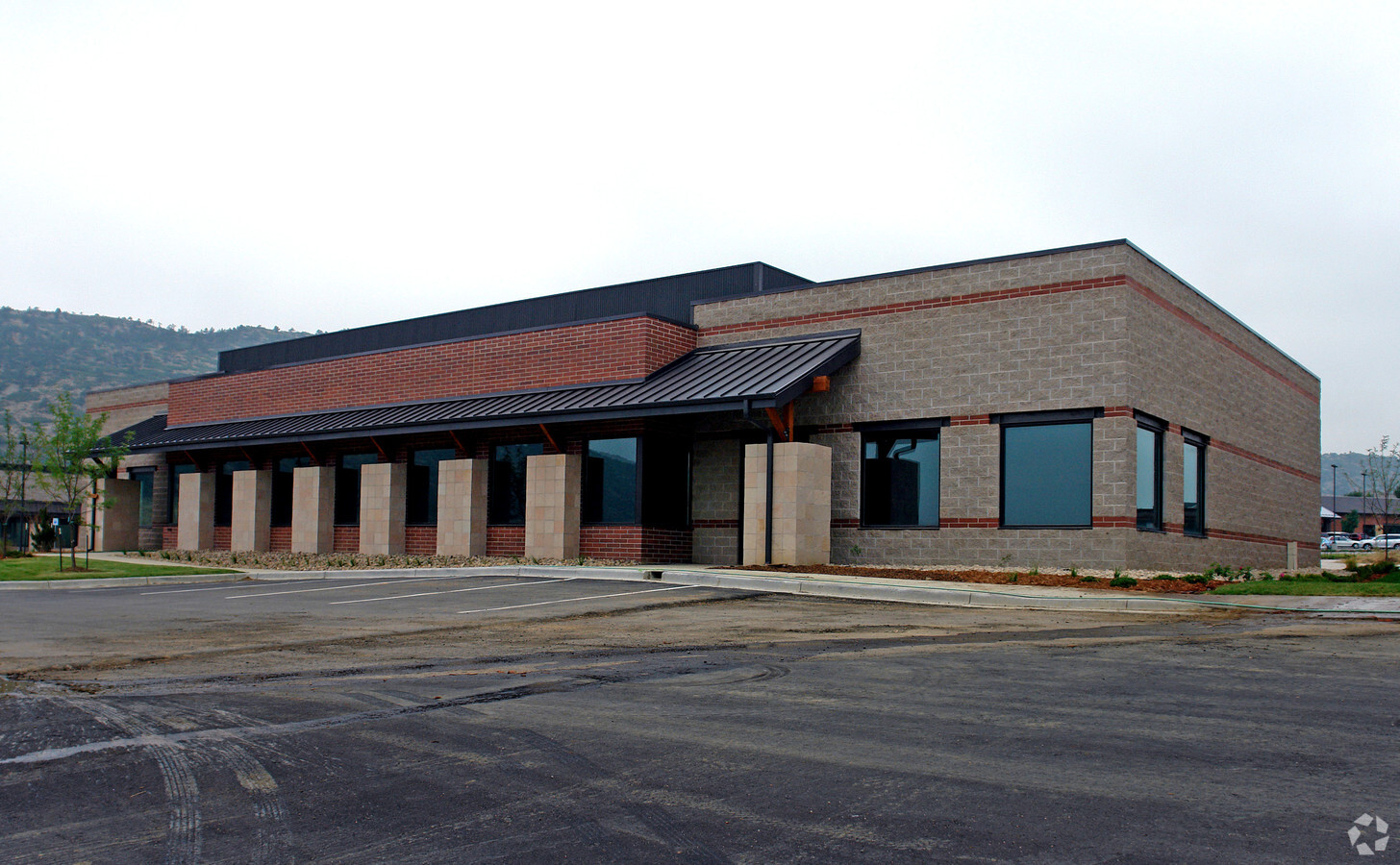
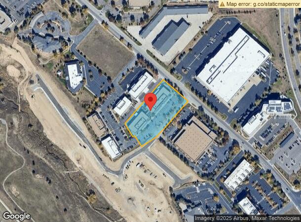
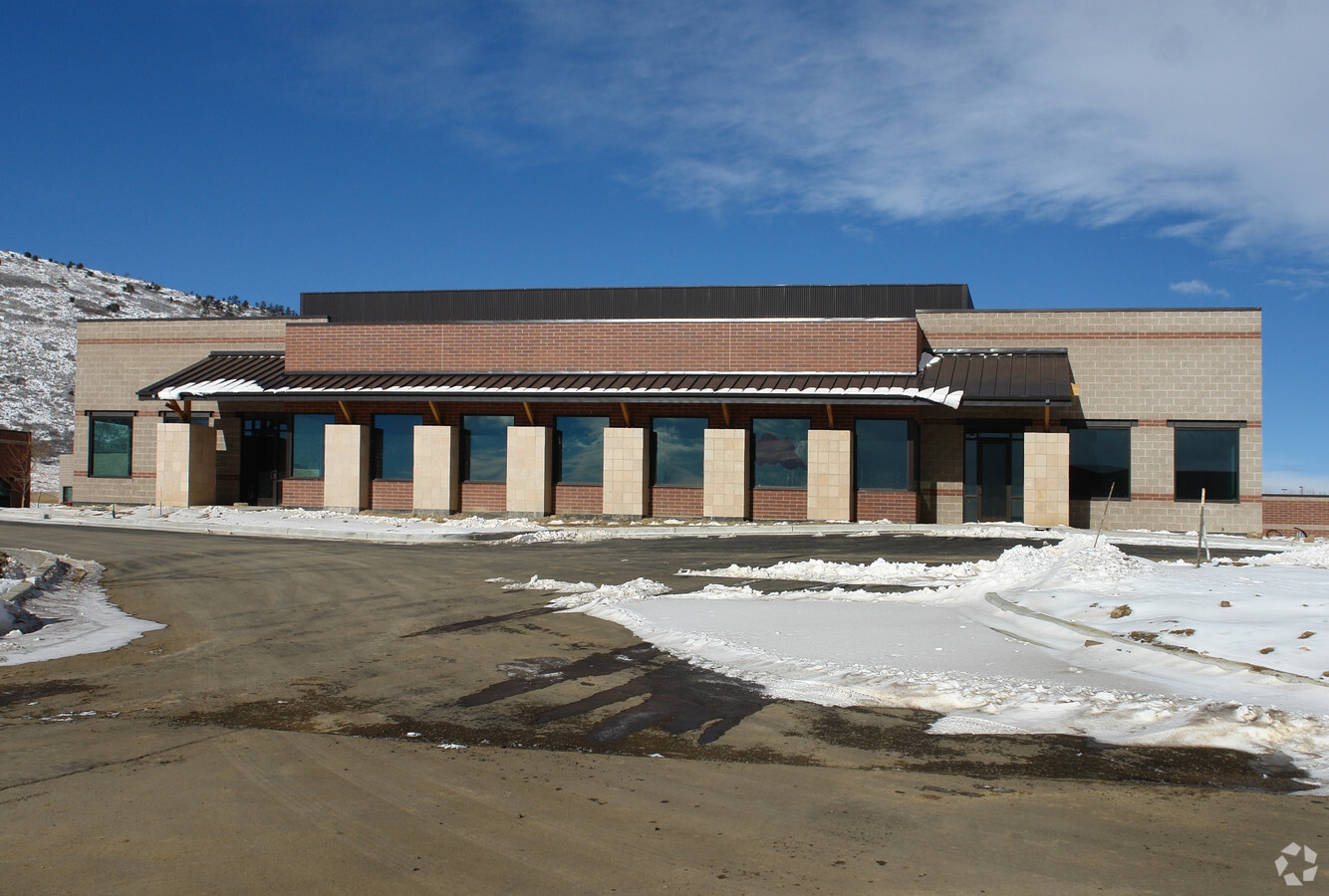
Property Record
7921 Shaffer Pkwy, Littleton, CO 80127

NEARBY LISTINGS FOR SALE OR LEASE
Property Detail
7921 Shaffer Pkwy
Denver-Aurora-Lakewood, CO
Shaffer Greens Flg 1
59-324-01-054
SECTION 32 TOWNSHIP 05 RANGE 69 QTR SE SUBDIVISIONCD 668930 SUBDIVISIONNAME SHAFFER GREENS FLG 1 BLOCK LOT 0001 SIZE: 42291 TRACT VALUE: .971 SECTION 32 TOWNSHIP 05 RANGE 69 QTR SE SUBDIVISIONCD 668930 SUBDIVISIONNAME SHAFFER GREENS FLG 1 BLOCK LOT 0
Industrialgeneral
Jefferson
X
Colorado
08059C0384F
1,2,
2023
1.73 AC
2024
Southwest C-470
012024
Denver
18,776 SF
DEMOGRAPHICS near 7921 Shaffer Pkwy
1 Mile
3 Mile
5 Mile
2024 Total Population
6,969
59,327
122,496
2029 Population
6,877
58,303
120,840
Pop Growth 2024-2029
(1.32%)
(1.73%)
(1.35%)
Average Age
43
42
42
2024 Total Households
2,868
22,867
47,297
HH Growth 2024-2029
(1.29%)
(1.79%)
(1.39%)
Median Household Inc
$115,381
$114,644
$112,067
Avg Household Size
2.40
2.50
2.50
2024 Avg HH Vehicles
2.00
2.00
2.00
Median Home Value
$659,874
$588,251
$581,717
Median Year Built
1986
1987
1987
Nearby Places
- Restaurants
- Banks
- Shops
- Fitness
- Groceries
SALE & LEASE HISTORY
LISTING DATE
SALE/LEASE

Feb 23, 2024
For Sale
Nearby Properties
Address
Land Use
TOTAL SIZE
Lot Size
Zoning
Address
Land Use
TOTAL SIZE
Lot Size
Zoning
918 SF
1,492.98 AC
A2
Address
Land Use
TOTAL SIZE
Lot Size
Zoning
895,137 SF
124.99 AC
PD
Address
Land Use
TOTAL SIZE
Lot Size
Zoning
272,246 SF
31.76 AC
PD
Address
Land Use
TOTAL SIZE
Lot Size
Zoning
2,884.97 AC
A1
Address
Land Use
TOTAL SIZE
Lot Size
Zoning
214,066 SF
82.60 AC
PD
Address
Land Use
TOTAL SIZE
Lot Size
Zoning
392,710 SF
21.22 AC
PD
Address
Land Use
TOTAL SIZE
Lot Size
Zoning
150,951 SF
17.90 AC
PD
Address
Land Use
TOTAL SIZE
Lot Size
Zoning
101,699 SF
10.34 AC
Address
Land Use
TOTAL SIZE
Lot Size
Zoning
175,000 SF
36.25 AC
PD
Address
Land Use
TOTAL SIZE
Lot Size
Zoning
297,003 SF
26.77 AC
PD
Address
Land Use
TOTAL SIZE
Lot Size
Zoning
218,391 SF
9.73 AC
PD
Address
Land Use
TOTAL SIZE
Lot Size
Zoning
120,766 SF
20.56 AC
PD
Address
Land Use
TOTAL SIZE
Lot Size
Zoning
100,550 SF
7.72 AC
PD
Address
Land Use
TOTAL SIZE
Lot Size
Zoning
188,653 SF
17.64 AC
PD
Address
Land Use
TOTAL SIZE
Lot Size
Zoning
124,224 SF
1.56 AC
Address
Land Use
TOTAL SIZE
Lot Size
Zoning
65,463 SF
4.80 AC
PD
Address
Land Use
TOTAL SIZE
Lot Size
Zoning
68,365 SF
12.17 AC
PD
Address
Land Use
TOTAL SIZE
Lot Size
Zoning
107,693 SF
9.17 AC
PD
Address
Land Use
TOTAL SIZE
Lot Size
Zoning
177,688 SF
8.45 AC
Address
Land Use
TOTAL SIZE
Lot Size
Zoning
71,791 SF
24.38 AC
PD
Address
Land Use
TOTAL SIZE
Lot Size
Zoning
12,367 SF
4.18 AC
Address
Land Use
TOTAL SIZE
Lot Size
Zoning
59,816 SF
16.92 AC
Address
Land Use
TOTAL SIZE
Lot Size
Zoning
58,550 SF
9.67 AC
Address
Land Use
TOTAL SIZE
Lot Size
Zoning
105,392 SF
7.44 AC
Address
Land Use
TOTAL SIZE
Lot Size
Zoning
28,533 SF
11.07 AC
Address
Land Use
TOTAL SIZE
Lot Size
Zoning
71,091 SF
4.93 AC
PD
Address
Land Use
TOTAL SIZE
Lot Size
Zoning
82,765 SF
4.84 AC
PD
Address
Land Use
TOTAL SIZE
Lot Size
Zoning
56,769 SF
2.28 AC
Address
Land Use
TOTAL SIZE
Lot Size
Zoning
104,984 SF
3.11 AC
Address
Land Use
TOTAL SIZE
Lot Size
Zoning
36,847 SF
3.02 AC
PD
The World's #1 Commercial Real Estate Marketplace
Connect with us
© 2025 CoStar Group
The information above has been obtained from sources believed reliable. While we do not doubt its accuracy we have not verified it and make no guarantee, warranty or representation about it. It is your responsibility to independently confirm its accuracy and completeness. Any projections, opinions, assumptions, or estimates used are for example only and do not represent the current or future performance of the property. The value of this transaction to you depends on tax and other factors which should be evaluated by your tax, financial, and legal advisors. You and your advisors should conduct a careful, independent investigation of the property to determine to your satisfaction the suitability of the property for your needs.