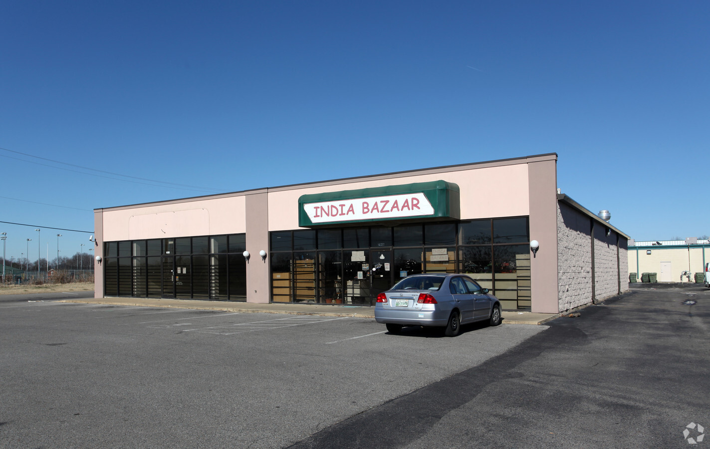
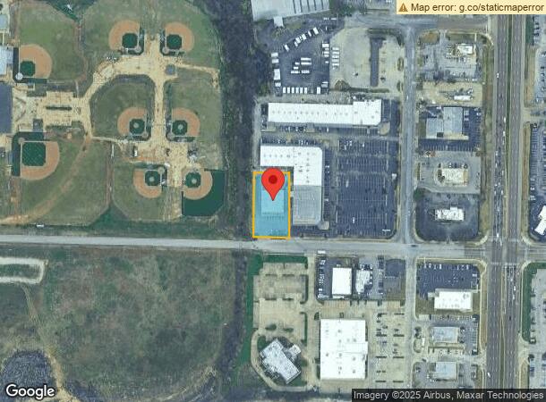
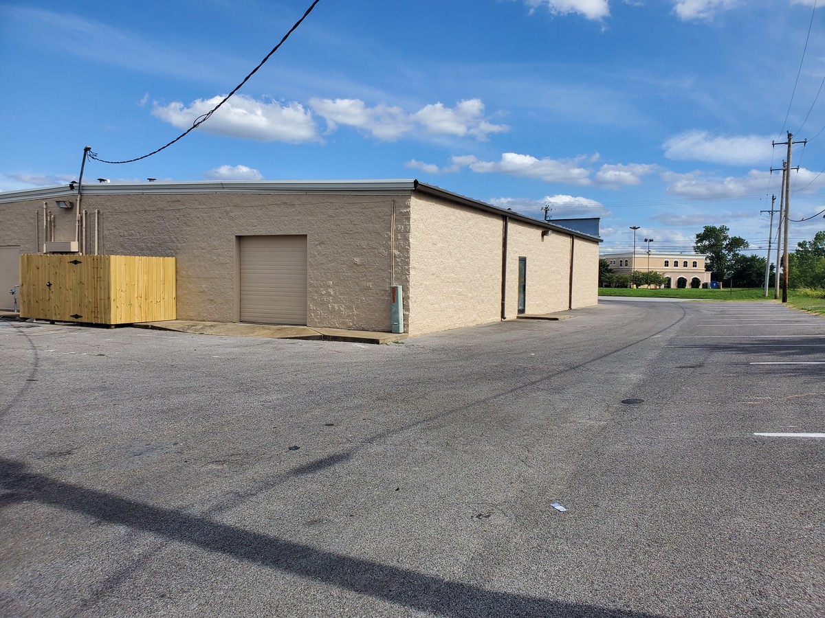
Property Record
7940 Fischer Steel Rd, Cordova, TN 38018

NEARBY LISTINGS FOR SALE OR LEASE
Property Detail
7940 Fischer Steel Rd
Memphis, TN-MS-AR
East Memphis Industrial District Ph 1
09-1033-A0-0028
NS FISCHER STEEL ROAD
Regionalshoppingcenterormallwithanchorstore
Shelby
X
Tennessee
47157C0320G
pt14
2023
0.58 AC
2024
Cordova
021125
Memphis
6,400 SF
DEMOGRAPHICS near 7940 Fischer Steel Rd
1 Mile
3 Mile
5 Mile
2024 Total Population
8,971
60,997
149,636
2029 Population
8,810
59,545
145,674
Pop Growth 2024-2029
(1.79%)
(2.38%)
(2.65%)
Average Age
38
39
39
2024 Total Households
3,992
25,175
60,004
HH Growth 2024-2029
(1.80%)
(2.43%)
(2.69%)
Median Household Inc
$65,974
$73,863
$80,649
Avg Household Size
2.20
2.40
2.40
2024 Avg HH Vehicles
2.00
2.00
2.00
Median Home Value
$197,344
$230,340
$274,033
Median Year Built
1991
1992
1989
Nearby Places
- Restaurants
- Banks
- Shops
- Fitness
- Groceries
PUBLIC TRANSPORTATION
AIRPORT
Memphis International
DRIVE
WALK
Distance
Memphis International
28 min
18.2 mi
Freight Ports
Port of Shreveport
DRIVE
WALK
Distance
Port of Shreveport
424 min
388.2 mi
SALE & LEASE HISTORY
LISTING DATE
SALE/LEASE

Jun 24, 2019
For Lease
Jun 24, 2019
For Sale
Nearby Properties
Address
Land Use
TOTAL SIZE
Lot Size
Zoning
Address
Land Use
TOTAL SIZE
Lot Size
Zoning
270,045 SF
28.34 AC
CA
Address
Land Use
TOTAL SIZE
Lot Size
Zoning
92,452 SF
5 AC
O
Address
Land Use
TOTAL SIZE
Lot Size
Zoning
231,038 SF
24.97 AC
RU-2
Address
Land Use
TOTAL SIZE
Lot Size
Zoning
325,370 SF
64.04 AC
CA
Address
Land Use
TOTAL SIZE
Lot Size
Zoning
134,272 SF
28.85 AC
CMP-1
Address
Land Use
TOTAL SIZE
Lot Size
Zoning
1,919.25 AC
CA
Address
Land Use
TOTAL SIZE
Lot Size
Zoning
75,099 SF
12.22 AC
EMP
Address
Land Use
TOTAL SIZE
Lot Size
Zoning
159,917 SF
9.61 AC
O-51
Address
Land Use
TOTAL SIZE
Lot Size
Zoning
50,534 SF
4.32 AC
O
Address
Land Use
TOTAL SIZE
Lot Size
Zoning
94,003 SF
7.20 AC
CMU-2
Address
Land Use
TOTAL SIZE
Lot Size
Zoning
358,137 SF
32.18 AC
RU-3
Address
Land Use
TOTAL SIZE
Lot Size
Zoning
175,984 SF
22.75 AC
RU-4
Address
Land Use
TOTAL SIZE
Lot Size
Zoning
31,562 SF
27.68 AC
R-T
Address
Land Use
TOTAL SIZE
Lot Size
Zoning
260,599 SF
28.13 AC
CA
Address
Land Use
TOTAL SIZE
Lot Size
Zoning
64,002 SF
67.10 AC
RU-2
Address
Land Use
TOTAL SIZE
Lot Size
Zoning
57,751 SF
7.36 AC
O
Address
Land Use
TOTAL SIZE
Lot Size
Zoning
375,848 SF
27.49 AC
R-H
Address
Land Use
TOTAL SIZE
Lot Size
Zoning
91,232 SF
21.66 AC
IH
Address
Land Use
TOTAL SIZE
Lot Size
Zoning
196,088 SF
5.28 AC
C-2
Address
Land Use
TOTAL SIZE
Lot Size
Zoning
35,313 SF
22.81 AC
RU-3
Address
Land Use
TOTAL SIZE
Lot Size
Zoning
83,821 SF
39.50 AC
RU-3
Address
Land Use
TOTAL SIZE
Lot Size
Zoning
253,831 SF
16.74 AC
EMP
Address
Land Use
TOTAL SIZE
Lot Size
Zoning
50,218 SF
30.77 AC
R-T
Address
Land Use
TOTAL SIZE
Lot Size
Zoning
54,560 SF
17.29 AC
RU-2
Address
Land Use
TOTAL SIZE
Lot Size
Zoning
43.88 AC
R-10
Address
Land Use
TOTAL SIZE
Lot Size
Zoning
30,201 SF
44.30 AC
RU-2
Address
Land Use
TOTAL SIZE
Lot Size
Zoning
62,425 SF
6.08 AC
C-2
Address
Land Use
TOTAL SIZE
Lot Size
Zoning
39,581 SF
7.69 AC
R-6
Address
Land Use
TOTAL SIZE
Lot Size
Zoning
105,950 SF
21.19 AC
RU-3
Address
Land Use
TOTAL SIZE
Lot Size
Zoning
59,675 SF
27.21 AC
R-T
The World's #1 Commercial Real Estate Marketplace
Connect with us
© 2025 CoStar Group
The information above has been obtained from sources believed reliable. While we do not doubt its accuracy we have not verified it and make no guarantee, warranty or representation about it. It is your responsibility to independently confirm its accuracy and completeness. Any projections, opinions, assumptions, or estimates used are for example only and do not represent the current or future performance of the property. The value of this transaction to you depends on tax and other factors which should be evaluated by your tax, financial, and legal advisors. You and your advisors should conduct a careful, independent investigation of the property to determine to your satisfaction the suitability of the property for your needs.