Property Record
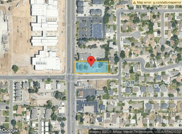
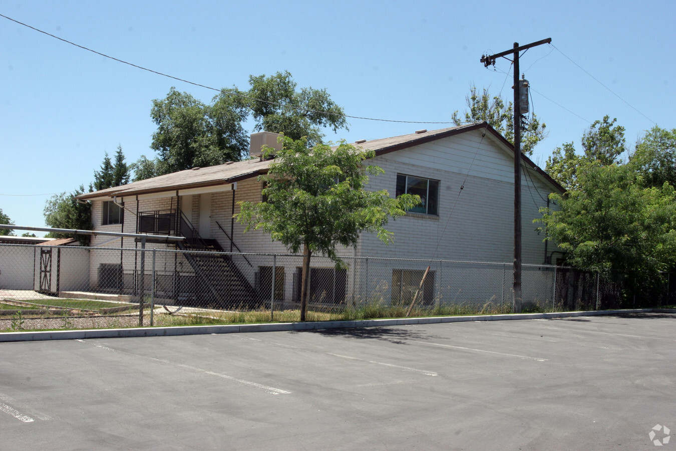
7985 S 700 E, Sandy, UT 84070

NEARBY LISTINGS FOR SALE OR LEASE
Property Detail
7985 S 700 E
Salt Lake City, UT
BEG S 1287 FT FR THE NW COR OF NW 1/4 OF SEC 32, T2S, R1E, SLM; E 363 FT; N 120 FT; W 363 FT; S 120 FT TO BEG. LESS PORTION DEED TO STREET. ALSO LESS AND EXCEPTING, BEG S 1287.25 FT & N 89^5812 E 53.0 FT FR NW COR OF NW 1/4 OF SAID SEC 32: N 3.77 FT;
22-32-102-073-0000
Salt Lake
Officebuilding
Utah
2023
m
2023
0.90 AC
112611
Union Park District
5,121 SF
Salt Lake City
DEMOGRAPHICS near 7985 S 700 E
1 Mile
3 Mile
5 Mile
2024 Total Population
20,736
134,404
315,994
2029 Population
20,816
135,704
319,134
Pop Growth 2024-2029
+ 0.39%
+ 0.97%
+ 0.99%
Average Age
38
38
39
2024 Total Households
7,958
51,002
115,553
HH Growth 2024-2029
+ 0.25%
+ 0.96%
+ 0.95%
Median Household Inc
$77,351
$79,683
$84,732
Avg Household Size
2.60
2.60
2.70
2024 Avg HH Vehicles
2.00
2.00
2.00
Median Home Value
$425,382
$441,053
$476,394
Median Year Built
1984
1980
1983
Nearby Places
- Restaurants
- Banks
- Shops
- Fitness
- Groceries
PUBLIC TRANSPORTATION
COMMUTER RAIL
South Jordan Station (FrontRunner - Utah Transit Authority (UTA))
DRIVE
WALK
Distance
South Jordan Station (FrontRunner - Utah Transit Authority (UTA))
9 min
5.3 mi
Draper Station (FrontRunner - Utah Transit Authority (UTA))
DRIVE
WALK
Distance
Draper Station (FrontRunner - Utah Transit Authority (UTA))
15 min
8.7 mi
AIRPORT
Salt Lake City International
DRIVE
WALK
Distance
Salt Lake City International
25 min
17.8 mi
Provo Municipal
DRIVE
WALK
Distance
Provo Municipal
48 min
36.0 mi
Freight Ports
Port of Stockton
DRIVE
WALK
Distance
Port of Stockton
724 min
705.4 mi
Nearby Properties
Address
Land Use
TOTAL SIZE
Lot Size
Zoning
Address
Land Use
TOTAL SIZE
Lot Size
Zoning
670,751 SF
18.32 AC
CDC
Address
Land Use
TOTAL SIZE
Lot Size
Zoning
397,171 SF
35.56 AC
1208
Address
Land Use
TOTAL SIZE
Lot Size
Zoning
257,906 SF
36.42 AC
1110
Address
Land Use
TOTAL SIZE
Lot Size
Zoning
512,301 SF
25.39 AC
SD(H)
Address
Land Use
TOTAL SIZE
Lot Size
Zoning
512,301 SF
25.39 AC
SD(H)
Address
Land Use
TOTAL SIZE
Lot Size
Zoning
553,122 SF
13.64 AC
SD-X
Address
Land Use
TOTAL SIZE
Lot Size
Zoning
186,717 SF
21.58 AC
RM
Address
Land Use
TOTAL SIZE
Lot Size
Zoning
566,327 SF
7.02 AC
CBD-O
Address
Land Use
TOTAL SIZE
Lot Size
Zoning
427,884 SF
18.22 AC
JB
Address
Land Use
TOTAL SIZE
Lot Size
Zoning
258,000 SF
13.25 AC
1D
Address
Land Use
TOTAL SIZE
Lot Size
Zoning
195,834 SF
6.74 AC
RM-25
Address
Land Use
TOTAL SIZE
Lot Size
Zoning
191,718 SF
0.83 AC
RM-25
Address
Land Use
TOTAL SIZE
Lot Size
Zoning
153,245 SF
27.10 AC
PUD137
Address
Land Use
TOTAL SIZE
Lot Size
Zoning
133,669 SF
19.81 AC
R-M
Address
Land Use
TOTAL SIZE
Lot Size
Zoning
251,867 SF
25.66 AC
H
Address
Land Use
TOTAL SIZE
Lot Size
Zoning
497,522 SF
16.43 AC
MH
Address
Land Use
TOTAL SIZE
Lot Size
Zoning
679,800 SF
18.14 AC
BJ-1-3
Address
Land Use
TOTAL SIZE
Lot Size
Zoning
106,318 SF
4.46 AC
CBD-O
Address
Land Use
TOTAL SIZE
Lot Size
Zoning
500,249 SF
3.16 AC
MU
Address
Land Use
TOTAL SIZE
Lot Size
Zoning
500,249 SF
3.16 AC
MU
Address
Land Use
TOTAL SIZE
Lot Size
Zoning
164,539 SF
5.29 AC
MU
Address
Land Use
TOTAL SIZE
Lot Size
Zoning
124,434 SF
13.64 AC
PUD-15
Address
Land Use
TOTAL SIZE
Lot Size
Zoning
448,232 SF
9.08 AC
PC
Address
Land Use
TOTAL SIZE
Lot Size
Zoning
376,067 SF
6.05 AC
MU
Address
Land Use
TOTAL SIZE
Lot Size
Zoning
397,526 SF
10.77 AC
A-1
Address
Land Use
TOTAL SIZE
Lot Size
Zoning
225,849 SF
16.36 AC
RM-ZC
Address
Land Use
TOTAL SIZE
Lot Size
Zoning
69,206 SF
12.61 AC
BJ
Address
Land Use
TOTAL SIZE
Lot Size
Zoning
327,940 SF
3.95 AC
SD
Address
Land Use
TOTAL SIZE
Lot Size
Zoning
327,940 SF
3.37 AC
SD
Address
Land Use
TOTAL SIZE
Lot Size
Zoning
103,114 SF
14.82 AC
RM 25
The World's #1 Commercial Real Estate Marketplace
Connect with us
© 2025 CoStar Group
The information above has been obtained from sources believed reliable. While we do not doubt its accuracy we have not verified it and make no guarantee, warranty or representation about it. It is your responsibility to independently confirm its accuracy and completeness. Any projections, opinions, assumptions, or estimates used are for example only and do not represent the current or future performance of the property. The value of this transaction to you depends on tax and other factors which should be evaluated by your tax, financial, and legal advisors. You and your advisors should conduct a careful, independent investigation of the property to determine to your satisfaction the suitability of the property for your needs.