Property Record
799 James Record Rd Sw, Huntsville, AL 35824
NEARBY LISTINGS FOR SALE OR LEASE
Property Detail
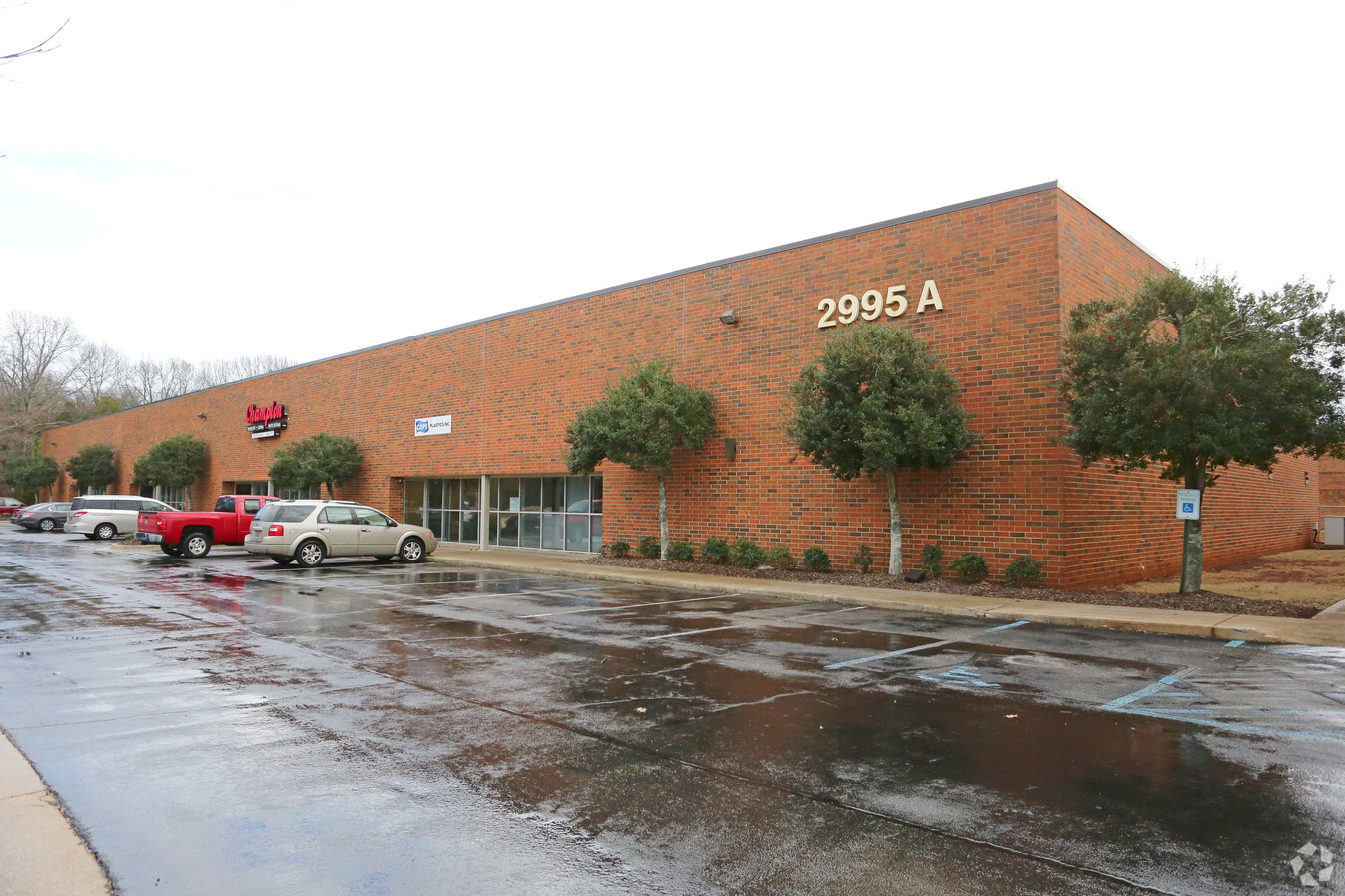
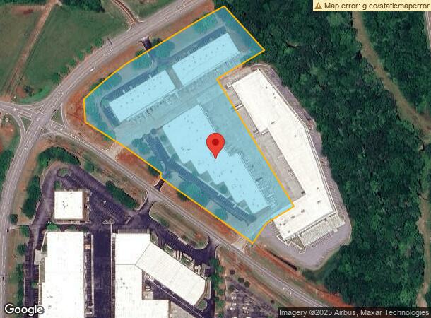
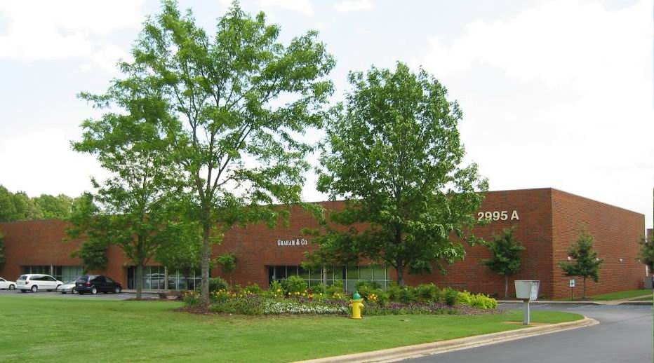
799 James Record Rd Sw
Huntsville, AL
Jetplex Centre
16-09-32-0-000-003.000
PT OF LOT 1 JETPLEX CENTRE PB 25 PG 72 DESC AS COM AT THE NW COR OF SEC 32 T4S R2W TH N 89 DEG E 3073.19 FT TH N 88 DEG E 211
Distributionwarehouseregional
Madison
AE
Alabama
01089C0294F
1
2024
11 AC
2024
Jetplex/Madison
011202
Huntsville
84,608 SF
DEMOGRAPHICS near 799 James Record Rd Sw
1 Mile
3 Mile
5 Mile
2024 Total Population
240
19,147
56,249
2029 Population
265
21,440
63,055
Pop Growth 2024-2029
+ 10.42%
+ 11.98%
+ 12.10%
Average Age
37
39
38
2024 Total Households
102
8,859
22,805
HH Growth 2024-2029
+ 11.76%
+ 12.24%
+ 12.33%
Median Household Inc
$107,065
$96,625
$97,259
Avg Household Size
2.30
2.10
2.40
2024 Avg HH Vehicles
2.00
2.00
2.00
Median Home Value
$190,697
$330,659
$313,747
Median Year Built
2010
2002
2001
Nearby Places
- Restaurants
- Banks
- Shops
- Fitness
- Groceries
PUBLIC TRANSPORTATION
AIRPORT
Huntsville International-Carl T Jones Field
DRIVE
WALK
Distance
Huntsville International-Carl T Jones Field
9 min
3.5 mi
Freight Ports
Port of Mobile
DRIVE
WALK
Distance
Port of Mobile
378 min
345.6 mi
SALE & LEASE HISTORY
LISTING DATE
SALE/LEASE

Sep 25, 2016
For Lease
Mar 01, 2017
For Lease
Apr 12, 2019
For Lease
Nearby Properties
Address
Land Use
TOTAL SIZE
Lot Size
Zoning
Address
Land Use
TOTAL SIZE
Lot Size
Zoning
Address
Land Use
TOTAL SIZE
Lot Size
Zoning
31,506 SF
5.28 AC
Address
Land Use
TOTAL SIZE
Lot Size
Zoning
1,049,518 SF
15.63 AC
Address
Land Use
TOTAL SIZE
Lot Size
Zoning
Address
Land Use
TOTAL SIZE
Lot Size
Zoning
Address
Land Use
TOTAL SIZE
Lot Size
Zoning
Address
Land Use
TOTAL SIZE
Lot Size
Zoning
4,431 SF
23.55 AC
Address
Land Use
TOTAL SIZE
Lot Size
Zoning
29,400 SF
80 AC
Address
Land Use
TOTAL SIZE
Lot Size
Zoning
229,300 SF
243 AC
Address
Land Use
TOTAL SIZE
Lot Size
Zoning
Address
Land Use
TOTAL SIZE
Lot Size
Zoning
4,644 SF
20.70 AC
Address
Land Use
TOTAL SIZE
Lot Size
Zoning
4,798 SF
32.72 AC
Address
Land Use
TOTAL SIZE
Lot Size
Zoning
4,631 SF
41.41 AC
Address
Land Use
TOTAL SIZE
Lot Size
Zoning
4,410 SF
13 AC
Address
Land Use
TOTAL SIZE
Lot Size
Zoning
13,720 SF
40 AC
Address
Land Use
TOTAL SIZE
Lot Size
Zoning
3,948 SF
22.35 AC
Address
Land Use
TOTAL SIZE
Lot Size
Zoning
6,337 SF
35 AC
Address
Land Use
TOTAL SIZE
Lot Size
Zoning
30,552 SF
22.24 AC
Address
Land Use
TOTAL SIZE
Lot Size
Zoning
4.40 AC
Address
Land Use
TOTAL SIZE
Lot Size
Zoning
20,648 SF
16.89 AC
Address
Land Use
TOTAL SIZE
Lot Size
Zoning
2,009 SF
20.06 AC
Address
Land Use
TOTAL SIZE
Lot Size
Zoning
553,868 SF
37 AC
Address
Land Use
TOTAL SIZE
Lot Size
Zoning
7,920 SF
49 AC
Address
Land Use
TOTAL SIZE
Lot Size
Zoning
11,255 SF
37 AC
Address
Land Use
TOTAL SIZE
Lot Size
Zoning
21,000 SF
49 AC
Address
Land Use
TOTAL SIZE
Lot Size
Zoning
2,687 SF
14 AC
Address
Land Use
TOTAL SIZE
Lot Size
Zoning
1,887 SF
603 AC
Address
Land Use
TOTAL SIZE
Lot Size
Zoning
299,200 SF
33 AC
Address
Land Use
TOTAL SIZE
Lot Size
Zoning
38,047 SF
7 AC
Address
Land Use
TOTAL SIZE
Lot Size
Zoning
2,471 SF
14.08 AC
The World's #1 Commercial Real Estate Marketplace
Connect with us
© 2025 CoStar Group
The information above has been obtained from sources believed reliable. While we do not doubt its accuracy we have not verified it and make no guarantee, warranty or representation about it. It is your responsibility to independently confirm its accuracy and completeness. Any projections, opinions, assumptions, or estimates used are for example only and do not represent the current or future performance of the property. The value of this transaction to you depends on tax and other factors which should be evaluated by your tax, financial, and legal advisors. You and your advisors should conduct a careful, independent investigation of the property to determine to your satisfaction the suitability of the property for your needs.