Property Record
80 Lower River St, Oneonta, NY 13820
NEARBY LISTINGS FOR SALE OR LEASE
Property Detail
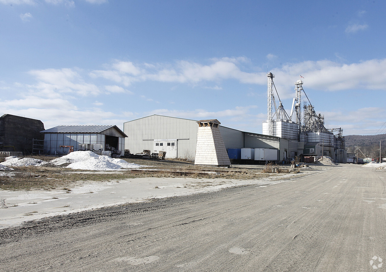
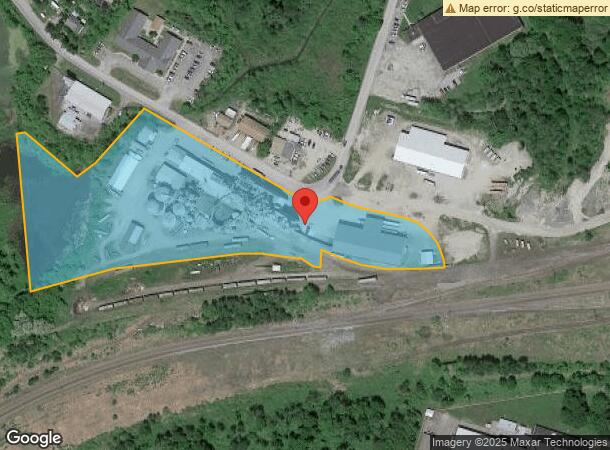
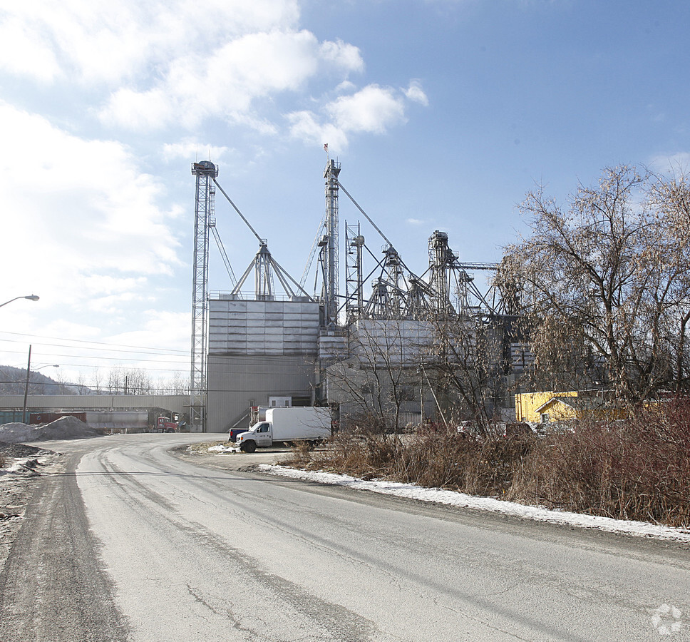
80 Lower River St
364600-299-000-0001-026-005-0000
998FM 4225 5089 0 0
Grainelevator
Otsego
X
New York
36077C0653E
26.005
2024
7.60 AC
2023
Otsego County
590800
Albany/Schenectady/Troy
24,097 SF
Oneonta, NY
DEMOGRAPHICS near 80 Lower River St
1 Mile
3 Mile
5 Mile
2024 Total Population
3,950
19,621
22,892
2029 Population
3,952
19,613
22,847
Pop Growth 2024-2029
+ 0.05%
(0.04%)
(0.20%)
Average Age
40
36
37
2024 Total Households
1,201
5,832
7,181
HH Growth 2024-2029
(1.33%)
(0.15%)
(0.36%)
Median Household Inc
$59,243
$56,778
$57,878
Avg Household Size
2.20
2.00
2.10
2024 Avg HH Vehicles
2.00
1.00
1.00
Median Home Value
$173,229
$167,970
$170,672
Median Year Built
1954
1948
1950
Nearby Places
- Restaurants
- Banks
- Shops
- Fitness
- Groceries
Nearby Properties
Address
Land Use
TOTAL SIZE
Lot Size
Zoning
Address
Land Use
TOTAL SIZE
Lot Size
Zoning
44,216 SF
106.49 AC
610
Address
Land Use
TOTAL SIZE
Lot Size
Zoning
10,927 SF
142.34 AC
610
Address
Land Use
TOTAL SIZE
Lot Size
Zoning
204.26 AC
01
Address
Land Use
TOTAL SIZE
Lot Size
Zoning
310,471 SF
3.04 AC
610
Address
Land Use
TOTAL SIZE
Lot Size
Zoning
103.77 AC
01
Address
Land Use
TOTAL SIZE
Lot Size
Zoning
456,905 SF
73.89 AC
620
Address
Land Use
TOTAL SIZE
Lot Size
Zoning
126,759 SF
0.97 AC
610
Address
Land Use
TOTAL SIZE
Lot Size
Zoning
170,000 SF
15.79 AC
120
Address
Land Use
TOTAL SIZE
Lot Size
Zoning
130,300 SF
20.06 AC
PDD-R
Address
Land Use
TOTAL SIZE
Lot Size
Zoning
275,240 SF
28.08 AC
Address
Land Use
TOTAL SIZE
Lot Size
Zoning
Address
Land Use
TOTAL SIZE
Lot Size
Zoning
179,626 SF
21.80 AC
01
Address
Land Use
TOTAL SIZE
Lot Size
Zoning
8,400 SF
65.53 AC
510
Address
Land Use
TOTAL SIZE
Lot Size
Zoning
42,000 SF
2.06 AC
230
Address
Land Use
TOTAL SIZE
Lot Size
Zoning
71,504 SF
4.09 AC
Address
Land Use
TOTAL SIZE
Lot Size
Zoning
67,224 SF
8.11 AC
Address
Land Use
TOTAL SIZE
Lot Size
Zoning
113.33 AC
520
Address
Land Use
TOTAL SIZE
Lot Size
Zoning
36,629 SF
2.11 AC
610
Address
Land Use
TOTAL SIZE
Lot Size
Zoning
84,790 SF
2.11 AC
150
Address
Land Use
TOTAL SIZE
Lot Size
Zoning
83,256 SF
1.30 AC
620
Address
Land Use
TOTAL SIZE
Lot Size
Zoning
7,980 SF
63.84 AC
01
Address
Land Use
TOTAL SIZE
Lot Size
Zoning
64,072 SF
1.53 AC
330
Address
Land Use
TOTAL SIZE
Lot Size
Zoning
0.01 AC
Address
Land Use
TOTAL SIZE
Lot Size
Zoning
55,648 SF
9.90 AC
Address
Land Use
TOTAL SIZE
Lot Size
Zoning
83,384 SF
10.45 AC
Address
Land Use
TOTAL SIZE
Lot Size
Zoning
53,900 SF
4.08 AC
Address
Land Use
TOTAL SIZE
Lot Size
Zoning
8,839 SF
15.16 AC
140
Address
Land Use
TOTAL SIZE
Lot Size
Zoning
39,872 SF
4.10 AC
230
Address
Land Use
TOTAL SIZE
Lot Size
Zoning
49,047 SF
11.37 AC
01
Address
Land Use
TOTAL SIZE
Lot Size
Zoning
50,000 SF
16.41 AC
120
The World's #1 Commercial Real Estate Marketplace
Connect with us
© 2025 CoStar Group
The information above has been obtained from sources believed reliable. While we do not doubt its accuracy we have not verified it and make no guarantee, warranty or representation about it. It is your responsibility to independently confirm its accuracy and completeness. Any projections, opinions, assumptions, or estimates used are for example only and do not represent the current or future performance of the property. The value of this transaction to you depends on tax and other factors which should be evaluated by your tax, financial, and legal advisors. You and your advisors should conduct a careful, independent investigation of the property to determine to your satisfaction the suitability of the property for your needs.