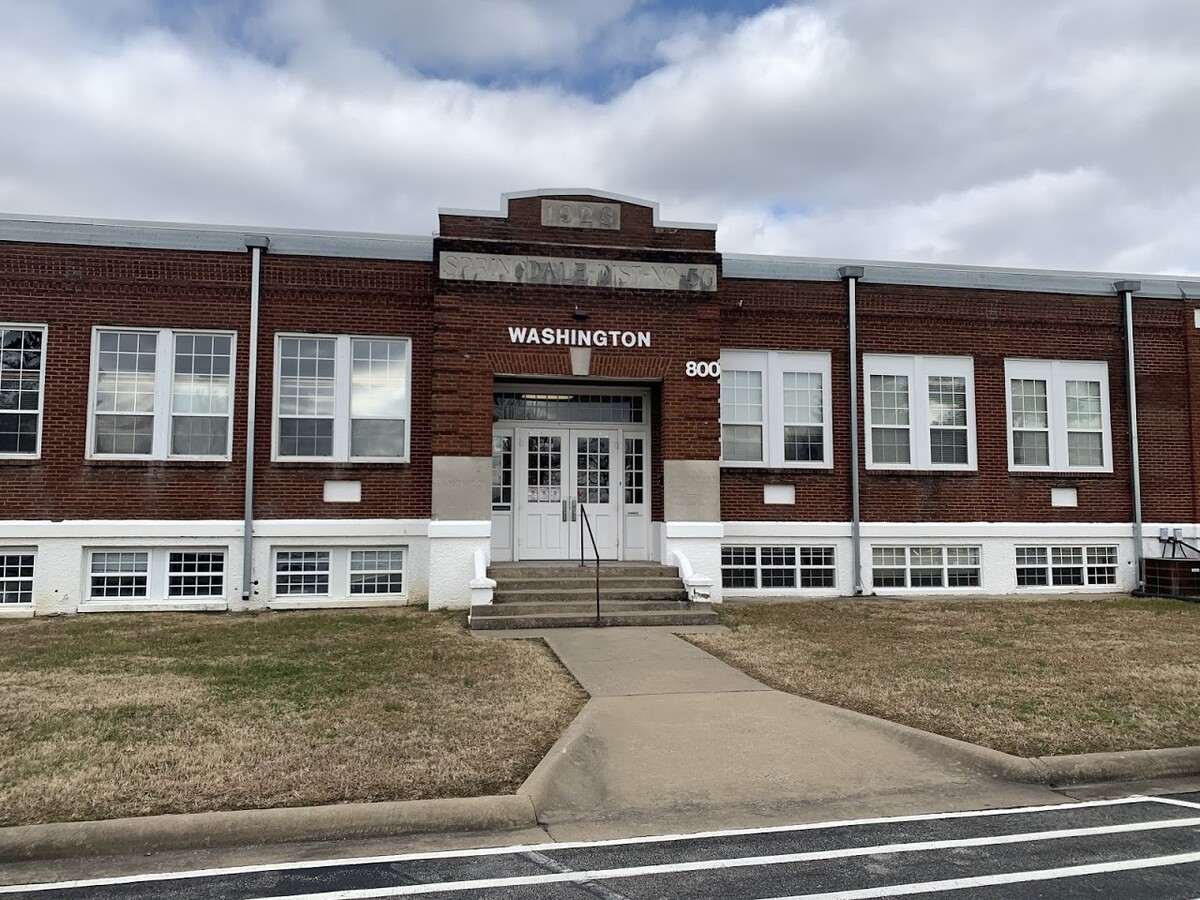
Property Record
800 E Emma Ave, Springdale, AR 72764
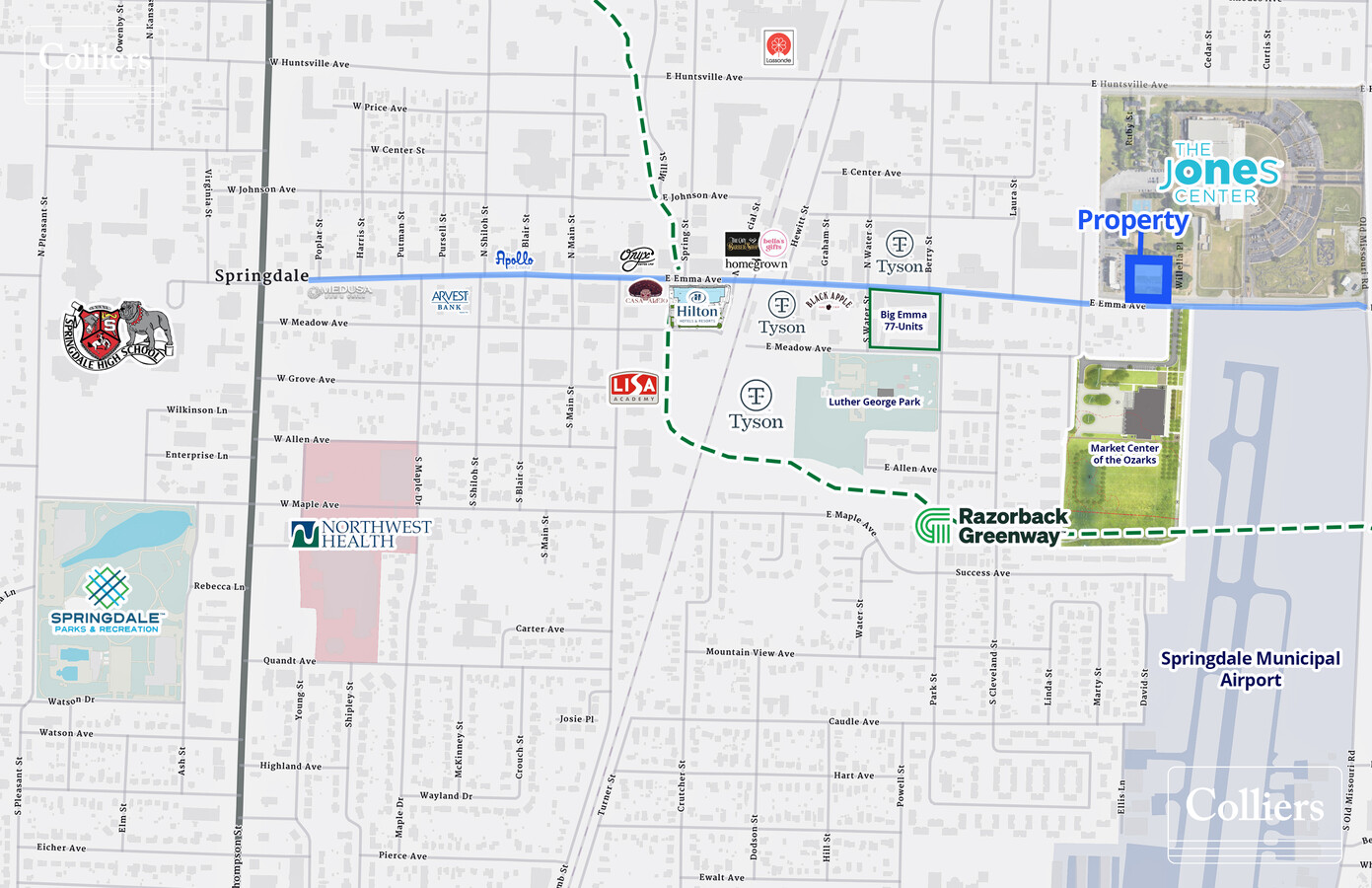
NEARBY LISTINGS FOR SALE OR LEASE
Property Detail
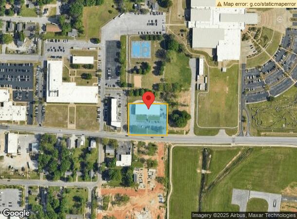
800 E Emma Ave
815-28392-000
County Court Plat
Officebuilding
FOR 1996: PT NE SE 1.34 AC FURTHER DESCRIBED FROM 2021-23531 AS: PART OF THE NORTHEAST QUARTER OF THE SOUTHEAST QUARTER OF SE
X
Washington
05143C0090G
Arkansas
2024
1.34 AC
2024
Greater Springdale
010202
Fayetteville/Springdale/Rogers
21,020 SF
Fayetteville-Springdale-Rogers, AR-MO
DEMOGRAPHICS near 800 E Emma Ave
1 Mile
3 Mile
5 Mile
2024 Total Population
9,364
67,486
105,610
2029 Population
10,260
74,136
116,581
Pop Growth 2024-2029
+ 9.57%
+ 9.85%
+ 10.39%
Average Age
32
34
35
2024 Total Households
2,813
20,682
35,418
HH Growth 2024-2029
+ 9.81%
+ 9.95%
+ 10.53%
Median Household Inc
$40,696
$58,442
$65,115
Avg Household Size
3.20
3.10
2.80
2024 Avg HH Vehicles
2.00
2.00
2.00
Median Home Value
$137,878
$184,127
$217,732
Median Year Built
1987
1991
1994
Nearby Places
- Restaurants
- Banks
- Shops
- Fitness
- Groceries
PUBLIC TRANSPORTATION
AIRPORT
Northwest Arkansas Ntl
DRIVE
WALK
Distance
Northwest Arkansas Ntl
35 min
17.8 mi
Freight Ports
Tulsa Port of Inola
DRIVE
WALK
Distance
Tulsa Port of Inola
106 min
88.0 mi
SALE & LEASE HISTORY
LISTING DATE
SALE/LEASE

Sep 13, 2023
For Sale
Oct 13, 2022
For Lease
Jul 07, 2021
For Lease
Nearby Properties
Address
Land Use
TOTAL SIZE
Lot Size
Zoning
Address
Land Use
TOTAL SIZE
Lot Size
Zoning
167,116 SF
41.39 AC
I1
Address
Land Use
TOTAL SIZE
Lot Size
Zoning
58,764 SF
1.56 AC
Address
Land Use
TOTAL SIZE
Lot Size
Zoning
403,089 SF
1.93 AC
Address
Land Use
TOTAL SIZE
Lot Size
Zoning
481,800 SF
40 AC
Address
Land Use
TOTAL SIZE
Lot Size
Zoning
153,718 SF
Address
Land Use
TOTAL SIZE
Lot Size
Zoning
341,266 SF
17.61 AC
Address
Land Use
TOTAL SIZE
Lot Size
Zoning
117,690 SF
2.38 AC
Address
Land Use
TOTAL SIZE
Lot Size
Zoning
292,470 SF
18.50 AC
Address
Land Use
TOTAL SIZE
Lot Size
Zoning
4,941 SF
10.87 AC
Address
Land Use
TOTAL SIZE
Lot Size
Zoning
174,333 SF
25 AC
I1I2
Address
Land Use
TOTAL SIZE
Lot Size
Zoning
134,342 SF
14.95 AC
Address
Land Use
TOTAL SIZE
Lot Size
Zoning
156,072 SF
12.43 AC
Address
Land Use
TOTAL SIZE
Lot Size
Zoning
178,140 SF
4.39 AC
Address
Land Use
TOTAL SIZE
Lot Size
Zoning
180,412 SF
13.14 AC
Address
Land Use
TOTAL SIZE
Lot Size
Zoning
224,408 SF
9.80 AC
I1
Address
Land Use
TOTAL SIZE
Lot Size
Zoning
73,436 SF
16.01 AC
I1
Address
Land Use
TOTAL SIZE
Lot Size
Zoning
116,736 SF
10.95 AC
Address
Land Use
TOTAL SIZE
Lot Size
Zoning
177,864 SF
18.04 AC
Address
Land Use
TOTAL SIZE
Lot Size
Zoning
113,404 SF
2.48 AC
Address
Land Use
TOTAL SIZE
Lot Size
Zoning
80,475 SF
0.45 AC
C3
Address
Land Use
TOTAL SIZE
Lot Size
Zoning
147,762 SF
Address
Land Use
TOTAL SIZE
Lot Size
Zoning
46,701 SF
4.10 AC
Address
Land Use
TOTAL SIZE
Lot Size
Zoning
352,195 SF
15 AC
Address
Land Use
TOTAL SIZE
Lot Size
Zoning
107,950 SF
6.68 AC
C2
Address
Land Use
TOTAL SIZE
Lot Size
Zoning
54,460 SF
6.38 AC
Address
Land Use
TOTAL SIZE
Lot Size
Zoning
153,968 SF
21 AC
Address
Land Use
TOTAL SIZE
Lot Size
Zoning
364,696 SF
4.49 AC
Address
Land Use
TOTAL SIZE
Lot Size
Zoning
189,244 SF
11.16 AC
I2
Address
Land Use
TOTAL SIZE
Lot Size
Zoning
79,453 SF
7.04 AC
Address
Land Use
TOTAL SIZE
Lot Size
Zoning
38,594 SF
6.04 AC
The World's #1 Commercial Real Estate Marketplace
Connect with us
© 2025 CoStar Group
The information above has been obtained from sources believed reliable. While we do not doubt its accuracy we have not verified it and make no guarantee, warranty or representation about it. It is your responsibility to independently confirm its accuracy and completeness. Any projections, opinions, assumptions, or estimates used are for example only and do not represent the current or future performance of the property. The value of this transaction to you depends on tax and other factors which should be evaluated by your tax, financial, and legal advisors. You and your advisors should conduct a careful, independent investigation of the property to determine to your satisfaction the suitability of the property for your needs.