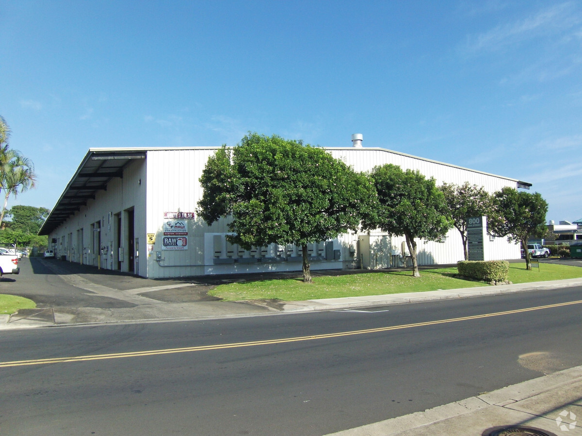
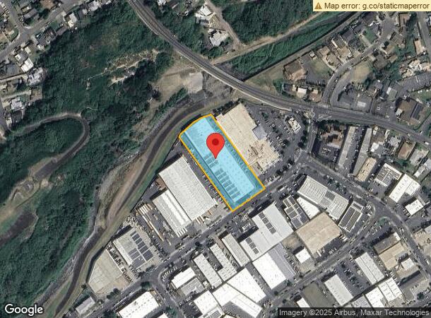
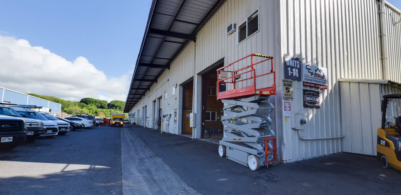
Property Record
800 Eha St, Wailuku, HI 96793
NEARBY LISTINGS FOR SALE OR LEASE
Property Detail
800 Eha St
Kahului-Wailuku-Lahaina, HI
Wailuku Industrial Park Subd
2-3-4-044-017-0000
LOT 33 WAILUKU INDUSTRIAL PARK SUBD FP 1525 96,855 SF
Industrialgeneral
Maui
X
Hawaii
1500030384E
33
2024
2.22 AC
2024
Central Maui
030902
Hawaii
50,050 SF
DEMOGRAPHICS near 800 Eha St
1 Mile
3 Mile
5 Mile
2024 Total Population
10,484
48,584
54,213
2029 Population
10,240
47,581
53,169
Pop Growth 2024-2029
(2.33%)
(2.06%)
(1.93%)
Average Age
41
40
40
2024 Total Households
3,189
14,044
15,691
HH Growth 2024-2029
(3.04%)
(2.68%)
(2.56%)
Median Household Inc
$81,506
$77,749
$81,407
Avg Household Size
3.10
3.10
3.20
2024 Avg HH Vehicles
2.00
2.00
2.00
Median Home Value
$576,279
$663,810
$672,431
Median Year Built
1983
1984
1986
Nearby Places
- Restaurants
- Banks
- Shops
- Fitness
- Groceries
PUBLIC TRANSPORTATION
AIRPORT
Kahului
DRIVE
WALK
Distance
Kahului
15 min
6.3 mi
SALE & LEASE HISTORY
LISTING DATE
SALE/LEASE

Sep 01, 2020
For Lease
Oct 19, 2017
For Lease
Feb 11, 2019
For Lease
Apr 23, 2020
For Lease
Apr 03, 2024
For Lease
Nearby Properties
Address
Land Use
TOTAL SIZE
Lot Size
Zoning
Address
Land Use
TOTAL SIZE
Lot Size
Zoning
191,252 SF
25.37 AC
M-2
Address
Land Use
TOTAL SIZE
Lot Size
Zoning
130,920 SF
11.42 AC
Address
Land Use
TOTAL SIZE
Lot Size
Zoning
43,434 SF
13.89 AC
M-1
Address
Land Use
TOTAL SIZE
Lot Size
Zoning
149,380 SF
12.84 AC
SMA
Address
Land Use
TOTAL SIZE
Lot Size
Zoning
144,519 SF
12.98 AC
STATE URB
Address
Land Use
TOTAL SIZE
Lot Size
Zoning
103,221 SF
12.93 AC
SMA NONE
Address
Land Use
TOTAL SIZE
Lot Size
Zoning
234,826 SF
14.36 AC
STATE URB
Address
Land Use
TOTAL SIZE
Lot Size
Zoning
14.34 AC
STATE AG
Address
Land Use
TOTAL SIZE
Lot Size
Zoning
79,284 SF
3.34 AC
H-M
Address
Land Use
TOTAL SIZE
Lot Size
Zoning
552,589 SF
24.60 AC
M-2
Address
Land Use
TOTAL SIZE
Lot Size
Zoning
72,457 SF
2.96 AC
SMA
Address
Land Use
TOTAL SIZE
Lot Size
Zoning
81,702 SF
4.24 AC
Address
Land Use
TOTAL SIZE
Lot Size
Zoning
106,972 SF
7.30 AC
M-2
Address
Land Use
TOTAL SIZE
Lot Size
Zoning
19.54 AC
SMA NONE
Address
Land Use
TOTAL SIZE
Lot Size
Zoning
72,377 SF
6.06 AC
PD-WK/1
Address
Land Use
TOTAL SIZE
Lot Size
Zoning
1.83 AC
Address
Land Use
TOTAL SIZE
Lot Size
Zoning
16.75 AC
STATE URB
Address
Land Use
TOTAL SIZE
Lot Size
Zoning
12.49 AC
Address
Land Use
TOTAL SIZE
Lot Size
Zoning
69,340 SF
5.33 AC
B-2
Address
Land Use
TOTAL SIZE
Lot Size
Zoning
94,025 SF
0.84 AC
WRA-COMM
Address
Land Use
TOTAL SIZE
Lot Size
Zoning
247.01 AC
PD-WK/4OS
Address
Land Use
TOTAL SIZE
Lot Size
Zoning
103,520 SF
4.50 AC
3
Address
Land Use
TOTAL SIZE
Lot Size
Zoning
2.01 AC
Address
Land Use
TOTAL SIZE
Lot Size
Zoning
42,501 SF
2.59 AC
STATE URB
Address
Land Use
TOTAL SIZE
Lot Size
Zoning
82,080 SF
3.23 AC
B-2
Address
Land Use
TOTAL SIZE
Lot Size
Zoning
191,383 SF
12.82 AC
M-2
Address
Land Use
TOTAL SIZE
Lot Size
Zoning
144,700 SF
7.69 AC
SMA NONE
Address
Land Use
TOTAL SIZE
Lot Size
Zoning
42,672 SF
4.50 AC
STATE URB
Address
Land Use
TOTAL SIZE
Lot Size
Zoning
117,800 SF
6.20 AC
M-2
Address
Land Use
TOTAL SIZE
Lot Size
Zoning
The World's #1 Commercial Real Estate Marketplace
Connect with us
© 2025 CoStar Group
The information above has been obtained from sources believed reliable. While we do not doubt its accuracy we have not verified it and make no guarantee, warranty or representation about it. It is your responsibility to independently confirm its accuracy and completeness. Any projections, opinions, assumptions, or estimates used are for example only and do not represent the current or future performance of the property. The value of this transaction to you depends on tax and other factors which should be evaluated by your tax, financial, and legal advisors. You and your advisors should conduct a careful, independent investigation of the property to determine to your satisfaction the suitability of the property for your needs.