Property Record
800 Lake Placid Dr, Atlanta, GA 30342
NEARBY LISTINGS FOR SALE OR LEASE
Property Detail
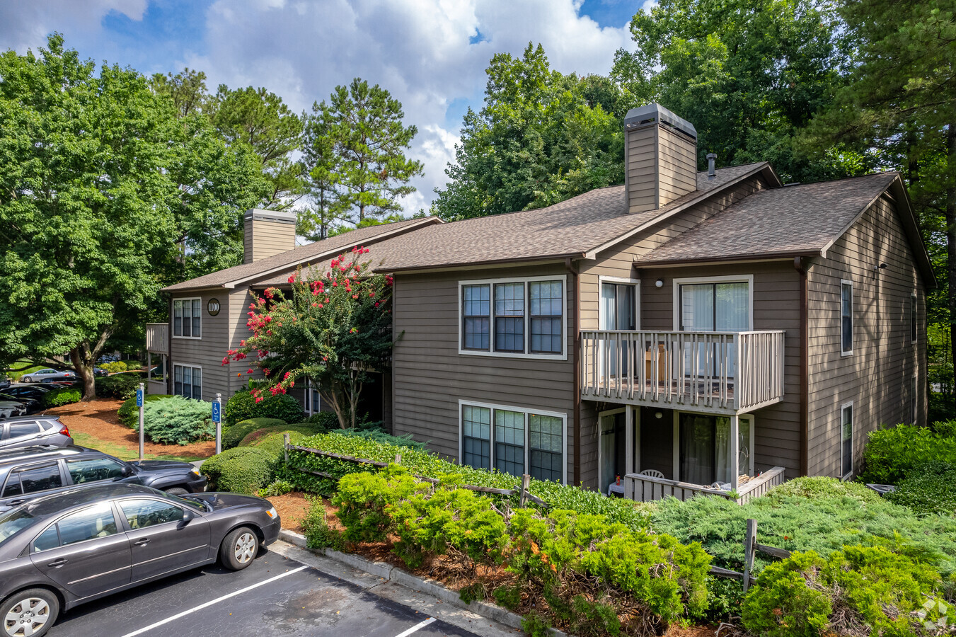
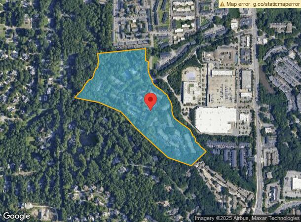
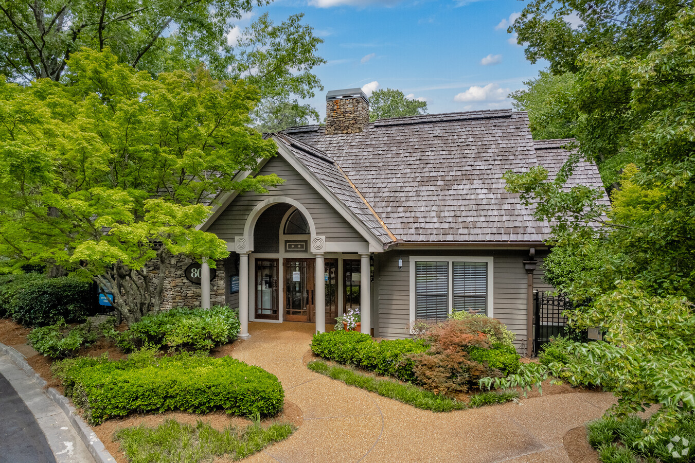
800 Lake Placid Dr
Apartment
Fulton
AE
Georgia
13121C0144F
23.97 AC
2023
South Sandy Springs
2023
Atlanta
010212
Atlanta-Sandy Springs-Roswell, GA
351,787 SF
17-0091-LL-185-4
DEMOGRAPHICS near 800 Lake Placid Dr
1 Mile
3 Mile
5 Mile
2024 Total Population
15,442
78,118
249,662
2029 Population
15,826
79,830
253,775
Pop Growth 2024-2029
+ 2.49%
+ 2.19%
+ 1.65%
Average Age
38
40
39
2024 Total Households
7,014
34,447
116,727
HH Growth 2024-2029
+ 2.78%
+ 2.35%
+ 1.89%
Median Household Inc
$90,257
$119,309
$110,126
Avg Household Size
2.10
2.20
2.10
2024 Avg HH Vehicles
1.00
2.00
2.00
Median Home Value
$656,096
$700,192
$642,151
Median Year Built
1984
1988
1991
Nearby Places
- Restaurants
- Banks
- Shops
- Fitness
- Groceries
PUBLIC TRANSPORTATION
COMMUTER RAIL
Atlanta (Crescent - Amtrak)
DRIVE
WALK
Distance
Atlanta (Crescent - Amtrak)
17 min
8.4 mi
AIRPORT
Hartsfield - Jackson Atlanta International
DRIVE
WALK
Distance
Hartsfield - Jackson Atlanta International
36 min
23.5 mi
Freight Ports
Georgia Ports - Savannah
DRIVE
WALK
Distance
Georgia Ports - Savannah
299 min
262.8 mi
Nearby Properties
Address
Land Use
TOTAL SIZE
Lot Size
Zoning
Address
Land Use
TOTAL SIZE
Lot Size
Zoning
1,123,714 SF
47.33 AC
C1
Address
Land Use
TOTAL SIZE
Lot Size
Zoning
854,744 SF
1.95 AC
OI
Address
Land Use
TOTAL SIZE
Lot Size
Zoning
374,311 SF
0.19 AC
X
Address
Land Use
TOTAL SIZE
Lot Size
Zoning
216,464 SF
X
Address
Land Use
TOTAL SIZE
Lot Size
Zoning
104,625 SF
0.99 AC
X
Address
Land Use
TOTAL SIZE
Lot Size
Zoning
458,822 SF
2.86 AC
RG2
Address
Land Use
TOTAL SIZE
Lot Size
Zoning
376,010 SF
3.80 AC
OI
Address
Land Use
TOTAL SIZE
Lot Size
Zoning
1,088,359 SF
7.07 AC
OIC
Address
Land Use
TOTAL SIZE
Lot Size
Zoning
699,202 SF
13.90 AC
OIC
Address
Land Use
TOTAL SIZE
Lot Size
Zoning
1,119,177 SF
5.21 AC
OIC
Address
Land Use
TOTAL SIZE
Lot Size
Zoning
907,800 SF
2.65 AC
Address
Land Use
TOTAL SIZE
Lot Size
Zoning
406,188 SF
4.43 AC
X
Address
Land Use
TOTAL SIZE
Lot Size
Zoning
754,619 SF
27.30 AC
RG3C
Address
Land Use
TOTAL SIZE
Lot Size
Zoning
1,067,348 SF
6.41 AC
OIC
Address
Land Use
TOTAL SIZE
Lot Size
Zoning
664,199 SF
2.84 AC
Address
Land Use
TOTAL SIZE
Lot Size
Zoning
478,332 SF
4.07 AC
Address
Land Use
TOTAL SIZE
Lot Size
Zoning
588,846 SF
3.80 AC
Address
Land Use
TOTAL SIZE
Lot Size
Zoning
466,569 SF
4.90 AC
A1
Address
Land Use
TOTAL SIZE
Lot Size
Zoning
912,649 SF
5.21 AC
OIC
Address
Land Use
TOTAL SIZE
Lot Size
Zoning
543,420 SF
4.15 AC
Address
Land Use
TOTAL SIZE
Lot Size
Zoning
395,191 SF
2.78 AC
OIC
Address
Land Use
TOTAL SIZE
Lot Size
Zoning
892,367 SF
3.37 AC
OIC
Address
Land Use
TOTAL SIZE
Lot Size
Zoning
1,430,700 SF
5.77 AC
OIC
Address
Land Use
TOTAL SIZE
Lot Size
Zoning
480,790 SF
5.93 AC
Address
Land Use
TOTAL SIZE
Lot Size
Zoning
326,734 SF
13.15 AC
OIC
Address
Land Use
TOTAL SIZE
Lot Size
Zoning
572,181 SF
3.76 AC
C1
Address
Land Use
TOTAL SIZE
Lot Size
Zoning
582,939 SF
5.59 AC
A1
Address
Land Use
TOTAL SIZE
Lot Size
Zoning
732,923 SF
2.77 AC
OIC
Address
Land Use
TOTAL SIZE
Lot Size
Zoning
274,733 SF
4.50 AC
OIC
Address
Land Use
TOTAL SIZE
Lot Size
Zoning
732,896 SF
3.96 AC
OIC
The World's #1 Commercial Real Estate Marketplace
Connect with us
© 2025 CoStar Group
The information above has been obtained from sources believed reliable. While we do not doubt its accuracy we have not verified it and make no guarantee, warranty or representation about it. It is your responsibility to independently confirm its accuracy and completeness. Any projections, opinions, assumptions, or estimates used are for example only and do not represent the current or future performance of the property. The value of this transaction to you depends on tax and other factors which should be evaluated by your tax, financial, and legal advisors. You and your advisors should conduct a careful, independent investigation of the property to determine to your satisfaction the suitability of the property for your needs.