Property Record
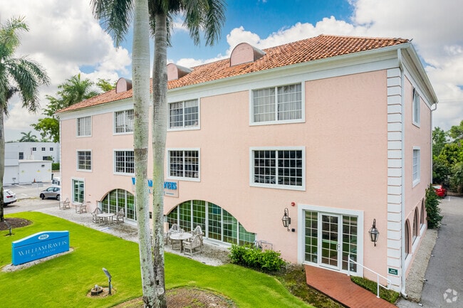
800 Seagate Dr, Naples, FL 34103

NEARBY LISTINGS FOR SALE OR LEASE
Property Detail
800 Seagate Dr
Naples-Immokalee-Marco Island, FL
North Naples Estates
14450000057
NORTH NAPLES ESTATES W 150 LOT 1 OR 1583 PG 195-96
Retailwithmorethanonenonretailuse
Collier
X
Florida
12021C0383J
1
2024
0.46 AC
2025
North Naples
000301
Southwest Florida
4,450 SF
DEMOGRAPHICS near 800 Seagate Dr
1 Mile
3 Mile
5 Mile
2024 Total Population
8,555
47,563
97,895
2029 Population
9,837
54,800
112,260
Pop Growth 2024-2029
+ 14.99%
+ 15.22%
+ 14.67%
Average Age
58
57
54
2024 Total Households
4,151
23,480
46,725
HH Growth 2024-2029
+ 14.94%
+ 15.04%
+ 14.50%
Median Household Inc
$120,604
$103,847
$92,635
Avg Household Size
1.90
1.90
2.00
2024 Avg HH Vehicles
2.00
2.00
2.00
Median Home Value
$975,112
$814,178
$696,147
Median Year Built
1984
1989
1992
Nearby Places
Map Layers
Map Styles
 Street
 Aerial
- Restaurants
- Banks
- Shops
- Fitness
- Groceries
PUBLIC TRANSPORTATION
AIRPORT
Southwest Florida International
DRIVE
WALK
Distance
Southwest Florida International
42 min
31.2 mi
SALE & LEASE HISTORY
LISTING DATE
SALE/LEASE

Sep 24, 2016
For Lease
Sep 20, 2017
For Lease
Mar 20, 2017
For Lease
Dec 10, 2018
For Sale
Nearby Properties
Address
Land Use
TOTAL SIZE
Lot Size
Zoning
Address
Land Use
TOTAL SIZE
Lot Size
Zoning
688,632 SF
29.28 AC
A
Address
Land Use
TOTAL SIZE
Lot Size
Zoning
905,326 SF
69.45 AC
GC
Address
Land Use
TOTAL SIZE
Lot Size
Zoning
735,070 SF
41.34 AC
A
Address
Land Use
TOTAL SIZE
Lot Size
Zoning
411,909 SF
181.63 AC
RSF-3
Address
Land Use
TOTAL SIZE
Lot Size
Zoning
123,282 SF
6.50 AC
PUD
Address
Land Use
TOTAL SIZE
Lot Size
Zoning
250,674 SF
33.61 AC
NAPLES
Address
Land Use
TOTAL SIZE
Lot Size
Zoning
398,094 SF
17.31 AC
A
Address
Land Use
TOTAL SIZE
Lot Size
Zoning
363,275 SF
21.02 AC
PUD
Address
Land Use
TOTAL SIZE
Lot Size
Zoning
218,013 SF
77.73 AC
A
Address
Land Use
TOTAL SIZE
Lot Size
Zoning
418,075 SF
38.19 AC
Address
Land Use
TOTAL SIZE
Lot Size
Zoning
453,819 SF
4.53 AC
Address
Land Use
TOTAL SIZE
Lot Size
Zoning
932,389 SF
36.28 AC
NAPLES
Address
Land Use
TOTAL SIZE
Lot Size
Zoning
256,507 SF
26.32 AC
PUD
Address
Land Use
TOTAL SIZE
Lot Size
Zoning
72,844 SF
15.94 AC
RSF-1
Address
Land Use
TOTAL SIZE
Lot Size
Zoning
277,290 SF
31.01 AC
PUD
Address
Land Use
TOTAL SIZE
Lot Size
Zoning
255,522 SF
21.83 AC
NAPLES
Address
Land Use
TOTAL SIZE
Lot Size
Zoning
82,382 SF
9.98 AC
PUD
Address
Land Use
TOTAL SIZE
Lot Size
Zoning
363,194 SF
2.51 AC
A
Address
Land Use
TOTAL SIZE
Lot Size
Zoning
203,171 SF
16.64 AC
NAPLES
Address
Land Use
TOTAL SIZE
Lot Size
Zoning
134,551 SF
19.50 AC
PUD
Address
Land Use
TOTAL SIZE
Lot Size
Zoning
145,061 SF
18.82 AC
PUD
Address
Land Use
TOTAL SIZE
Lot Size
Zoning
164,004 SF
2.66 AC
Address
Land Use
TOTAL SIZE
Lot Size
Zoning
133,302 SF
3.82 AC
NAPLES
Address
Land Use
TOTAL SIZE
Lot Size
Zoning
174,104 SF
13.36 AC
PUD
Address
Land Use
TOTAL SIZE
Lot Size
Zoning
153,644 SF
14.69 AC
PUD
Address
Land Use
TOTAL SIZE
Lot Size
Zoning
119,011 SF
13.50 AC
PD
Address
Land Use
TOTAL SIZE
Lot Size
Zoning
161,531 SF
18.72 AC
PUD
Address
Land Use
TOTAL SIZE
Lot Size
Zoning
21,704 SF
1.58 AC
Address
Land Use
TOTAL SIZE
Lot Size
Zoning
138,108 SF
14.46 AC
CPUD
Address
Land Use
TOTAL SIZE
Lot Size
Zoning
64,875 SF
6.30 AC
NAPLES
The World's #1 Commercial Real Estate Marketplace
Connect with us
© 2025 CoStar Group
The information above has been obtained from sources believed reliable. While we do not doubt its accuracy we have not verified it and make no guarantee, warranty or representation about it. It is your responsibility to independently confirm its accuracy and completeness. Any projections, opinions, assumptions, or estimates used are for example only and do not represent the current or future performance of the property. The value of this transaction to you depends on tax and other factors which should be evaluated by your tax, financial, and legal advisors. You and your advisors should conduct a careful, independent investigation of the property to determine to your satisfaction the suitability of the property for your needs.