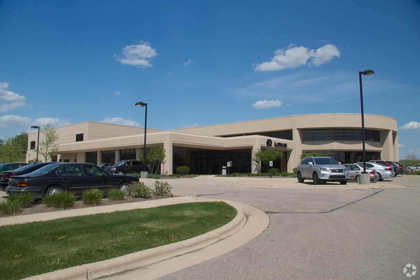
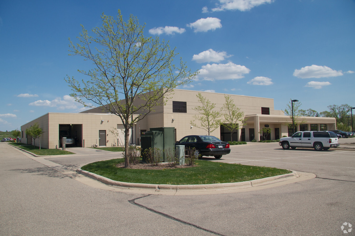
Property Record
8000 Airport Rd, Middleton, WI 53562
NEARBY LISTINGS FOR SALE OR LEASE
Property Detail
8000 Airport Rd
Madison, WI
Certified Survey Map No 11208
0708-022-9200-2
LOT 2 CSM 11208 CS67/295-298 10-12-04 DESCR AS SEC 02-07-08 PRT OFSW1/4 NW1/4 (9 .243 ACRE) TOG/W INGRESS-EGRESS ESMT AND SUBJ TO STORMWATER ESMT IN DOC #399181 6
Commercialnec
Dane
X
Wisconsin
55025C0382G
2
2023
9.24 AC
2023
Northwest Madison
010908
Milwaukee/Madison
DEMOGRAPHICS near 8000 Airport Rd
1 Mile
3 Mile
5 Mile
2024 Total Population
4,275
37,062
87,465
2029 Population
4,489
38,366
91,126
Pop Growth 2024-2029
+ 5.01%
+ 3.52%
+ 4.19%
Average Age
39
42
40
2024 Total Households
1,730
16,525
40,767
HH Growth 2024-2029
+ 5.14%
+ 3.49%
+ 4.28%
Median Household Inc
$95,548
$96,591
$83,899
Avg Household Size
2.40
2.20
2.10
2024 Avg HH Vehicles
2.00
2.00
2.00
Median Home Value
$441,272
$450,430
$423,933
Median Year Built
1987
1988
1987
Nearby Places
- Restaurants
- Banks
- Shops
- Fitness
- Groceries
PUBLIC TRANSPORTATION
AIRPORT
Dane County Regional/Truax Field
DRIVE
WALK
Distance
Dane County Regional/Truax Field
22 min
13.0 mi
Freight Ports
Port Milwaukee
DRIVE
WALK
Distance
Port Milwaukee
111 min
90.0 mi
Nearby Properties
Address
Land Use
TOTAL SIZE
Lot Size
Zoning
Address
Land Use
TOTAL SIZE
Lot Size
Zoning
203,672 SF
7.34 AC
PD
Address
Land Use
TOTAL SIZE
Lot Size
Zoning
8.48 AC
Address
Land Use
TOTAL SIZE
Lot Size
Zoning
15.61 AC
Address
Land Use
TOTAL SIZE
Lot Size
Zoning
169,563 SF
19.82 AC
SEC
Address
Land Use
TOTAL SIZE
Lot Size
Zoning
10.12 AC
Address
Land Use
TOTAL SIZE
Lot Size
Zoning
11.09 AC
Address
Land Use
TOTAL SIZE
Lot Size
Zoning
5.95 AC
Address
Land Use
TOTAL SIZE
Lot Size
Zoning
4.37 AC
Address
Land Use
TOTAL SIZE
Lot Size
Zoning
159,686 SF
7.39 AC
SEC
Address
Land Use
TOTAL SIZE
Lot Size
Zoning
37,909 SF
10.27 AC
SEC
Address
Land Use
TOTAL SIZE
Lot Size
Zoning
37,909 SF
10.27 AC
SEC
Address
Land Use
TOTAL SIZE
Lot Size
Zoning
Address
Land Use
TOTAL SIZE
Lot Size
Zoning
10.01 AC
Address
Land Use
TOTAL SIZE
Lot Size
Zoning
320,074 SF
9.28 AC
SR-V2
Address
Land Use
TOTAL SIZE
Lot Size
Zoning
40.70 AC
Address
Land Use
TOTAL SIZE
Lot Size
Zoning
26.62 AC
Address
Land Use
TOTAL SIZE
Lot Size
Zoning
Address
Land Use
TOTAL SIZE
Lot Size
Zoning
264,603 SF
10.32 AC
PD
Address
Land Use
TOTAL SIZE
Lot Size
Zoning
1.19 AC
Address
Land Use
TOTAL SIZE
Lot Size
Zoning
3.19 AC
Address
Land Use
TOTAL SIZE
Lot Size
Zoning
109,272 SF
10.76 AC
PD
Address
Land Use
TOTAL SIZE
Lot Size
Zoning
179,552 SF
5.10 AC
PD
Address
Land Use
TOTAL SIZE
Lot Size
Zoning
13.43 AC
Address
Land Use
TOTAL SIZE
Lot Size
Zoning
7.16 AC
Address
Land Use
TOTAL SIZE
Lot Size
Zoning
Address
Land Use
TOTAL SIZE
Lot Size
Zoning
0.95 AC
Address
Land Use
TOTAL SIZE
Lot Size
Zoning
75,756 SF
3.64 AC
SR-V2
Address
Land Use
TOTAL SIZE
Lot Size
Zoning
3.30 AC
SR-V2
Address
Land Use
TOTAL SIZE
Lot Size
Zoning
40,887 SF
2.79 AC
PD
Address
Land Use
TOTAL SIZE
Lot Size
Zoning
180,600 SF
6 AC
PD
The World's #1 Commercial Real Estate Marketplace
Connect with us
© 2025 CoStar Group
The information above has been obtained from sources believed reliable. While we do not doubt its accuracy we have not verified it and make no guarantee, warranty or representation about it. It is your responsibility to independently confirm its accuracy and completeness. Any projections, opinions, assumptions, or estimates used are for example only and do not represent the current or future performance of the property. The value of this transaction to you depends on tax and other factors which should be evaluated by your tax, financial, and legal advisors. You and your advisors should conduct a careful, independent investigation of the property to determine to your satisfaction the suitability of the property for your needs.