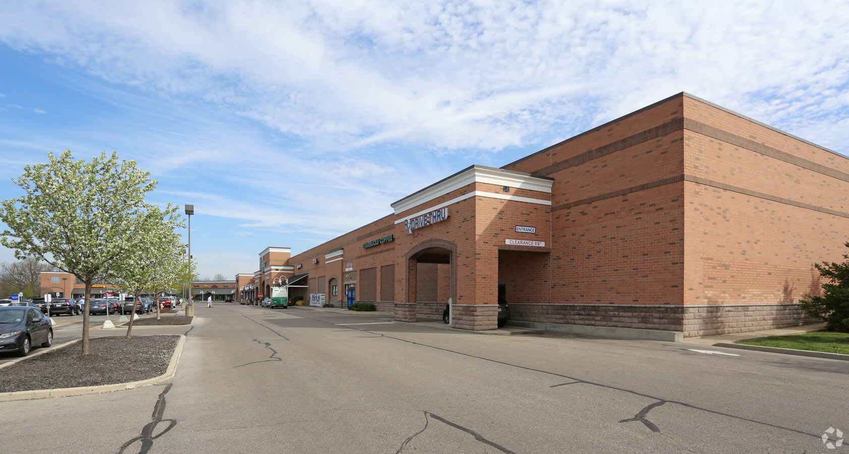
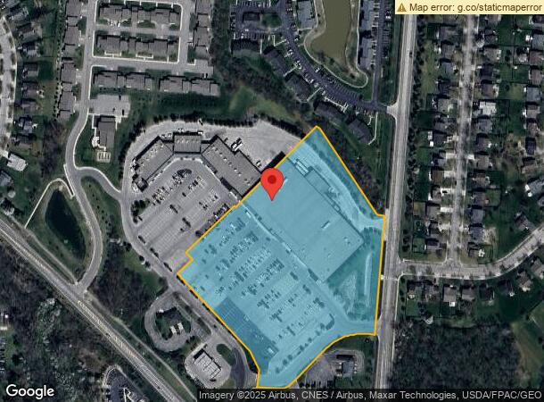
Property Record
801 N Houk Rd, Delaware, OH 43015
NEARBY LISTINGS FOR SALE OR LEASE
Property Detail
801 N Houk Rd
519-320-22-002-000
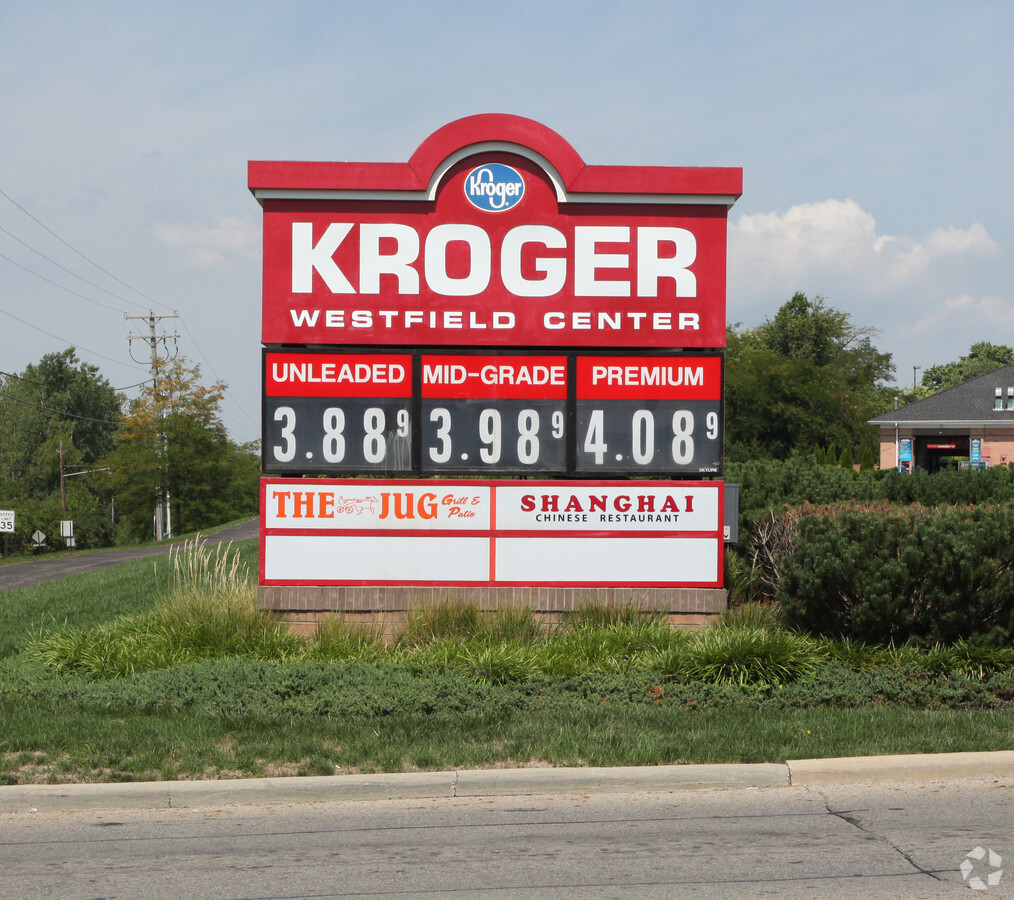
LOT 7779 WESTFIELD SHOPPING CENTER
Supermarket
Delaware
X
Ohio
39041C0103K
7779
2023
8.11 AC
2023
Outlying Delaware County
010422
Columbus
81,496 SF
Columbus, OH
DEMOGRAPHICS near 801 N Houk Rd
1 Mile
3 Mile
5 Mile
2024 Total Population
9,827
31,841
47,753
2029 Population
11,214
36,332
54,641
Pop Growth 2024-2029
+ 14.11%
+ 14.10%
+ 14.42%
Average Age
39
39
40
2024 Total Households
3,838
12,498
18,808
HH Growth 2024-2029
+ 14.28%
+ 14.27%
+ 14.61%
Median Household Inc
$76,567
$77,145
$78,189
Avg Household Size
2.50
2.40
2.40
2024 Avg HH Vehicles
2.00
2.00
2.00
Median Home Value
$233,818
$231,632
$244,509
Median Year Built
1998
1989
1990
Nearby Places
- Restaurants
- Banks
- Shops
- Fitness
- Groceries
PUBLIC TRANSPORTATION
AIRPORT
John Glenn Columbus International
DRIVE
WALK
Distance
John Glenn Columbus International
46 min
35.3 mi
Freight Ports
Port of Toledo
DRIVE
WALK
Distance
Port of Toledo
152 min
122.2 mi
SALE & LEASE HISTORY
LISTING DATE
SALE/LEASE

Sep 25, 2016
For Lease
Sep 22, 2017
For Lease
Feb 06, 2024
For Lease
Nearby Properties
Address
Land Use
TOTAL SIZE
Lot Size
Zoning
Address
Land Use
TOTAL SIZE
Lot Size
Zoning
349,949 SF
22.53 AC
Address
Land Use
TOTAL SIZE
Lot Size
Zoning
202,185 SF
7.97 AC
Address
Land Use
TOTAL SIZE
Lot Size
Zoning
376,140 SF
28.71 AC
Address
Land Use
TOTAL SIZE
Lot Size
Zoning
213,294 SF
27.58 AC
Address
Land Use
TOTAL SIZE
Lot Size
Zoning
154,070 SF
29.10 AC
Address
Land Use
TOTAL SIZE
Lot Size
Zoning
242,045 SF
47.87 AC
Address
Land Use
TOTAL SIZE
Lot Size
Zoning
234,776 SF
15.94 AC
Address
Land Use
TOTAL SIZE
Lot Size
Zoning
271,443 SF
15.63 AC
Address
Land Use
TOTAL SIZE
Lot Size
Zoning
113,813 SF
1.99 AC
Address
Land Use
TOTAL SIZE
Lot Size
Zoning
135,780 SF
17.32 AC
Address
Land Use
TOTAL SIZE
Lot Size
Zoning
79,389 SF
15.51 AC
Address
Land Use
TOTAL SIZE
Lot Size
Zoning
48,054 SF
20.06 AC
Address
Land Use
TOTAL SIZE
Lot Size
Zoning
162,878 SF
3.18 AC
Address
Land Use
TOTAL SIZE
Lot Size
Zoning
75,278 SF
2.34 AC
Address
Land Use
TOTAL SIZE
Lot Size
Zoning
362,100 SF
26 AC
Address
Land Use
TOTAL SIZE
Lot Size
Zoning
188,411 SF
9.11 AC
Address
Land Use
TOTAL SIZE
Lot Size
Zoning
33,704 SF
10.64 AC
Address
Land Use
TOTAL SIZE
Lot Size
Zoning
88,191 SF
34.68 AC
Address
Land Use
TOTAL SIZE
Lot Size
Zoning
51,288 SF
1.19 AC
Address
Land Use
TOTAL SIZE
Lot Size
Zoning
105,099 SF
3.73 AC
Address
Land Use
TOTAL SIZE
Lot Size
Zoning
147,120 SF
14.70 AC
Address
Land Use
TOTAL SIZE
Lot Size
Zoning
202,800 SF
13.95 AC
Address
Land Use
TOTAL SIZE
Lot Size
Zoning
215,220 SF
22.88 AC
Address
Land Use
TOTAL SIZE
Lot Size
Zoning
62,578 SF
4.09 AC
Address
Land Use
TOTAL SIZE
Lot Size
Zoning
109,000 SF
17.16 AC
Address
Land Use
TOTAL SIZE
Lot Size
Zoning
Address
Land Use
TOTAL SIZE
Lot Size
Zoning
81,279 SF
1.25 AC
Address
Land Use
TOTAL SIZE
Lot Size
Zoning
77,525 SF
9.49 AC
Address
Land Use
TOTAL SIZE
Lot Size
Zoning
511,887 SF
32.25 AC
Address
Land Use
TOTAL SIZE
Lot Size
Zoning
60,000 SF
6.02 AC
The World's #1 Commercial Real Estate Marketplace
Connect with us
© 2025 CoStar Group
The information above has been obtained from sources believed reliable. While we do not doubt its accuracy we have not verified it and make no guarantee, warranty or representation about it. It is your responsibility to independently confirm its accuracy and completeness. Any projections, opinions, assumptions, or estimates used are for example only and do not represent the current or future performance of the property. The value of this transaction to you depends on tax and other factors which should be evaluated by your tax, financial, and legal advisors. You and your advisors should conduct a careful, independent investigation of the property to determine to your satisfaction the suitability of the property for your needs.