Property Record
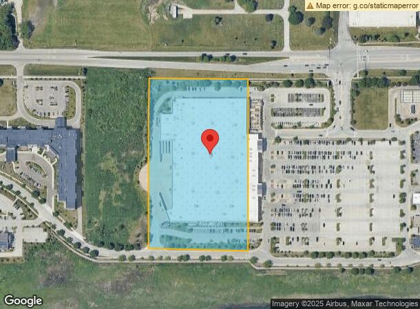
801 N Randall Rd, Batavia, IL 60510


NEARBY LISTINGS FOR SALE OR LEASE
Property Detail
801 N Randall Rd
Chicago-Naperville-Elgin, IL-IN-WI
Fabyan Randall Sub
12-17-254-002
FABYAN RANDALL SUB PT LOT 7 LYING IN W 1/2 NE 1/4 ALSO INCLUDES 12-17-277-001
Commercialnec
Kane
X
Illinois
17089C0326H
7
2023
7.16 AC
2023
Western East/West Corr
854800
Chicago
153,432 SF
DEMOGRAPHICS near 801 N Randall Rd
1 Mile
3 Mile
5 Mile
2024 Total Population
5,602
47,563
109,522
2029 Population
5,553
47,289
108,919
Pop Growth 2024-2029
(0.87%)
(0.58%)
(0.55%)
Average Age
42
42
41
2024 Total Households
2,014
17,965
41,275
HH Growth 2024-2029
(1.09%)
(0.54%)
(0.51%)
Median Household Inc
$143,823
$124,970
$116,477
Avg Household Size
2.70
2.60
2.60
2024 Avg HH Vehicles
2.00
2.00
2.00
Median Home Value
$390,299
$373,829
$348,036
Median Year Built
1994
1989
1989
Nearby Places
- Restaurants
- Banks
- Shops
- Fitness
- Groceries
PUBLIC TRANSPORTATION
COMMUTER RAIL
Geneva Station (Union Pacific West Line - Northeast Illinois Regional Commuter Railroad (Metra))
DRIVE
WALK
Distance
Geneva Station (Union Pacific West Line - Northeast Illinois Regional Commuter Railroad (Metra))
8 min
3.3 mi
La Fox Station (Union Pacific West Line - Northeast Illinois Regional Commuter Railroad (Metra))
DRIVE
WALK
Distance
La Fox Station (Union Pacific West Line - Northeast Illinois Regional Commuter Railroad (Metra))
12 min
5.5 mi
AIRPORT
Chicago O'Hare International
DRIVE
WALK
Distance
Chicago O'Hare International
57 min
34.2 mi
Freight Ports
Port Milwaukee
DRIVE
WALK
Distance
Port Milwaukee
139 min
106.2 mi
Nearby Properties
Address
Land Use
TOTAL SIZE
Lot Size
Zoning
Address
Land Use
TOTAL SIZE
Lot Size
Zoning
404,578 SF
40.29 AC
Address
Land Use
TOTAL SIZE
Lot Size
Zoning
Address
Land Use
TOTAL SIZE
Lot Size
Zoning
217,340 SF
15.58 AC
Address
Land Use
TOTAL SIZE
Lot Size
Zoning
Address
Land Use
TOTAL SIZE
Lot Size
Zoning
86,704 SF
0.53 AC
Address
Land Use
TOTAL SIZE
Lot Size
Zoning
18.42 AC
Address
Land Use
TOTAL SIZE
Lot Size
Zoning
170,986 SF
15.25 AC
Address
Land Use
TOTAL SIZE
Lot Size
Zoning
494,108 SF
5 AC
Address
Land Use
TOTAL SIZE
Lot Size
Zoning
136,208 SF
12.52 AC
Address
Land Use
TOTAL SIZE
Lot Size
Zoning
74,929 SF
6.08 AC
Address
Land Use
TOTAL SIZE
Lot Size
Zoning
141,703 SF
15.94 AC
Address
Land Use
TOTAL SIZE
Lot Size
Zoning
Address
Land Use
TOTAL SIZE
Lot Size
Zoning
Address
Land Use
TOTAL SIZE
Lot Size
Zoning
Address
Land Use
TOTAL SIZE
Lot Size
Zoning
86,976 SF
8.15 AC
Address
Land Use
TOTAL SIZE
Lot Size
Zoning
33,761 SF
2.82 AC
Address
Land Use
TOTAL SIZE
Lot Size
Zoning
129,800 SF
11 AC
Address
Land Use
TOTAL SIZE
Lot Size
Zoning
3,614 SF
4.46 AC
Address
Land Use
TOTAL SIZE
Lot Size
Zoning
Address
Land Use
TOTAL SIZE
Lot Size
Zoning
309,756 SF
2.93 AC
Address
Land Use
TOTAL SIZE
Lot Size
Zoning
304,337 SF
15.34 AC
Address
Land Use
TOTAL SIZE
Lot Size
Zoning
72,765 SF
12.64 AC
Address
Land Use
TOTAL SIZE
Lot Size
Zoning
Address
Land Use
TOTAL SIZE
Lot Size
Zoning
Address
Land Use
TOTAL SIZE
Lot Size
Zoning
Address
Land Use
TOTAL SIZE
Lot Size
Zoning
3.53 AC
Address
Land Use
TOTAL SIZE
Lot Size
Zoning
514,662 SF
19.75 AC
Address
Land Use
TOTAL SIZE
Lot Size
Zoning
212,720 SF
10.24 AC
Address
Land Use
TOTAL SIZE
Lot Size
Zoning
260,812 SF
6.24 AC
The World's #1 Commercial Real Estate Marketplace
Connect with us
© 2025 CoStar Group
The information above has been obtained from sources believed reliable. While we do not doubt its accuracy we have not verified it and make no guarantee, warranty or representation about it. It is your responsibility to independently confirm its accuracy and completeness. Any projections, opinions, assumptions, or estimates used are for example only and do not represent the current or future performance of the property. The value of this transaction to you depends on tax and other factors which should be evaluated by your tax, financial, and legal advisors. You and your advisors should conduct a careful, independent investigation of the property to determine to your satisfaction the suitability of the property for your needs.