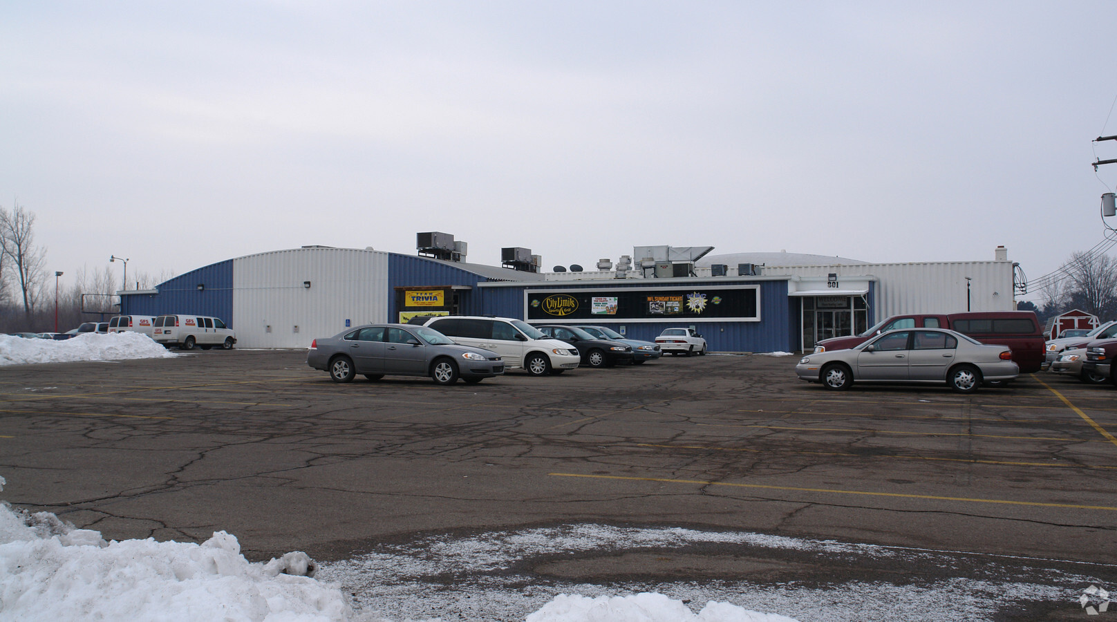
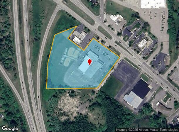
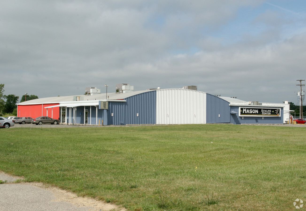
Property Record
801 S Cedar St, Mason, MI 48854
NEARBY LISTINGS FOR SALE OR LEASE
Property Detail
801 S Cedar St
19-10-05-153-006
Mason
Bowlingalley
BEG ON EW 1/4 LN SEC 5 83.6 FT E OF W 1/4 COR SEC, E 491.1 FT, N 36-32-18 E 367.75 FT SLY TO CEDAR ST, N 53-27-42 W 320.98
X
Ingham
26065C0254D
Michigan
2023
6.52 AC
2024
Mason/SE Ingham County
006302
West Michigan
32,556 SF
Lansing-East Lansing, MI
DEMOGRAPHICS near 801 S Cedar St
1 Mile
3 Mile
5 Mile
2024 Total Population
3,101
10,984
26,000
2029 Population
3,056
10,799
25,611
Pop Growth 2024-2029
(1.45%)
(1.68%)
(1.50%)
Average Age
40
41
40
2024 Total Households
1,277
4,462
10,649
HH Growth 2024-2029
(1.57%)
(1.79%)
(1.50%)
Median Household Inc
$72,318
$77,262
$74,559
Avg Household Size
2.30
2.40
2.40
2024 Avg HH Vehicles
2.00
2.00
2.00
Median Home Value
$174,720
$185,275
$178,270
Median Year Built
1984
1977
1977
Nearby Places
- Restaurants
- Banks
- Shops
- Fitness
- Groceries
PUBLIC TRANSPORTATION
AIRPORT
Capital Region International
DRIVE
WALK
Distance
Capital Region International
25 min
17.3 mi
Freight Ports
Port of Toledo
DRIVE
WALK
Distance
Port of Toledo
133 min
102.8 mi
Nearby Properties
Address
Land Use
TOTAL SIZE
Lot Size
Zoning
Address
Land Use
TOTAL SIZE
Lot Size
Zoning
146,160 SF
88.98 AC
I-1
Address
Land Use
TOTAL SIZE
Lot Size
Zoning
15,000 SF
Address
Land Use
TOTAL SIZE
Lot Size
Zoning
107,580 SF
Address
Land Use
TOTAL SIZE
Lot Size
Zoning
22,819 SF
63.48 AC
M2
Address
Land Use
TOTAL SIZE
Lot Size
Zoning
269,915 SF
Address
Land Use
TOTAL SIZE
Lot Size
Zoning
16,028 SF
30.69 AC
M2
Address
Land Use
TOTAL SIZE
Lot Size
Zoning
176,921 SF
26.92 AC
C2
Address
Land Use
TOTAL SIZE
Lot Size
Zoning
145,200 SF
MIXED ZONI
Address
Land Use
TOTAL SIZE
Lot Size
Zoning
23,254 SF
1.58 AC
C1
Address
Land Use
TOTAL SIZE
Lot Size
Zoning
32,160 SF
MIXED ZONI
Address
Land Use
TOTAL SIZE
Lot Size
Zoning
5,000 SF
10.74 AC
M1
Address
Land Use
TOTAL SIZE
Lot Size
Zoning
137,084 SF
6.86 AC
M1
Address
Land Use
TOTAL SIZE
Lot Size
Zoning
18,468 SF
12.26 AC
RM
Address
Land Use
TOTAL SIZE
Lot Size
Zoning
55.34 AC
MH
Address
Land Use
TOTAL SIZE
Lot Size
Zoning
Address
Land Use
TOTAL SIZE
Lot Size
Zoning
5,000 SF
16.45 AC
Address
Land Use
TOTAL SIZE
Lot Size
Zoning
6,768 SF
228.81 AC
A-1
Address
Land Use
TOTAL SIZE
Lot Size
Zoning
18,468 SF
5.50 AC
RM
Address
Land Use
TOTAL SIZE
Lot Size
Zoning
11,520 SF
8.69 AC
RM
Address
Land Use
TOTAL SIZE
Lot Size
Zoning
216 SF
6.17 AC
RM
Address
Land Use
TOTAL SIZE
Lot Size
Zoning
31.63 AC
MH
Address
Land Use
TOTAL SIZE
Lot Size
Zoning
15,704 SF
3.41 AC
RM
Address
Land Use
TOTAL SIZE
Lot Size
Zoning
11,112 SF
10.96 AC
M2
Address
Land Use
TOTAL SIZE
Lot Size
Zoning
64,640 SF
3.42 AC
M1
Address
Land Use
TOTAL SIZE
Lot Size
Zoning
71,901 SF
14.27 AC
C2
Address
Land Use
TOTAL SIZE
Lot Size
Zoning
6,745 SF
2.08 AC
C2
Address
Land Use
TOTAL SIZE
Lot Size
Zoning
42,954 SF
3.11 AC
C2
Address
Land Use
TOTAL SIZE
Lot Size
Zoning
6,768 SF
228.53 AC
Address
Land Use
TOTAL SIZE
Lot Size
Zoning
8,620 SF
80 AC
A-1
The World's #1 Commercial Real Estate Marketplace
Connect with us
© 2025 CoStar Group
The information above has been obtained from sources believed reliable. While we do not doubt its accuracy we have not verified it and make no guarantee, warranty or representation about it. It is your responsibility to independently confirm its accuracy and completeness. Any projections, opinions, assumptions, or estimates used are for example only and do not represent the current or future performance of the property. The value of this transaction to you depends on tax and other factors which should be evaluated by your tax, financial, and legal advisors. You and your advisors should conduct a careful, independent investigation of the property to determine to your satisfaction the suitability of the property for your needs.