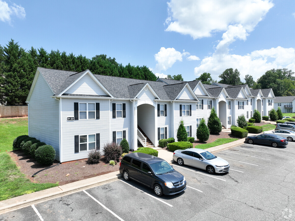
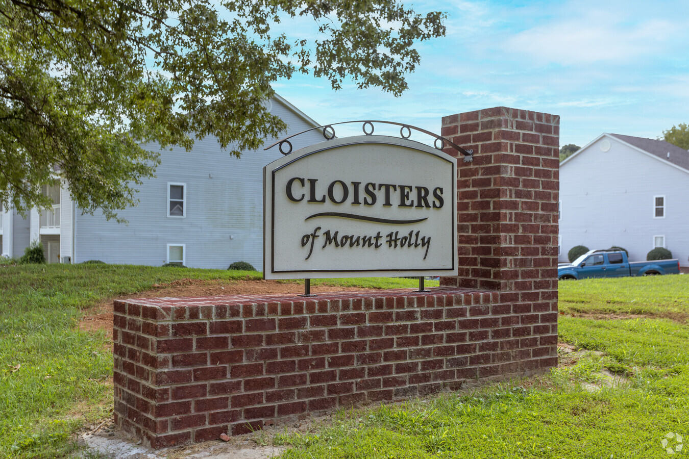
Property Record
801 S Main St, Dallas, NC 28034
NEARBY LISTINGS FOR SALE OR LEASE
-
-
View all Dallas listings for sale on LoopNet.com
Property Detail
801 S Main St
220246
03 018 002 00 000
Apartment
Gaston
AE
North Carolina
3710359600L
36.06 AC
2024
Outlying Gaston County
2024
Charlotte
030302
Charlotte-Concord-Gastonia, NC-SC
1,966 SF
DEMOGRAPHICS near 801 S Main St
1 Mile
3 Mile
5 Mile
2024 Total Population
4,847
33,339
93,134
2029 Population
5,180
35,679
99,714
Pop Growth 2024-2029
+ 6.87%
+ 7.02%
+ 7.07%
Average Age
39
39
39
2024 Total Households
2,214
13,578
36,534
HH Growth 2024-2029
+ 7.00%
+ 7.22%
+ 7.28%
Median Household Inc
$52,417
$58,799
$67,165
Avg Household Size
2.20
2.40
2.50
2024 Avg HH Vehicles
2.00
2.00
2.00
Median Home Value
$196,404
$223,107
$238,903
Median Year Built
1979
1988
1992
Nearby Places
- Restaurants
- Banks
- Shops
- Fitness
- Groceries
PUBLIC TRANSPORTATION
COMMUTER RAIL
Gastonia Amtrak Station (Crescent - Amtrak)
DRIVE
WALK
Distance
Gastonia Amtrak Station (Crescent - Amtrak)
12 min
6.7 mi
AIRPORT
Charlotte/Douglas International
DRIVE
WALK
Distance
Charlotte/Douglas International
37 min
20.7 mi
Concord-Padgett Regional
DRIVE
WALK
Distance
Concord-Padgett Regional
51 min
37.0 mi
Freight Ports
North Charleston Terminal
DRIVE
WALK
Distance
North Charleston Terminal
251 min
216.7 mi
Nearby Properties
Address
Land Use
TOTAL SIZE
Lot Size
Zoning
Address
Land Use
TOTAL SIZE
Lot Size
Zoning
11,696 SF
159.68 AC
Address
Land Use
TOTAL SIZE
Lot Size
Zoning
6.09 AC
Address
Land Use
TOTAL SIZE
Lot Size
Zoning
312,465 SF
35.23 AC
Address
Land Use
TOTAL SIZE
Lot Size
Zoning
192,315 SF
44.12 AC
INDS1
Address
Land Use
TOTAL SIZE
Lot Size
Zoning
176,657 SF
16.19 AC
Address
Land Use
TOTAL SIZE
Lot Size
Zoning
154,681 SF
63.07 AC
INDS1
Address
Land Use
TOTAL SIZE
Lot Size
Zoning
163,100 SF
41.60 AC
INDS1
Address
Land Use
TOTAL SIZE
Lot Size
Zoning
16,776 SF
49.87 AC
PUB01
Address
Land Use
TOTAL SIZE
Lot Size
Zoning
1,914 SF
15.78 AC
MRKT1
Address
Land Use
TOTAL SIZE
Lot Size
Zoning
3,328 SF
10.16 AC
APT02
Address
Land Use
TOTAL SIZE
Lot Size
Zoning
2,776 SF
57.41 AC
R1
Address
Land Use
TOTAL SIZE
Lot Size
Zoning
2,053 SF
15.34 AC
OFF01
Address
Land Use
TOTAL SIZE
Lot Size
Zoning
115,534 SF
50.10 AC
PUB01
Address
Land Use
TOTAL SIZE
Lot Size
Zoning
70,288 SF
13.42 AC
INDS1
Address
Land Use
TOTAL SIZE
Lot Size
Zoning
36,300 SF
15.83 AC
Address
Land Use
TOTAL SIZE
Lot Size
Zoning
2,145 SF
10.19 AC
Address
Land Use
TOTAL SIZE
Lot Size
Zoning
43,164 SF
11.52 AC
SHOP1
Address
Land Use
TOTAL SIZE
Lot Size
Zoning
103.84 AC
Address
Land Use
TOTAL SIZE
Lot Size
Zoning
69,540 SF
19.40 AC
PUB01
Address
Land Use
TOTAL SIZE
Lot Size
Zoning
864 SF
242.66 AC
GOV01
Address
Land Use
TOTAL SIZE
Lot Size
Zoning
193,964 SF
12.02 AC
INDS2
Address
Land Use
TOTAL SIZE
Lot Size
Zoning
43,320 SF
8.14 AC
Address
Land Use
TOTAL SIZE
Lot Size
Zoning
41,065 SF
20.61 AC
R1
Address
Land Use
TOTAL SIZE
Lot Size
Zoning
1,184 SF
42.55 AC
OFF01
Address
Land Use
TOTAL SIZE
Lot Size
Zoning
17,752 SF
11.54 AC
PUB01
Address
Land Use
TOTAL SIZE
Lot Size
Zoning
46,070 SF
5.43 AC
SHOP1
Address
Land Use
TOTAL SIZE
Lot Size
Zoning
14,647 SF
1.22 AC
RET05
Address
Land Use
TOTAL SIZE
Lot Size
Zoning
10,204 SF
10.13 AC
INDS2
Address
Land Use
TOTAL SIZE
Lot Size
Zoning
3,542 SF
10.04 AC
APT01
Address
Land Use
TOTAL SIZE
Lot Size
Zoning
45,970 SF
7.57 AC
SHOP1
The World's #1 Commercial Real Estate Marketplace
Connect with us
© 2025 CoStar Group
The information above has been obtained from sources believed reliable. While we do not doubt its accuracy we have not verified it and make no guarantee, warranty or representation about it. It is your responsibility to independently confirm its accuracy and completeness. Any projections, opinions, assumptions, or estimates used are for example only and do not represent the current or future performance of the property. The value of this transaction to you depends on tax and other factors which should be evaluated by your tax, financial, and legal advisors. You and your advisors should conduct a careful, independent investigation of the property to determine to your satisfaction the suitability of the property for your needs.