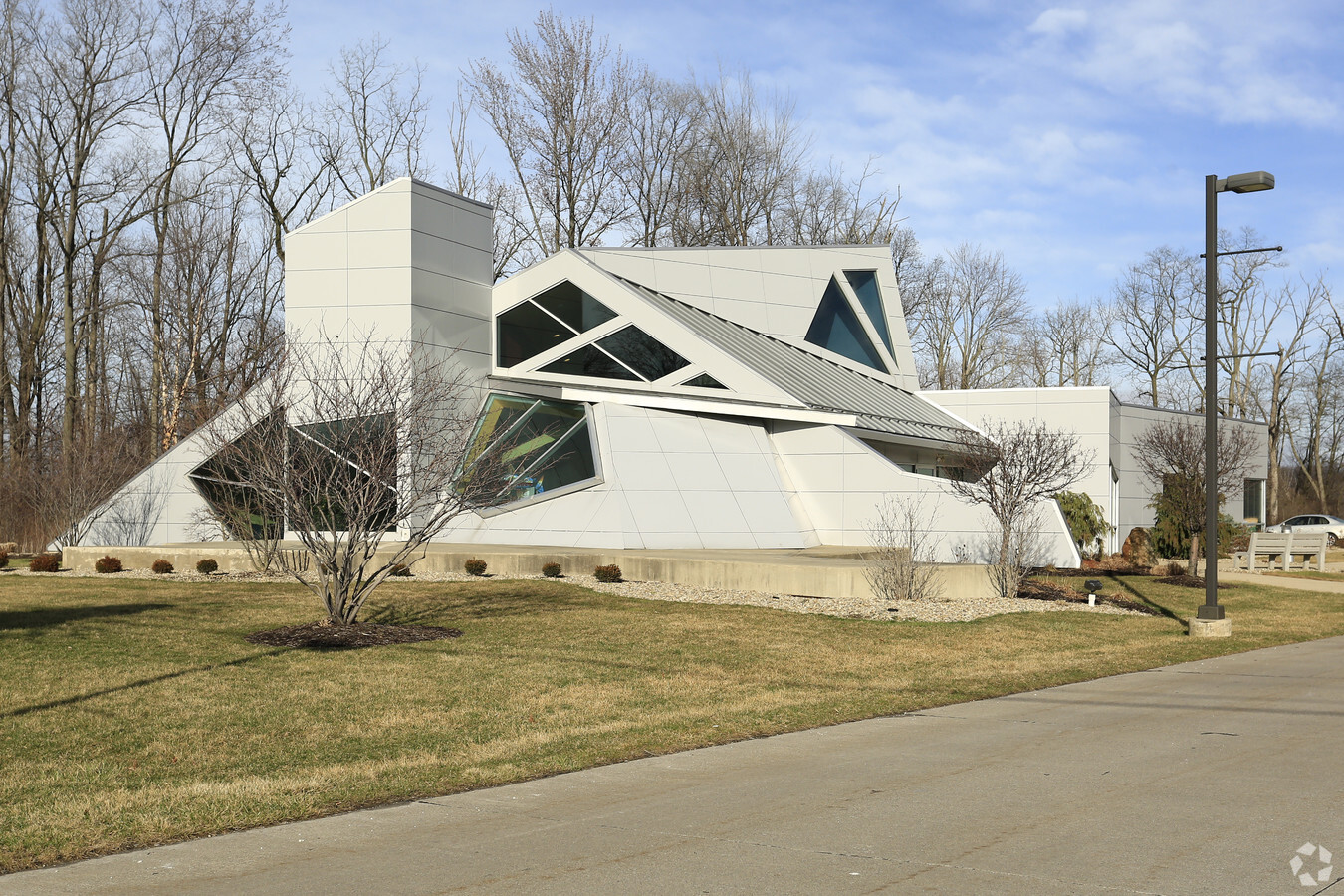
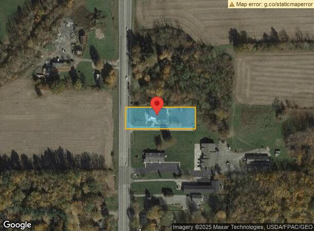
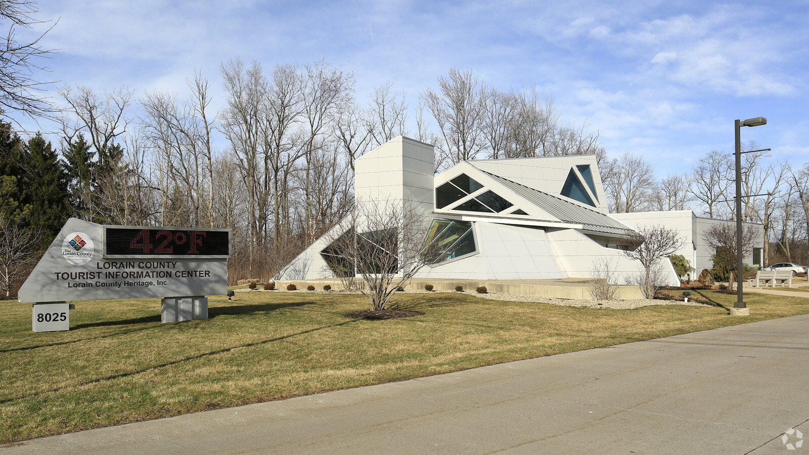
Property Record
8025 Leavitt Rd, Amherst, OH 44001
NEARBY LISTINGS FOR SALE OR LEASE
Property Detail
8025 Leavitt Rd
Cleveland-Elyria, OH
Previous
05-00-047-000-016
PREVIOUS #05-E-09 FROM -015
Charitableorganization
Lorain
X
Ohio
39093C0205D
47
2023
1.15 AC
2023
Lorain County
057100
Cleveland
5,884 SF
DEMOGRAPHICS near 8025 Leavitt Rd
1 Mile
3 Mile
5 Mile
2024 Total Population
964
20,301
65,124
2029 Population
996
21,012
67,895
Pop Growth 2024-2029
+ 3.32%
+ 3.50%
+ 4.25%
Average Age
44
44
43
2024 Total Households
382
8,505
27,518
HH Growth 2024-2029
+ 3.14%
+ 3.46%
+ 4.27%
Median Household Inc
$84,375
$73,635
$57,489
Avg Household Size
2.50
2.40
2.30
2024 Avg HH Vehicles
2.00
2.00
2.00
Median Home Value
$210,952
$183,010
$166,074
Median Year Built
1976
1973
1972
Nearby Places
- Restaurants
- Banks
- Shops
- Fitness
- Groceries
PUBLIC TRANSPORTATION
COMMUTER RAIL
Elyria Amtrak (Capitol Limited - Amtrak, Lake Shore Limited - Amtrak)
DRIVE
WALK
Distance
Elyria Amtrak (Capitol Limited - Amtrak, Lake Shore Limited - Amtrak)
13 min
7.8 mi
AIRPORT
Cleveland-Hopkins International
DRIVE
WALK
Distance
Cleveland-Hopkins International
30 min
21.8 mi
Freight Ports
Port of Toledo
DRIVE
WALK
Distance
Port of Toledo
100 min
83.7 mi
Nearby Properties
Address
Land Use
TOTAL SIZE
Lot Size
Zoning
Address
Land Use
TOTAL SIZE
Lot Size
Zoning
118,624 SF
19.80 AC
Address
Land Use
TOTAL SIZE
Lot Size
Zoning
111,373 SF
9.35 AC
Address
Land Use
TOTAL SIZE
Lot Size
Zoning
36.66 AC
Address
Land Use
TOTAL SIZE
Lot Size
Zoning
31,871 SF
6.90 AC
Address
Land Use
TOTAL SIZE
Lot Size
Zoning
9,880 SF
3.90 AC
Address
Land Use
TOTAL SIZE
Lot Size
Zoning
54,831 SF
3.93 AC
Address
Land Use
TOTAL SIZE
Lot Size
Zoning
66,196 SF
7.05 AC
Address
Land Use
TOTAL SIZE
Lot Size
Zoning
57,730 SF
7.35 AC
Address
Land Use
TOTAL SIZE
Lot Size
Zoning
67,408 SF
14.83 AC
Address
Land Use
TOTAL SIZE
Lot Size
Zoning
Address
Land Use
TOTAL SIZE
Lot Size
Zoning
80,852 SF
9.41 AC
Address
Land Use
TOTAL SIZE
Lot Size
Zoning
17,787 SF
3.67 AC
Address
Land Use
TOTAL SIZE
Lot Size
Zoning
19,512 SF
3.64 AC
Address
Land Use
TOTAL SIZE
Lot Size
Zoning
64,442 SF
7.67 AC
Address
Land Use
TOTAL SIZE
Lot Size
Zoning
22,737 SF
8.58 AC
Address
Land Use
TOTAL SIZE
Lot Size
Zoning
27,756 SF
2.61 AC
Address
Land Use
TOTAL SIZE
Lot Size
Zoning
28,524 SF
5.90 AC
Address
Land Use
TOTAL SIZE
Lot Size
Zoning
30,988 SF
0.33 AC
Address
Land Use
TOTAL SIZE
Lot Size
Zoning
23,068 SF
2.94 AC
Address
Land Use
TOTAL SIZE
Lot Size
Zoning
3.07 AC
Address
Land Use
TOTAL SIZE
Lot Size
Zoning
11.65 AC
Address
Land Use
TOTAL SIZE
Lot Size
Zoning
26,990 SF
20.02 AC
Address
Land Use
TOTAL SIZE
Lot Size
Zoning
14,776 SF
0.48 AC
Address
Land Use
TOTAL SIZE
Lot Size
Zoning
48,978 SF
6.60 AC
Address
Land Use
TOTAL SIZE
Lot Size
Zoning
22,044 SF
7.34 AC
Address
Land Use
TOTAL SIZE
Lot Size
Zoning
87,914 SF
5.03 AC
Address
Land Use
TOTAL SIZE
Lot Size
Zoning
33,882 SF
3.28 AC
Address
Land Use
TOTAL SIZE
Lot Size
Zoning
31,461 SF
3.99 AC
Address
Land Use
TOTAL SIZE
Lot Size
Zoning
182,568 SF
43.21 AC
Address
Land Use
TOTAL SIZE
Lot Size
Zoning
16,453 SF
9.77 AC
The World's #1 Commercial Real Estate Marketplace
Connect with us
© 2025 CoStar Group
The information above has been obtained from sources believed reliable. While we do not doubt its accuracy we have not verified it and make no guarantee, warranty or representation about it. It is your responsibility to independently confirm its accuracy and completeness. Any projections, opinions, assumptions, or estimates used are for example only and do not represent the current or future performance of the property. The value of this transaction to you depends on tax and other factors which should be evaluated by your tax, financial, and legal advisors. You and your advisors should conduct a careful, independent investigation of the property to determine to your satisfaction the suitability of the property for your needs.