Property Record
8025 State Highway 25 Ne, Monticello, MN 55362

NEARBY LISTINGS FOR SALE OR LEASE
Property Detail
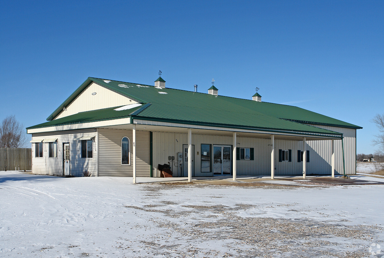
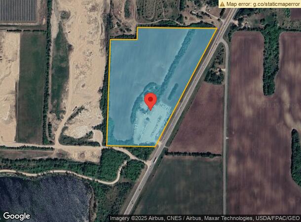
8025 State Highway 25 Ne
Minneapolis-St. Paul-Bloomington, MN-WI
Monticello Twp
213-100-223402
SECT-22 TWP-121 RANGE-025 UNPLATTED LAND MONTICELLO TWP2 25.45 AC E1/2 OF SW1/4 LY W OF WLY R/W OF HWY25 & LY S OF N1306.29FT
Warehouse
Wright
2024
Minnesota
2024
25.45 AC
100202
Wright County
4,224 SF
Minneapolis/St Paul
DEMOGRAPHICS near 8025 State Highway 25 Ne
1 Mile
3 Mile
5 Mile
2024 Total Population
393
11,572
23,974
2029 Population
433
12,849
26,664
Pop Growth 2024-2029
+ 10.18%
+ 11.04%
+ 11.22%
Average Age
37
37
38
2024 Total Households
135
4,258
8,709
HH Growth 2024-2029
+ 9.63%
+ 11.18%
+ 11.31%
Median Household Inc
$82,927
$85,045
$91,149
Avg Household Size
2.80
2.60
2.70
2024 Avg HH Vehicles
3.00
2.00
2.00
Median Home Value
$235,849
$259,292
$283,680
Median Year Built
1997
1995
1993
Nearby Places
- Restaurants
- Banks
- Shops
- Fitness
- Groceries
PUBLIC TRANSPORTATION
COMMUTER RAIL
Big Lake Station (Northstar Corridor - Northstar Commuter Rail)
DRIVE
WALK
Distance
Big Lake Station (Northstar Corridor - Northstar Commuter Rail)
14 min
7.0 mi
Freight Ports
Port Milwaukee
DRIVE
WALK
Distance
Port Milwaukee
418 min
378.5 mi
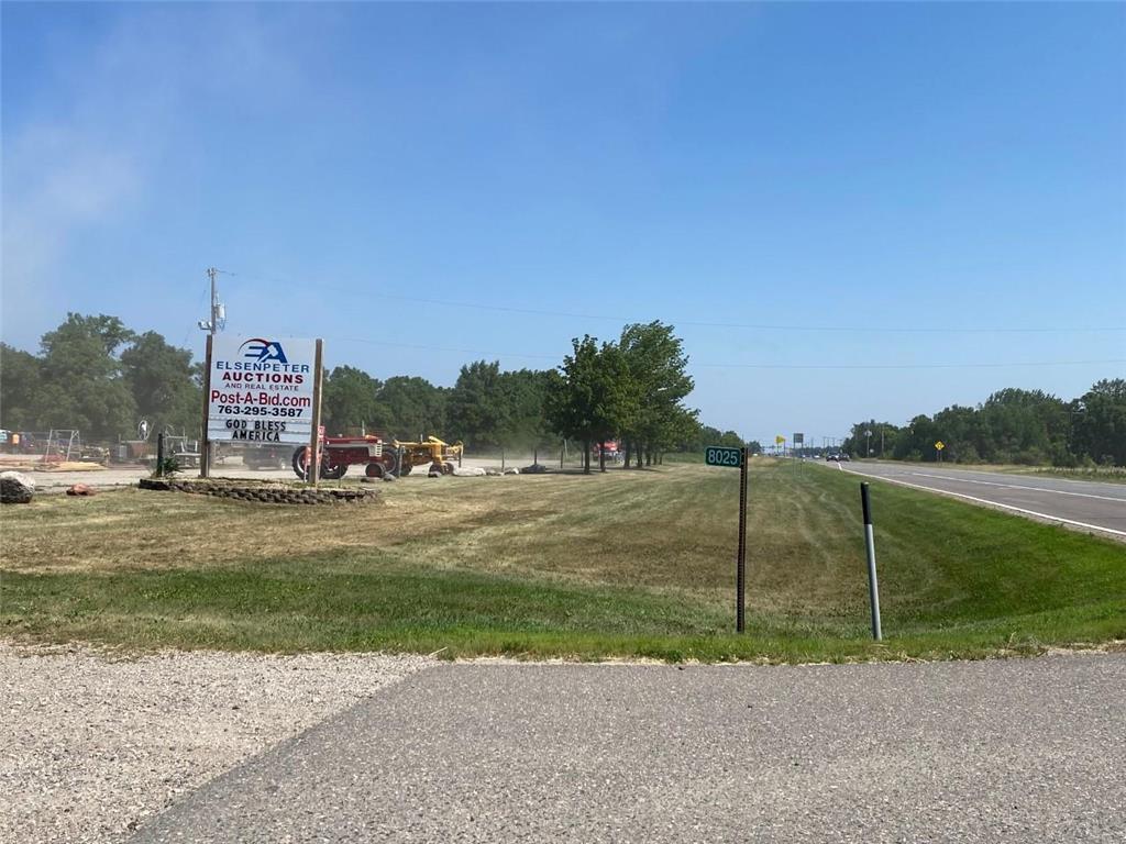
SALE & LEASE HISTORY
LISTING DATE
SALE/LEASE

Feb 16, 2022
For Sale
Nearby Properties
Address
Land Use
TOTAL SIZE
Lot Size
Zoning
Address
Land Use
TOTAL SIZE
Lot Size
Zoning
284,950 SF
101.58 AC
Address
Land Use
TOTAL SIZE
Lot Size
Zoning
259,284 SF
12.70 AC
Address
Land Use
TOTAL SIZE
Lot Size
Zoning
83,437 SF
6.40 AC
Address
Land Use
TOTAL SIZE
Lot Size
Zoning
207,895 SF
26.76 AC
Address
Land Use
TOTAL SIZE
Lot Size
Zoning
29,409 SF
2.95 AC
Address
Land Use
TOTAL SIZE
Lot Size
Zoning
141,593 SF
18.15 AC
Address
Land Use
TOTAL SIZE
Lot Size
Zoning
174,200 SF
14.09 AC
Address
Land Use
TOTAL SIZE
Lot Size
Zoning
165,248 SF
28.59 AC
Address
Land Use
TOTAL SIZE
Lot Size
Zoning
214,571 SF
26.90 AC
Address
Land Use
TOTAL SIZE
Lot Size
Zoning
15,271 SF
0.55 AC
Address
Land Use
TOTAL SIZE
Lot Size
Zoning
1,800 SF
64.56 AC
Address
Land Use
TOTAL SIZE
Lot Size
Zoning
50,900 SF
17.86 AC
Address
Land Use
TOTAL SIZE
Lot Size
Zoning
69,747 SF
2.08 AC
Address
Land Use
TOTAL SIZE
Lot Size
Zoning
105,255 SF
10.39 AC
Address
Land Use
TOTAL SIZE
Lot Size
Zoning
69,500 SF
3.50 AC
Address
Land Use
TOTAL SIZE
Lot Size
Zoning
60,432 SF
0.76 AC
Address
Land Use
TOTAL SIZE
Lot Size
Zoning
12,960 SF
3.81 AC
Address
Land Use
TOTAL SIZE
Lot Size
Zoning
4.50 AC
Address
Land Use
TOTAL SIZE
Lot Size
Zoning
10.34 AC
Address
Land Use
TOTAL SIZE
Lot Size
Zoning
10.72 AC
Address
Land Use
TOTAL SIZE
Lot Size
Zoning
50,610 SF
9.38 AC
Address
Land Use
TOTAL SIZE
Lot Size
Zoning
76,164 SF
6.28 AC
Address
Land Use
TOTAL SIZE
Lot Size
Zoning
59,269 SF
8.32 AC
Address
Land Use
TOTAL SIZE
Lot Size
Zoning
82,667 SF
8.86 AC
Address
Land Use
TOTAL SIZE
Lot Size
Zoning
20,511 SF
3.06 AC
Address
Land Use
TOTAL SIZE
Lot Size
Zoning
3.03 AC
Address
Land Use
TOTAL SIZE
Lot Size
Zoning
65,671 SF
4.68 AC
Address
Land Use
TOTAL SIZE
Lot Size
Zoning
73,160 SF
12.79 AC
Address
Land Use
TOTAL SIZE
Lot Size
Zoning
11,100 SF
3.60 AC
Address
Land Use
TOTAL SIZE
Lot Size
Zoning
8,868 SF
10.80 AC
The World's #1 Commercial Real Estate Marketplace
Connect with us
© 2025 CoStar Group
The information above has been obtained from sources believed reliable. While we do not doubt its accuracy we have not verified it and make no guarantee, warranty or representation about it. It is your responsibility to independently confirm its accuracy and completeness. Any projections, opinions, assumptions, or estimates used are for example only and do not represent the current or future performance of the property. The value of this transaction to you depends on tax and other factors which should be evaluated by your tax, financial, and legal advisors. You and your advisors should conduct a careful, independent investigation of the property to determine to your satisfaction the suitability of the property for your needs.