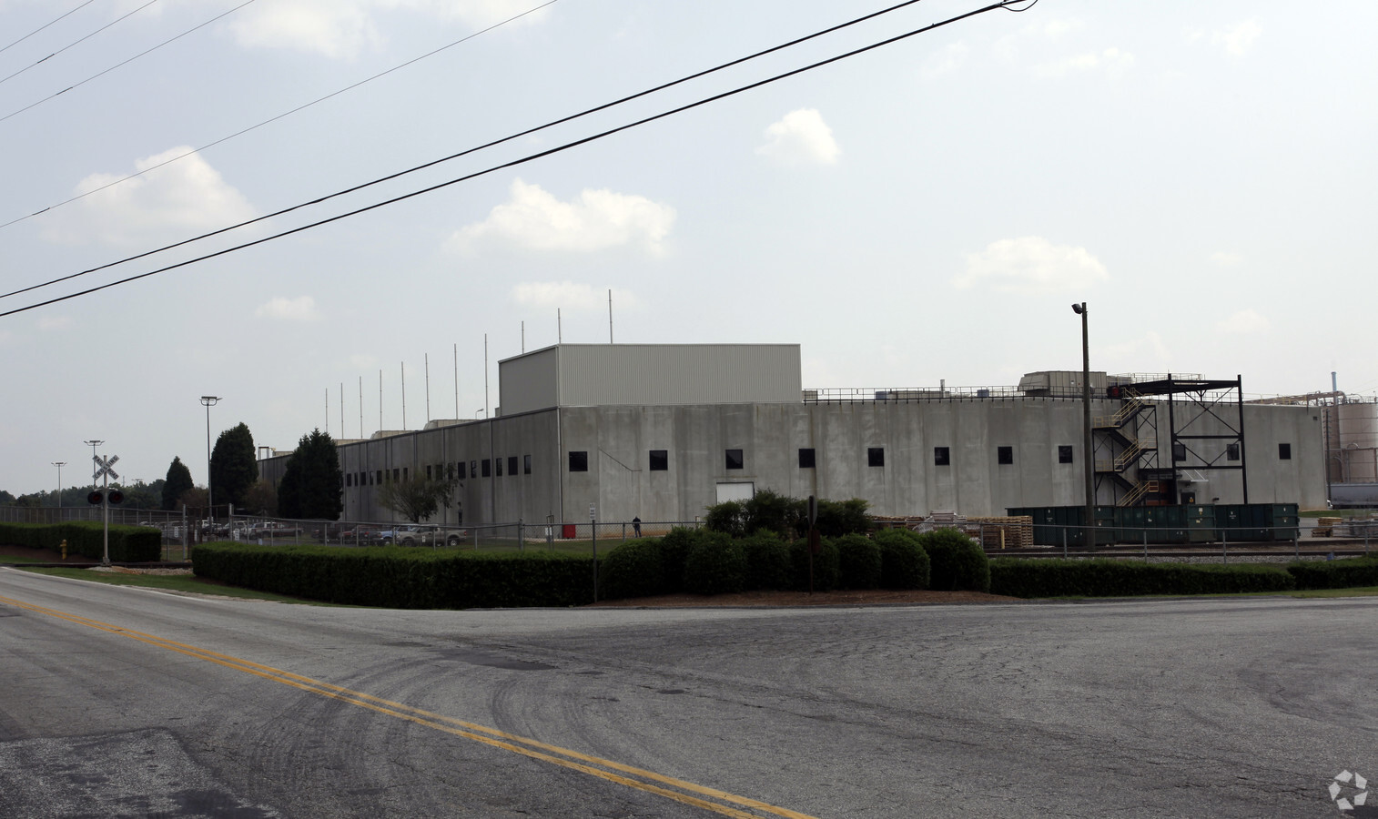
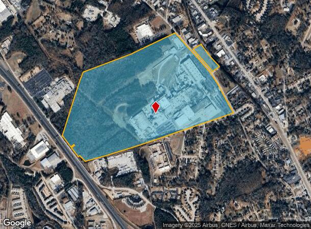
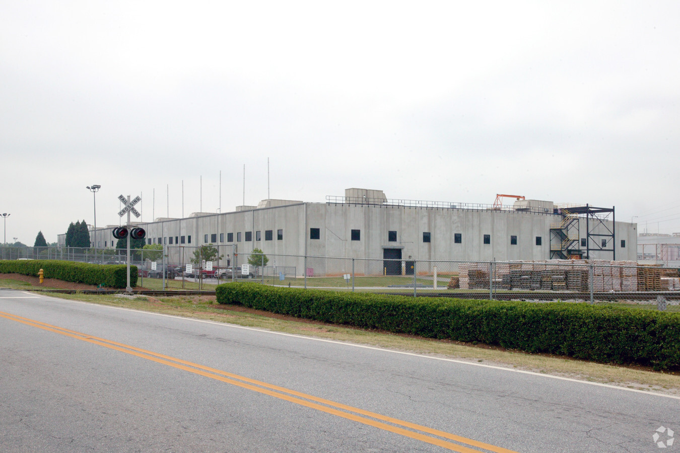
Property Record
803 N Maple St, Simpsonville, SC 29681
NEARBY LISTINGS FOR SALE OR LEASE
Property Detail
803 N Maple St
Greenville-Anderson-Mauldin, SC
MAP 0303.00
0303.00-01-002.01
Greenville
Lightindustrial
South Carolina
X
002.01
45045C0482E
195.23 AC
2024
I-385/Simpsonville
2024
Greenville/Spartanburg
003005
DEMOGRAPHICS near 803 N Maple St
1 Mile
3 Mile
5 Mile
2024 Total Population
3,917
48,206
125,525
2029 Population
4,305
53,103
138,559
Pop Growth 2024-2029
+ 9.91%
+ 10.16%
+ 10.38%
Average Age
40
40
40
2024 Total Households
1,639
18,594
48,242
HH Growth 2024-2029
+ 9.95%
+ 10.22%
+ 10.48%
Median Household Inc
$73,679
$86,115
$86,707
Avg Household Size
2.40
2.60
2.60
2024 Avg HH Vehicles
2.00
2.00
2.00
Median Home Value
$242,713
$244,989
$253,477
Median Year Built
1993
1996
1999
Nearby Places
- Restaurants
- Banks
- Shops
- Fitness
- Groceries
PUBLIC TRANSPORTATION
AIRPORT
Greenville Spartanburg International
DRIVE
WALK
Distance
Greenville Spartanburg International
24 min
14.2 mi
Freight Ports
North Charleston Terminal
DRIVE
WALK
Distance
North Charleston Terminal
218 min
191.8 mi
Nearby Properties
Address
Land Use
TOTAL SIZE
Lot Size
Zoning
Address
Land Use
TOTAL SIZE
Lot Size
Zoning
10.20 AC
R12
Address
Land Use
TOTAL SIZE
Lot Size
Zoning
23.23 AC
Address
Land Use
TOTAL SIZE
Lot Size
Zoning
11.91 AC
RM20
Address
Land Use
TOTAL SIZE
Lot Size
Zoning
12.31 AC
Address
Land Use
TOTAL SIZE
Lot Size
Zoning
17.59 AC
Address
Land Use
TOTAL SIZE
Lot Size
Zoning
29.21 AC
I1
Address
Land Use
TOTAL SIZE
Lot Size
Zoning
47.12 AC
RRROW
Address
Land Use
TOTAL SIZE
Lot Size
Zoning
Address
Land Use
TOTAL SIZE
Lot Size
Zoning
10.78 AC
I1
Address
Land Use
TOTAL SIZE
Lot Size
Zoning
4.58 AC
BI
Address
Land Use
TOTAL SIZE
Lot Size
Zoning
9.46 AC
I1
Address
Land Use
TOTAL SIZE
Lot Size
Zoning
12.42 AC
RS
Address
Land Use
TOTAL SIZE
Lot Size
Zoning
5.30 AC
BI
Address
Land Use
TOTAL SIZE
Lot Size
Zoning
76.20 AC
R20
Address
Land Use
TOTAL SIZE
Lot Size
Zoning
7.03 AC
I1
Address
Land Use
TOTAL SIZE
Lot Size
Zoning
12.31 AC
I1
Address
Land Use
TOTAL SIZE
Lot Size
Zoning
50.76 AC
PDC
Address
Land Use
TOTAL SIZE
Lot Size
Zoning
96.14 AC
NZ
Address
Land Use
TOTAL SIZE
Lot Size
Zoning
26.30 AC
ROI
Address
Land Use
TOTAL SIZE
Lot Size
Zoning
10.50 AC
RRROW
Address
Land Use
TOTAL SIZE
Lot Size
Zoning
Address
Land Use
TOTAL SIZE
Lot Size
Zoning
12.11 AC
BG
Address
Land Use
TOTAL SIZE
Lot Size
Zoning
51.30 AC
RS
Address
Land Use
TOTAL SIZE
Lot Size
Zoning
8.23 AC
S1
Address
Land Use
TOTAL SIZE
Lot Size
Zoning
17.65 AC
ID
Address
Land Use
TOTAL SIZE
Lot Size
Zoning
65.40 AC
RS
Address
Land Use
TOTAL SIZE
Lot Size
Zoning
17.02 AC
BG
Address
Land Use
TOTAL SIZE
Lot Size
Zoning
3.20 AC
I1
Address
Land Use
TOTAL SIZE
Lot Size
Zoning
31.90 AC
I1
The World's #1 Commercial Real Estate Marketplace
Connect with us
© 2025 CoStar Group
The information above has been obtained from sources believed reliable. While we do not doubt its accuracy we have not verified it and make no guarantee, warranty or representation about it. It is your responsibility to independently confirm its accuracy and completeness. Any projections, opinions, assumptions, or estimates used are for example only and do not represent the current or future performance of the property. The value of this transaction to you depends on tax and other factors which should be evaluated by your tax, financial, and legal advisors. You and your advisors should conduct a careful, independent investigation of the property to determine to your satisfaction the suitability of the property for your needs.