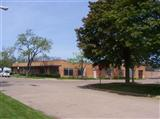
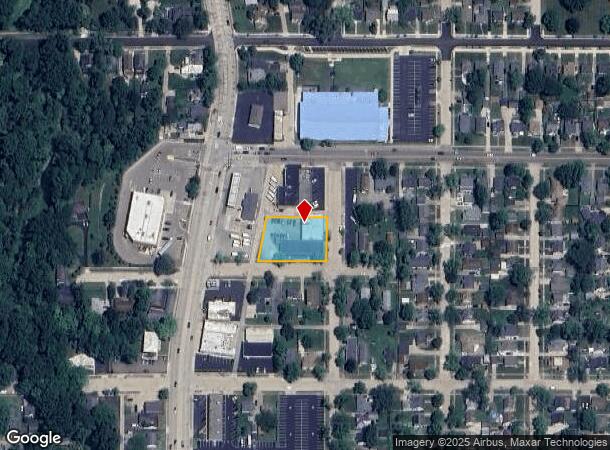
Property Record
815 Myrtle Ave, Saint Joseph, MI 49085
NEARBY LISTINGS FOR SALE OR LEASE
Property Detail
815 Myrtle Ave
Niles-Benton Harbor, MI
F J Burkhard Add
11-76-0900-0020-00-7
LOTS 20 THRU 24 INCL F J BURKHARD ADD TO CITY OF ST JOSEPH
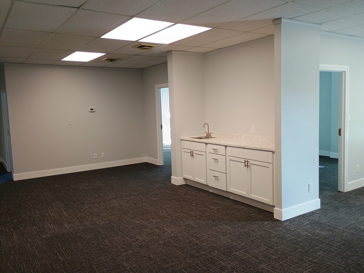
Officebuilding
Berrien
X
Michigan
26021C0103D
20-24
2024
0.53 AC
2024
Michigan Southwest Area
001000
Other Market Areas
9,830 SF
DEMOGRAPHICS near 815 Myrtle Ave
1 Mile
3 Mile
5 Mile
2024 Total Population
5,836
31,297
49,613
2029 Population
5,664
30,831
48,829
Pop Growth 2024-2029
(2.95%)
(1.49%)
(1.58%)
Average Age
43
41
41
2024 Total Households
2,951
13,422
20,692
HH Growth 2024-2029
(3.08%)
(1.83%)
(1.87%)
Median Household Inc
$69,128
$51,435
$52,948
Avg Household Size
2.00
2.30
2.30
2024 Avg HH Vehicles
2.00
2.00
2.00
Median Home Value
$216,486
$190,199
$210,141
Median Year Built
1952
1959
1964
Nearby Places
- Restaurants
- Banks
- Shops
- Fitness
- Groceries
PUBLIC TRANSPORTATION
COMMUTER RAIL
St. Joseph-Benton Harbor Amtrak Station (Pere Marquette - Amtrak)
DRIVE
WALK
Distance
St. Joseph-Benton Harbor Amtrak Station (Pere Marquette - Amtrak)
5 min
1.9 mi
AIRPORT
South Bend International
DRIVE
WALK
Distance
South Bend International
50 min
33.2 mi
Freight Ports
Port Milwaukee
DRIVE
WALK
Distance
Port Milwaukee
219 min
181.8 mi
SALE & LEASE HISTORY
LISTING DATE
SALE/LEASE

Nov 13, 2024
For Lease
Jul 06, 2023
For Sale
Nearby Properties
Address
Land Use
TOTAL SIZE
Lot Size
Zoning
Address
Land Use
TOTAL SIZE
Lot Size
Zoning
Address
Land Use
TOTAL SIZE
Lot Size
Zoning
1.60 AC
Address
Land Use
TOTAL SIZE
Lot Size
Zoning
125,408 SF
4.66 AC
R-3
Address
Land Use
TOTAL SIZE
Lot Size
Zoning
64,000 SF
4.85 AC
DISTRICT G
Address
Land Use
TOTAL SIZE
Lot Size
Zoning
202,713 SF
14.23 AC
CO-A
Address
Land Use
TOTAL SIZE
Lot Size
Zoning
73,680 SF
CO-A
Address
Land Use
TOTAL SIZE
Lot Size
Zoning
358,000 SF
20.56 AC
I1
Address
Land Use
TOTAL SIZE
Lot Size
Zoning
5.30 AC
C4 HEAVY
Address
Land Use
TOTAL SIZE
Lot Size
Zoning
216,232 SF
Address
Land Use
TOTAL SIZE
Lot Size
Zoning
Address
Land Use
TOTAL SIZE
Lot Size
Zoning
258,549 SF
17.20 AC
C MULTI
Address
Land Use
TOTAL SIZE
Lot Size
Zoning
28,243 SF
CO-A
Address
Land Use
TOTAL SIZE
Lot Size
Zoning
112,503 SF
4.30 AC
C MULTI FA
Address
Land Use
TOTAL SIZE
Lot Size
Zoning
69,750 SF
0.47 AC
D
Address
Land Use
TOTAL SIZE
Lot Size
Zoning
90,000 SF
7.62 AC
W
Address
Land Use
TOTAL SIZE
Lot Size
Zoning
518,375 SF
25.57 AC
C
Address
Land Use
TOTAL SIZE
Lot Size
Zoning
93,032 SF
0.51 AC
D
Address
Land Use
TOTAL SIZE
Lot Size
Zoning
82,567 SF
1.74 AC
D
Address
Land Use
TOTAL SIZE
Lot Size
Zoning
40,063 SF
9.78 AC
DISTRICT G
Address
Land Use
TOTAL SIZE
Lot Size
Zoning
25,080 SF
I-1
Address
Land Use
TOTAL SIZE
Lot Size
Zoning
70,617 SF
12 AC
E RESTRICT
Address
Land Use
TOTAL SIZE
Lot Size
Zoning
84,732 SF
4.19 AC
C MULTI FA
Address
Land Use
TOTAL SIZE
Lot Size
Zoning
75,050 SF
5.33 AC
NONE
Address
Land Use
TOTAL SIZE
Lot Size
Zoning
172,489 SF
12.66 AC
E RESTRICT
Address
Land Use
TOTAL SIZE
Lot Size
Zoning
103,591 SF
8.77 AC
D1 COMM
Address
Land Use
TOTAL SIZE
Lot Size
Zoning
69,484 SF
8.08 AC
C MULTI
Address
Land Use
TOTAL SIZE
Lot Size
Zoning
151,462 SF
9.96 AC
DISTRICT F
Address
Land Use
TOTAL SIZE
Lot Size
Zoning
24,800 SF
0.29 AC
DISTRICT E
Address
Land Use
TOTAL SIZE
Lot Size
Zoning
55,753 SF
6 AC
DISTRICT D
Address
Land Use
TOTAL SIZE
Lot Size
Zoning
60,252 SF
3.17 AC
C
The World's #1 Commercial Real Estate Marketplace
Connect with us
© 2025 CoStar Group
The information above has been obtained from sources believed reliable. While we do not doubt its accuracy we have not verified it and make no guarantee, warranty or representation about it. It is your responsibility to independently confirm its accuracy and completeness. Any projections, opinions, assumptions, or estimates used are for example only and do not represent the current or future performance of the property. The value of this transaction to you depends on tax and other factors which should be evaluated by your tax, financial, and legal advisors. You and your advisors should conduct a careful, independent investigation of the property to determine to your satisfaction the suitability of the property for your needs.