Property Record
805 N Highway 44 76, Caledonia, MN 55921
NEARBY LISTINGS FOR SALE OR LEASE
-
-
View all Caledonia listings for sale on LoopNet.com
Property Detail
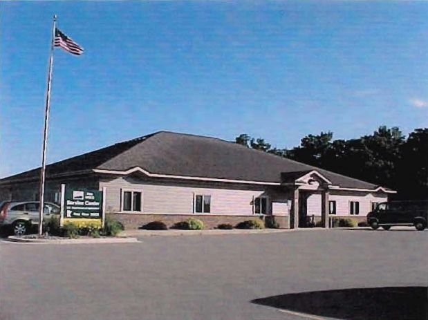
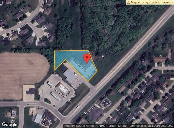
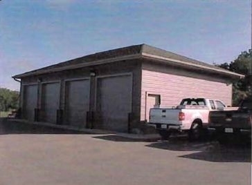
805 N Highway 44 76
R-21.1148.001
Ma-Cal Industrial Park
Officebuilding
SECT-13 TWP-102 RANGE-006 MA-CAL INDUSTRIAL PARK LOT-001 BLOCK-001 MA-CAL INSDUSTRIAL PARK PT LOT 1, BLK 1 DOC #248898 DOC 27
X
Houston
27055C0170E
Minnesota
2024
1
2024
1.72 AC
020500
Other Market Areas
5,723 SF
La Crosse-Onalaska, WI-MN
DEMOGRAPHICS near 805 N Highway 44 76
1 Mile
3 Mile
5 Mile
2024 Total Population
2,985
3,648
4,043
2029 Population
3,016
3,682
4,070
Pop Growth 2024-2029
+ 1.04%
+ 0.93%
+ 0.67%
Average Age
42
42
42
2024 Total Households
1,277
1,564
1,730
HH Growth 2024-2029
+ 1.02%
+ 0.90%
+ 0.64%
Median Household Inc
$58,532
$58,644
$58,875
Avg Household Size
2.20
2.20
2.20
2024 Avg HH Vehicles
2.00
2.00
2.00
Median Home Value
$148,901
$150,786
$156,288
Median Year Built
1969
1969
1968
Nearby Places
- Restaurants
- Banks
- Shops
- Fitness
- Groceries
PUBLIC TRANSPORTATION
AIRPORT
La Crosse Regional
DRIVE
WALK
Distance
La Crosse Regional
39 min
25.0 mi
Freight Ports
Port Milwaukee
DRIVE
WALK
Distance
Port Milwaukee
263 min
232.1 mi
SALE & LEASE HISTORY
LISTING DATE
SALE/LEASE

Sep 23, 2016
For Sale
Nearby Properties
Address
Land Use
TOTAL SIZE
Lot Size
Zoning
Address
Land Use
TOTAL SIZE
Lot Size
Zoning
7,570 SF
4 AC
Address
Land Use
TOTAL SIZE
Lot Size
Zoning
1,512 SF
18.09 AC
Address
Land Use
TOTAL SIZE
Lot Size
Zoning
35,276 SF
1.07 AC
Address
Land Use
TOTAL SIZE
Lot Size
Zoning
5.97 AC
Address
Land Use
TOTAL SIZE
Lot Size
Zoning
22,470 SF
8.79 AC
Address
Land Use
TOTAL SIZE
Lot Size
Zoning
20,882 SF
1.47 AC
Address
Land Use
TOTAL SIZE
Lot Size
Zoning
4,476 SF
4 AC
Address
Land Use
TOTAL SIZE
Lot Size
Zoning
8,347 SF
1.14 AC
Address
Land Use
TOTAL SIZE
Lot Size
Zoning
7,315 SF
1.97 AC
Address
Land Use
TOTAL SIZE
Lot Size
Zoning
3,696 SF
1.78 AC
Address
Land Use
TOTAL SIZE
Lot Size
Zoning
8,806 SF
6.15 AC
Address
Land Use
TOTAL SIZE
Lot Size
Zoning
4,416 SF
0.69 AC
Address
Land Use
TOTAL SIZE
Lot Size
Zoning
6,852 SF
1.76 AC
Address
Land Use
TOTAL SIZE
Lot Size
Zoning
11,500 SF
0.66 AC
Address
Land Use
TOTAL SIZE
Lot Size
Zoning
3,136 SF
1.26 AC
Address
Land Use
TOTAL SIZE
Lot Size
Zoning
6,960 SF
2.25 AC
Address
Land Use
TOTAL SIZE
Lot Size
Zoning
4,512 SF
1.88 AC
Address
Land Use
TOTAL SIZE
Lot Size
Zoning
11,025 SF
1.67 AC
Address
Land Use
TOTAL SIZE
Lot Size
Zoning
160 SF
1.32 AC
Address
Land Use
TOTAL SIZE
Lot Size
Zoning
6,356 SF
0.66 AC
Address
Land Use
TOTAL SIZE
Lot Size
Zoning
10,620 SF
1.06 AC
Address
Land Use
TOTAL SIZE
Lot Size
Zoning
9,504 SF
3.41 AC
Address
Land Use
TOTAL SIZE
Lot Size
Zoning
5,608 SF
1.08 AC
Address
Land Use
TOTAL SIZE
Lot Size
Zoning
8,000 SF
3.16 AC
Address
Land Use
TOTAL SIZE
Lot Size
Zoning
118.80 AC
Address
Land Use
TOTAL SIZE
Lot Size
Zoning
7,333 SF
0.94 AC
Address
Land Use
TOTAL SIZE
Lot Size
Zoning
1,118 SF
118.40 AC
Address
Land Use
TOTAL SIZE
Lot Size
Zoning
7,274 SF
0.51 AC
Address
Land Use
TOTAL SIZE
Lot Size
Zoning
Address
Land Use
TOTAL SIZE
Lot Size
Zoning
1,632 SF
2.50 AC
The World's #1 Commercial Real Estate Marketplace
Connect with us
© 2025 CoStar Group
The information above has been obtained from sources believed reliable. While we do not doubt its accuracy we have not verified it and make no guarantee, warranty or representation about it. It is your responsibility to independently confirm its accuracy and completeness. Any projections, opinions, assumptions, or estimates used are for example only and do not represent the current or future performance of the property. The value of this transaction to you depends on tax and other factors which should be evaluated by your tax, financial, and legal advisors. You and your advisors should conduct a careful, independent investigation of the property to determine to your satisfaction the suitability of the property for your needs.