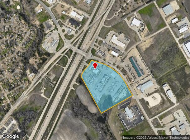
Property Record
8055 Interstate 35 S, Robinson, TX 76706
NEARBY LISTINGS FOR SALE OR LEASE
Property Detail
8055 Interstate 35 S
Waco, TX
Robinson Ind Park
44-013600-000101-3
ROBINSON IND PARK LOT A1 BLOCK 1 ACRES 16.229
Commercialnec
Mclennan
X
Texas
48309C0535D
a1
2024
16.23 AC
2024
Waco & Killeen
003703
Other Market Areas
27,916 SF
DEMOGRAPHICS near 8055 Interstate 35 S
1 Mile
3 Mile
5 Mile
2024 Total Population
3,990
26,855
71,680
2029 Population
4,200
28,479
76,141
Pop Growth 2024-2029
+ 5.26%
+ 6.05%
+ 6.22%
Average Age
38
39
39
2024 Total Households
1,468
10,060
27,300
HH Growth 2024-2029
+ 5.38%
+ 6.13%
+ 6.39%
Median Household Inc
$100,595
$89,698
$72,907
Avg Household Size
2.70
2.60
2.50
2024 Avg HH Vehicles
2.00
2.00
2.00
Median Home Value
$204,084
$226,185
$214,636
Median Year Built
1996
1997
1988
Nearby Places
- Restaurants
- Banks
- Shops
- Fitness
- Groceries
PUBLIC TRANSPORTATION
AIRPORT
Waco Regional
DRIVE
WALK
Distance
Waco Regional
27 min
15.3 mi
Freight Ports
Port of Houston
DRIVE
WALK
Distance
Port of Houston
220 min
190.6 mi
Nearby Properties
Address
Land Use
TOTAL SIZE
Lot Size
Zoning
Address
Land Use
TOTAL SIZE
Lot Size
Zoning
Address
Land Use
TOTAL SIZE
Lot Size
Zoning
108,521 SF
70 AC
Address
Land Use
TOTAL SIZE
Lot Size
Zoning
693,933 SF
57.98 AC
M2
Address
Land Use
TOTAL SIZE
Lot Size
Zoning
752,540 SF
96.04 AC
M-2
Address
Land Use
TOTAL SIZE
Lot Size
Zoning
285,829 SF
17.35 AC
Address
Land Use
TOTAL SIZE
Lot Size
Zoning
669,676 SF
87.44 AC
M2
Address
Land Use
TOTAL SIZE
Lot Size
Zoning
62.09 AC
Address
Land Use
TOTAL SIZE
Lot Size
Zoning
279,135 SF
13 AC
Address
Land Use
TOTAL SIZE
Lot Size
Zoning
106,633 SF
1.98 AC
C2
Address
Land Use
TOTAL SIZE
Lot Size
Zoning
34,723 SF
0.72 AC
Address
Land Use
TOTAL SIZE
Lot Size
Zoning
70.76 AC
O2
Address
Land Use
TOTAL SIZE
Lot Size
Zoning
459,747 SF
36.13 AC
M2
Address
Land Use
TOTAL SIZE
Lot Size
Zoning
629.24 AC
R
Address
Land Use
TOTAL SIZE
Lot Size
Zoning
Address
Land Use
TOTAL SIZE
Lot Size
Zoning
100,482 SF
4.50 AC
O2
Address
Land Use
TOTAL SIZE
Lot Size
Zoning
59,334 SF
0.59 AC
C2
Address
Land Use
TOTAL SIZE
Lot Size
Zoning
65,016 SF
5.08 AC
C-2
Address
Land Use
TOTAL SIZE
Lot Size
Zoning
23.11 AC
Address
Land Use
TOTAL SIZE
Lot Size
Zoning
12,658 SF
115.68 AC
M1
Address
Land Use
TOTAL SIZE
Lot Size
Zoning
169,278 SF
19.14 AC
R1
Address
Land Use
TOTAL SIZE
Lot Size
Zoning
77,188 SF
6.62 AC
Address
Land Use
TOTAL SIZE
Lot Size
Zoning
74,786 SF
2.28 AC
C2
Address
Land Use
TOTAL SIZE
Lot Size
Zoning
15 AC
Address
Land Use
TOTAL SIZE
Lot Size
Zoning
150,212 SF
16.79 AC
Address
Land Use
TOTAL SIZE
Lot Size
Zoning
160,093 SF
17.63 AC
Address
Land Use
TOTAL SIZE
Lot Size
Zoning
82.98 AC
M-2
Address
Land Use
TOTAL SIZE
Lot Size
Zoning
208,629 SF
49.69 AC
M2
Address
Land Use
TOTAL SIZE
Lot Size
Zoning
76,872 SF
2.14 AC
C2
Address
Land Use
TOTAL SIZE
Lot Size
Zoning
64,455 SF
8.56 AC
Address
Land Use
TOTAL SIZE
Lot Size
Zoning
71,951 SF
3.62 AC
C2
The World's #1 Commercial Real Estate Marketplace
Connect with us
© 2025 CoStar Group
The information above has been obtained from sources believed reliable. While we do not doubt its accuracy we have not verified it and make no guarantee, warranty or representation about it. It is your responsibility to independently confirm its accuracy and completeness. Any projections, opinions, assumptions, or estimates used are for example only and do not represent the current or future performance of the property. The value of this transaction to you depends on tax and other factors which should be evaluated by your tax, financial, and legal advisors. You and your advisors should conduct a careful, independent investigation of the property to determine to your satisfaction the suitability of the property for your needs.