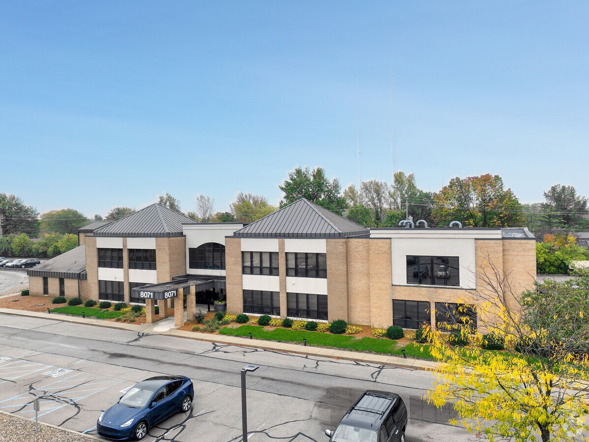
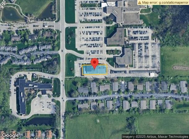
Property Record
8073 Township Line Rd, Indianapolis, IN 46260
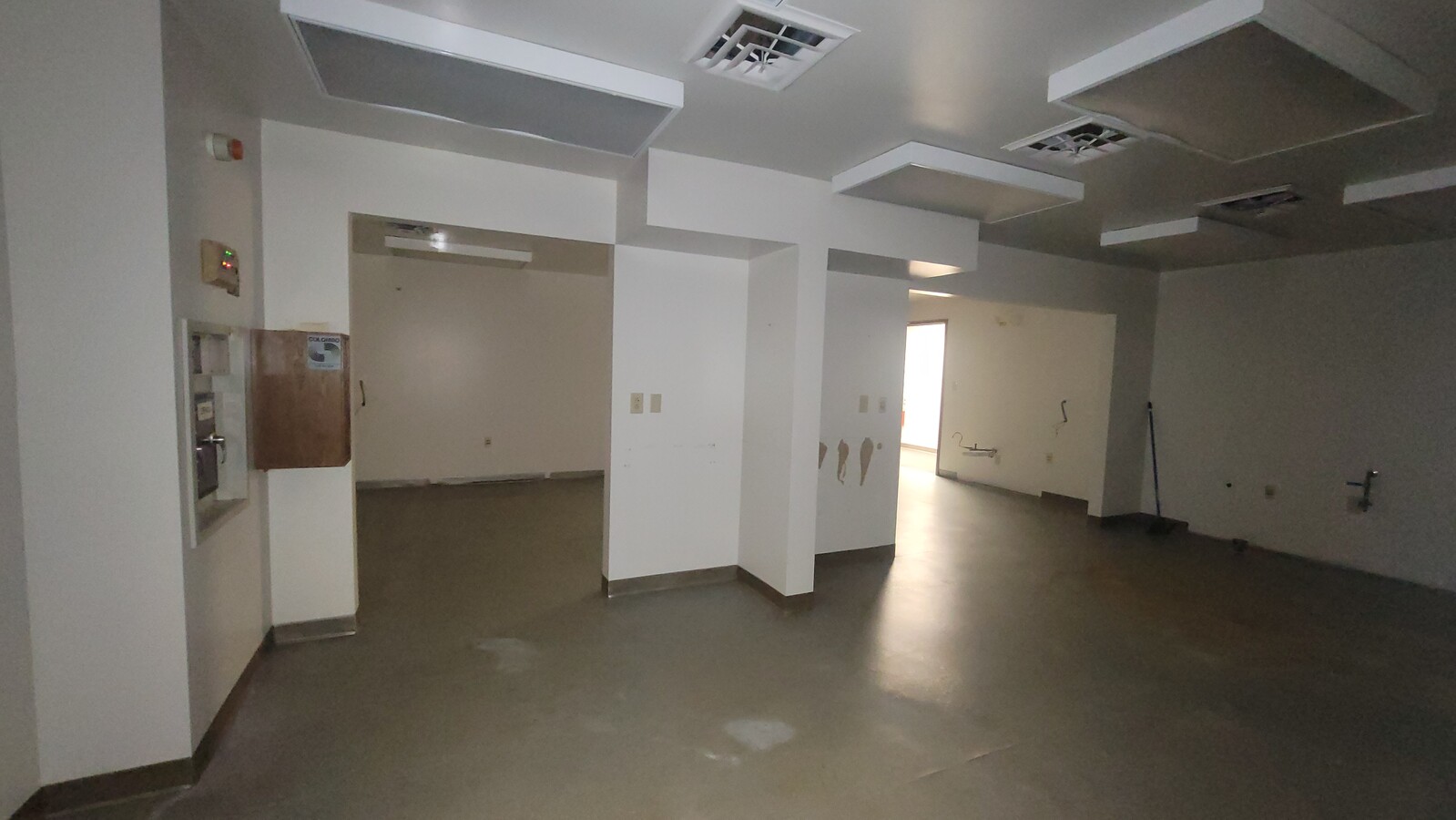


Current Lease Availabilities
NEARBY LISTINGS FOR SALE OR LEASE
Property Detail
8073 Township Line Rd
49-03-21-114-199.001-800
PT NW1/4 SW1/4 S21 T17 R3 BEG 977.84S 184E & 55N OFNW COR; E237.16 N92 W237.16 S92 TO BEG .501 AC
Medicalbuilding
Marion
X
Indiana
18097C0039F
0.50 AC
2023
College Park
2023
Indianapolis
320108
Indianapolis-Carmel-Anderson, IN
25,898 SF
DEMOGRAPHICS near 8073 Township Line Rd
1 Mile
3 Mile
5 Mile
2024 Total Population
14,847
63,908
165,004
2029 Population
14,575
63,339
166,796
Pop Growth 2024-2029
(1.83%)
(0.89%)
+ 1.09%
Average Age
37
39
39
2024 Total Households
7,062
27,251
69,835
HH Growth 2024-2029
(2.00%)
(1.16%)
+ 0.83%
Median Household Inc
$53,567
$70,391
$79,092
Avg Household Size
2.00
2.30
2.30
2024 Avg HH Vehicles
1.00
2.00
2.00
Median Home Value
$201,624
$241,729
$281,772
Median Year Built
1983
1980
1980
Nearby Places
- Restaurants
- Banks
- Shops
- Fitness
- Groceries
PUBLIC TRANSPORTATION
AIRPORT
Indianapolis International
DRIVE
WALK
Distance
Indianapolis International
41 min
22.5 mi
Freight Ports
Port of Toledo
DRIVE
WALK
Distance
Port of Toledo
269 min
222.0 mi
Nearby Properties
Address
Land Use
TOTAL SIZE
Lot Size
Zoning
Address
Land Use
TOTAL SIZE
Lot Size
Zoning
303,520 SF
39.62 AC
ZO01
Address
Land Use
TOTAL SIZE
Lot Size
Zoning
89,245 SF
45.14 AC
ZO01
Address
Land Use
TOTAL SIZE
Lot Size
Zoning
4,267 SF
21.06 AC
ZO01
Address
Land Use
TOTAL SIZE
Lot Size
Zoning
2,544 SF
37.75 AC
ZO01
Address
Land Use
TOTAL SIZE
Lot Size
Zoning
9,076 SF
18 AC
ZO01
Address
Land Use
TOTAL SIZE
Lot Size
Zoning
168,710 SF
5.24 AC
ZO01
Address
Land Use
TOTAL SIZE
Lot Size
Zoning
521,092 SF
23.46 AC
ZO01
Address
Land Use
TOTAL SIZE
Lot Size
Zoning
12,023 SF
48.47 AC
ZO01
Address
Land Use
TOTAL SIZE
Lot Size
Zoning
1,904 SF
45.69 AC
ZO01
Address
Land Use
TOTAL SIZE
Lot Size
Zoning
359,121 SF
0.06 AC
ZO01
Address
Land Use
TOTAL SIZE
Lot Size
Zoning
512,730 SF
21.80 AC
ZO01
Address
Land Use
TOTAL SIZE
Lot Size
Zoning
2,103 SF
11.67 AC
ZO01
Address
Land Use
TOTAL SIZE
Lot Size
Zoning
187,555 SF
1.85 AC
Address
Land Use
TOTAL SIZE
Lot Size
Zoning
110,373 SF
47.98 AC
ZO01
Address
Land Use
TOTAL SIZE
Lot Size
Zoning
179,586 SF
10.23 AC
ZO01
Address
Land Use
TOTAL SIZE
Lot Size
Zoning
4,495 SF
19.62 AC
ZO01
Address
Land Use
TOTAL SIZE
Lot Size
Zoning
7,469 SF
24.52 AC
ZO01
Address
Land Use
TOTAL SIZE
Lot Size
Zoning
14,854 SF
14.07 AC
ZO01
Address
Land Use
TOTAL SIZE
Lot Size
Zoning
155,919 SF
28.92 AC
Address
Land Use
TOTAL SIZE
Lot Size
Zoning
17,218 SF
9.80 AC
ZO01
Address
Land Use
TOTAL SIZE
Lot Size
Zoning
370,962 SF
17.91 AC
ZO01
Address
Land Use
TOTAL SIZE
Lot Size
Zoning
6,306 SF
33.65 AC
ZO01
Address
Land Use
TOTAL SIZE
Lot Size
Zoning
838 SF
18.39 AC
ZO01
Address
Land Use
TOTAL SIZE
Lot Size
Zoning
29,662 SF
17.96 AC
ZO01
Address
Land Use
TOTAL SIZE
Lot Size
Zoning
89,704 SF
28.63 AC
ZO01
Address
Land Use
TOTAL SIZE
Lot Size
Zoning
4,463 SF
29.49 AC
ZO01
Address
Land Use
TOTAL SIZE
Lot Size
Zoning
148,940 SF
23.14 AC
ZO01
Address
Land Use
TOTAL SIZE
Lot Size
Zoning
18,768 SF
45.36 AC
ZO01
Address
Land Use
TOTAL SIZE
Lot Size
Zoning
1,080 SF
19.24 AC
Address
Land Use
TOTAL SIZE
Lot Size
Zoning
123,575 SF
13.04 AC
The World's #1 Commercial Real Estate Marketplace
Connect with us
© 2025 CoStar Group
The information above has been obtained from sources believed reliable. While we do not doubt its accuracy we have not verified it and make no guarantee, warranty or representation about it. It is your responsibility to independently confirm its accuracy and completeness. Any projections, opinions, assumptions, or estimates used are for example only and do not represent the current or future performance of the property. The value of this transaction to you depends on tax and other factors which should be evaluated by your tax, financial, and legal advisors. You and your advisors should conduct a careful, independent investigation of the property to determine to your satisfaction the suitability of the property for your needs.