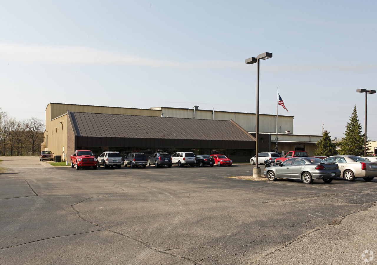
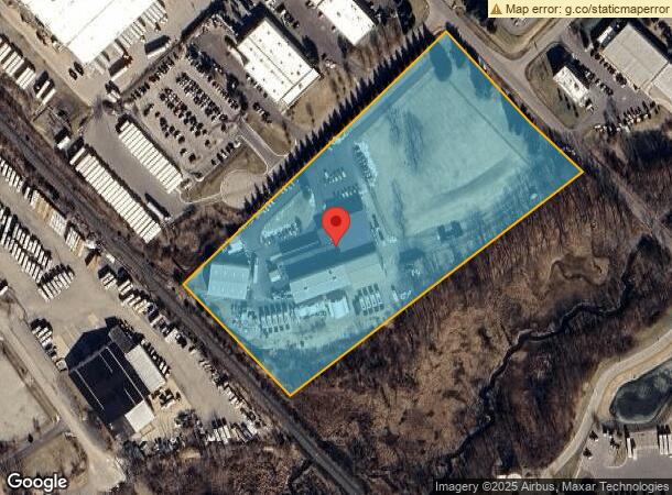
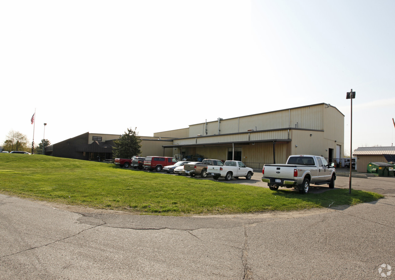
Property Record
8080 Kensington Ct, Brighton, MI 48116
NEARBY LISTINGS FOR SALE OR LEASE
Property Detail
8080 Kensington Ct
16-13-100-010
SEC 12/13 T1N R6E COMM AT THE W 1/4 COR OF SEC 12, TH S 01*20' 00"W ALONG W LINE OF SEC 12, 375 FT, TH S 39*20'55"E ALONG WLY
Industrialgeneral
Livingston
X
Michigan
26093C0481D
10.05 AC
2024
Livingston County
2024
Detroit
744800
Detroit-Warren-Dearborn, MI
43,838 SF
DEMOGRAPHICS near 8080 Kensington Ct
1 Mile
3 Mile
5 Mile
2024 Total Population
658
24,492
56,588
2029 Population
672
24,714
57,263
Pop Growth 2024-2029
+ 2.13%
+ 0.91%
+ 1.19%
Average Age
43
42
41
2024 Total Households
228
9,652
21,477
HH Growth 2024-2029
+ 2.19%
+ 0.92%
+ 1.19%
Median Household Inc
$134,574
$98,183
$103,701
Avg Household Size
2.80
2.50
2.60
2024 Avg HH Vehicles
3.00
2.00
2.00
Median Home Value
$363,235
$318,901
$340,514
Median Year Built
1994
1991
1991
Nearby Places
- Restaurants
- Banks
- Shops
- Fitness
- Groceries
PUBLIC TRANSPORTATION
AIRPORT
Detroit Metro Wayne County
DRIVE
WALK
Distance
Detroit Metro Wayne County
49 min
39.6 mi
Freight Ports
Port of Toledo
DRIVE
WALK
Distance
Port of Toledo
99 min
81.2 mi
Nearby Properties
Address
Land Use
TOTAL SIZE
Lot Size
Zoning
Address
Land Use
TOTAL SIZE
Lot Size
Zoning
394,554 SF
28.66 AC
GI
Address
Land Use
TOTAL SIZE
Lot Size
Zoning
139,056 SF
50.33 AC
GI
Address
Land Use
TOTAL SIZE
Lot Size
Zoning
9,784 SF
68.90 AC
MM
Address
Land Use
TOTAL SIZE
Lot Size
Zoning
140,000 SF
9.08 AC
LI PUD
Address
Land Use
TOTAL SIZE
Lot Size
Zoning
164,517 SF
27.78 AC
GI
Address
Land Use
TOTAL SIZE
Lot Size
Zoning
137,373 SF
16.51 AC
AI
Address
Land Use
TOTAL SIZE
Lot Size
Zoning
183,105 SF
13.38 AC
I-1
Address
Land Use
TOTAL SIZE
Lot Size
Zoning
55,744 SF
4.40 AC
Address
Land Use
TOTAL SIZE
Lot Size
Zoning
106,347 SF
11.47 AC
LI
Address
Land Use
TOTAL SIZE
Lot Size
Zoning
54,615 SF
6.14 AC
LI PUD
Address
Land Use
TOTAL SIZE
Lot Size
Zoning
96,480 SF
11.44 AC
GI
Address
Land Use
TOTAL SIZE
Lot Size
Zoning
73,010 SF
25.37 AC
GI
Address
Land Use
TOTAL SIZE
Lot Size
Zoning
87,046 SF
9.76 AC
GI
Address
Land Use
TOTAL SIZE
Lot Size
Zoning
116,663 SF
8.98 AC
AI
Address
Land Use
TOTAL SIZE
Lot Size
Zoning
91,510 SF
9.73 AC
GI
Address
Land Use
TOTAL SIZE
Lot Size
Zoning
76,240 SF
4.39 AC
GI
Address
Land Use
TOTAL SIZE
Lot Size
Zoning
33,808 SF
4.16 AC
LI PUD
Address
Land Use
TOTAL SIZE
Lot Size
Zoning
47,339 SF
9.56 AC
GI
Address
Land Use
TOTAL SIZE
Lot Size
Zoning
45,340 SF
2.86 AC
LI PUD
Address
Land Use
TOTAL SIZE
Lot Size
Zoning
56,745 SF
5.09 AC
GI
Address
Land Use
TOTAL SIZE
Lot Size
Zoning
1,472 SF
35.14 AC
MM
Address
Land Use
TOTAL SIZE
Lot Size
Zoning
30,000 SF
3.46 AC
GI
Address
Land Use
TOTAL SIZE
Lot Size
Zoning
34,200 SF
1.53 AC
RO
Address
Land Use
TOTAL SIZE
Lot Size
Zoning
9,914 SF
0.99 AC
LI
Address
Land Use
TOTAL SIZE
Lot Size
Zoning
581.35 AC
PL
Address
Land Use
TOTAL SIZE
Lot Size
Zoning
64,555 SF
9.60 AC
II
Address
Land Use
TOTAL SIZE
Lot Size
Zoning
32,841 SF
10.92 AC
GI
Address
Land Use
TOTAL SIZE
Lot Size
Zoning
49,710 SF
5.61 AC
LI PUD
The World's #1 Commercial Real Estate Marketplace
Connect with us
© 2025 CoStar Group
The information above has been obtained from sources believed reliable. While we do not doubt its accuracy we have not verified it and make no guarantee, warranty or representation about it. It is your responsibility to independently confirm its accuracy and completeness. Any projections, opinions, assumptions, or estimates used are for example only and do not represent the current or future performance of the property. The value of this transaction to you depends on tax and other factors which should be evaluated by your tax, financial, and legal advisors. You and your advisors should conduct a careful, independent investigation of the property to determine to your satisfaction the suitability of the property for your needs.