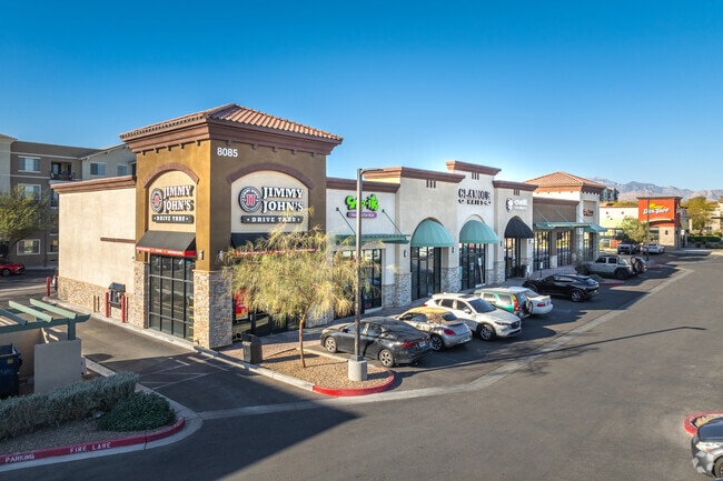
Property Record
8085 Blue Diamond Rd, Las Vegas, NV 89178


NEARBY LISTINGS FOR SALE OR LEASE
Property Detail
8085 Blue Diamond Rd
Las Vegas-Henderson-Paradise, NV
Pod 111 At Mountains Edge
176-21-610-006
POD 111 AT MOUNTAINS EDGE PLAT BOOK 206 PAGE 19 PT LOT PT 1
Storebuilding
Clark
X
Nevada
32003C2545F
1
2025
1.03 AC
2025
Southwest Las Vegas
005830
Las Vegas
10,560 SF
DEMOGRAPHICS near 8085 Blue Diamond Rd
1 Mile
3 Mile
5 Mile
2024 Total Population
17,640
138,439
242,058
2029 Population
19,353
150,637
263,311
Pop Growth 2024-2029
+ 9.71%
+ 8.81%
+ 8.78%
Average Age
36
37
37
2024 Total Households
6,316
47,791
85,983
HH Growth 2024-2029
+ 9.56%
+ 8.73%
+ 8.70%
Median Household Inc
$88,434
$90,995
$88,433
Avg Household Size
2.80
2.90
2.80
2024 Avg HH Vehicles
2.00
2.00
2.00
Median Home Value
$455,573
$432,853
$424,889
Median Year Built
2008
2008
2007
Nearby Places
Map Layers
Map Styles
 Street
 Aerial
- Restaurants
- Banks
- Shops
- Fitness
- Groceries
PUBLIC TRANSPORTATION
AIRPORT
Harry Reid International
DRIVE
WALK
Distance
Harry Reid International
17 min
10.4 mi
Boulder City Municipal
DRIVE
WALK
Distance
Boulder City Municipal
41 min
27.9 mi
SALE & LEASE HISTORY
LISTING DATE
SALE/LEASE

Sep 25, 2016
For Lease
Sep 17, 2021
For Sale
Nov 28, 2018
For Sale
Dec 09, 2020
For Lease
Nearby Properties
Address
Land Use
TOTAL SIZE
Lot Size
Zoning
Address
Land Use
TOTAL SIZE
Lot Size
Zoning
60 AC
PF
Address
Land Use
TOTAL SIZE
Lot Size
Zoning
17,206 SF
225 AC
Address
Land Use
TOTAL SIZE
Lot Size
Zoning
29.59 AC
CP
Address
Land Use
TOTAL SIZE
Lot Size
Zoning
760,651 SF
41.25 AC
Address
Land Use
TOTAL SIZE
Lot Size
Zoning
Address
Land Use
TOTAL SIZE
Lot Size
Zoning
35.55 AC
PF
Address
Land Use
TOTAL SIZE
Lot Size
Zoning
3,398 SF
13.56 AC
Address
Land Use
TOTAL SIZE
Lot Size
Zoning
4,830 SF
15.84 AC
Address
Land Use
TOTAL SIZE
Lot Size
Zoning
4,199 SF
12.11 AC
RE
Address
Land Use
TOTAL SIZE
Lot Size
Zoning
370,870 SF
28.56 AC
MD
Address
Land Use
TOTAL SIZE
Lot Size
Zoning
107.39 AC
RE
Address
Land Use
TOTAL SIZE
Lot Size
Zoning
4,446 SF
14.37 AC
Address
Land Use
TOTAL SIZE
Lot Size
Zoning
14.65 AC
RE
Address
Land Use
TOTAL SIZE
Lot Size
Zoning
18.03 AC
PF
Address
Land Use
TOTAL SIZE
Lot Size
Zoning
53,331 SF
77.50 AC
Address
Land Use
TOTAL SIZE
Lot Size
Zoning
115,488 SF
6.41 AC
Address
Land Use
TOTAL SIZE
Lot Size
Zoning
494,886 SF
26.61 AC
M1
Address
Land Use
TOTAL SIZE
Lot Size
Zoning
7,121 SF
14.27 AC
R3
Address
Land Use
TOTAL SIZE
Lot Size
Zoning
5,931 SF
3.80 AC
R3
Address
Land Use
TOTAL SIZE
Lot Size
Zoning
12.18 AC
PF
Address
Land Use
TOTAL SIZE
Lot Size
Zoning
9,787 SF
65.73 AC
RE
Address
Land Use
TOTAL SIZE
Lot Size
Zoning
17.85 AC
PF
Address
Land Use
TOTAL SIZE
Lot Size
Zoning
126,523 SF
21.55 AC
Address
Land Use
TOTAL SIZE
Lot Size
Zoning
86,780 SF
14.58 AC
PF
Address
Land Use
TOTAL SIZE
Lot Size
Zoning
4.37 AC
MLZ
Address
Land Use
TOTAL SIZE
Lot Size
Zoning
191,189 SF
4.53 AC
C2
Address
Land Use
TOTAL SIZE
Lot Size
Zoning
15 AC
RE
Address
Land Use
TOTAL SIZE
Lot Size
Zoning
136,654 SF
15 AC
PF
Address
Land Use
TOTAL SIZE
Lot Size
Zoning
3,755 SF
13.80 AC
R3
Address
Land Use
TOTAL SIZE
Lot Size
Zoning
124,257 SF
16.11 AC
The World's #1 Commercial Real Estate Marketplace
Connect with us
© 2026 CoStar Group
The information above has been obtained from sources believed reliable. While we do not doubt its accuracy we have not verified it and make no guarantee, warranty or representation about it. It is your responsibility to independently confirm its accuracy and completeness. Any projections, opinions, assumptions, or estimates used are for example only and do not represent the current or future performance of the property. The value of this transaction to you depends on tax and other factors which should be evaluated by your tax, financial, and legal advisors. You and your advisors should conduct a careful, independent investigation of the property to determine to your satisfaction the suitability of the property for your needs.