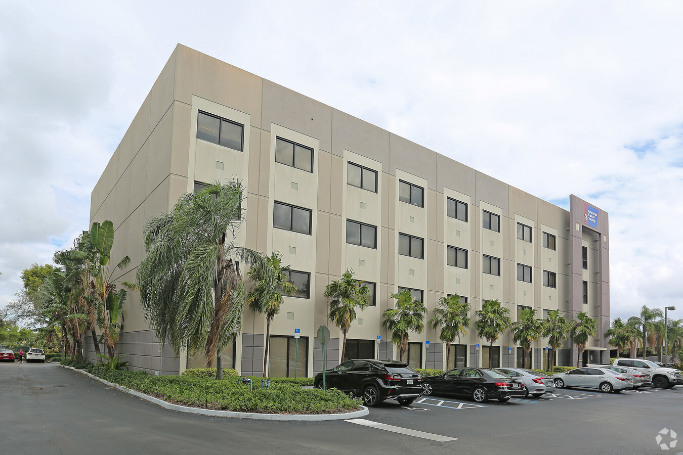
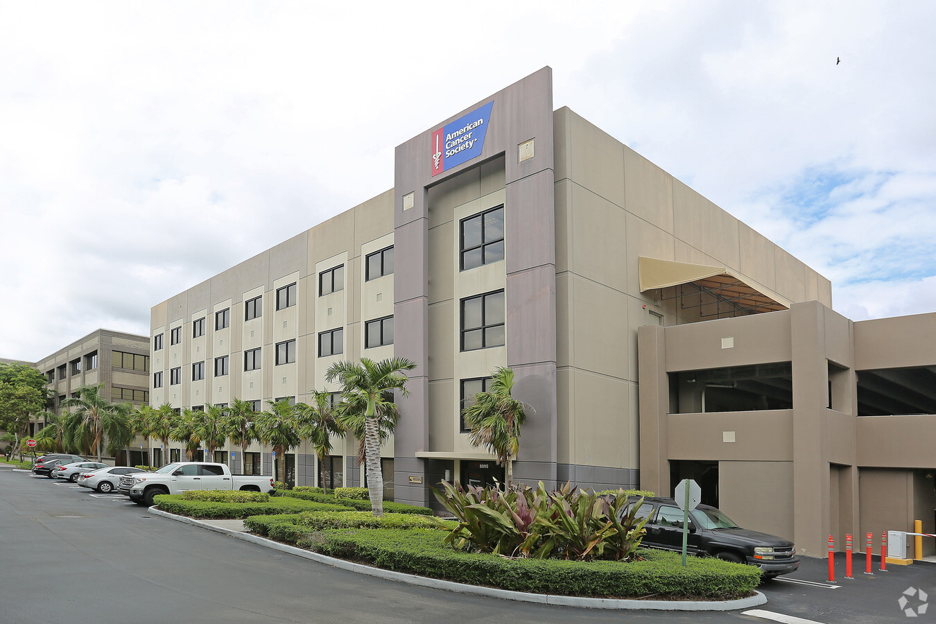
Property Record
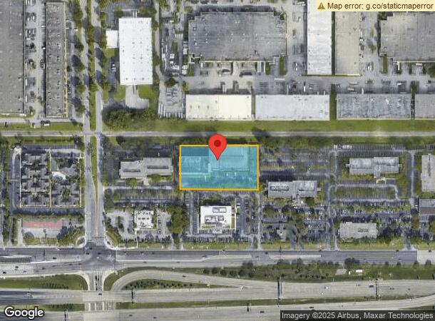
8095 Nw 12Th St, Doral, FL 33126
NEARBY LISTINGS FOR SALE OR LEASE
Property Detail
8095 Nw 12Th St
35-3034-038-0025
Miami Intl Commerce Center
Officebuilding
MIAMI INTL COMMERCE CENTER PB 147-46 T-18557 E380.23FT OF N218.22FT OF TR 19-B LOT SIZE 1.905 AC FAU 30-3034-038-0020 OR 18092-2158 0598 5 F/A/U 30-3034-038-0025
AH
Miami/Dade
12086C0287L
Florida
2023
1.90 AC
2024
Miami Airport
009010
South Florida
104,446 SF
Miami-Miami Beach-Kendall, FL
DEMOGRAPHICS near 8095 Nw 12Th St
1 Mile
3 Mile
5 Mile
2024 Total Population
18,857
152,392
422,952
2029 Population
18,966
149,398
412,349
Pop Growth 2024-2029
+ 0.58%
(1.96%)
(2.51%)
Average Age
42
43
43
2024 Total Households
6,907
54,649
148,229
HH Growth 2024-2029
+ 0.29%
(2.31%)
(2.88%)
Median Household Inc
$54,633
$58,460
$58,919
Avg Household Size
2.70
2.70
2.70
2024 Avg HH Vehicles
2.00
2.00
2.00
Median Home Value
$232,686
$351,221
$390,874
Median Year Built
1988
1979
1976
Nearby Places
- Restaurants
- Banks
- Shops
- Fitness
- Groceries
PUBLIC TRANSPORTATION
COMMUTER RAIL
Palmetto (Metrorail Green Line - Miami-Dade Transit (Metrorail/Metromover))
DRIVE
WALK
Distance
Palmetto (Metrorail Green Line - Miami-Dade Transit (Metrorail/Metromover))
11 min
5.4 mi
Okeechobee (Metrorail Green Line - Miami-Dade Transit (Metrorail/Metromover))
DRIVE
WALK
Distance
Okeechobee (Metrorail Green Line - Miami-Dade Transit (Metrorail/Metromover))
13 min
6.3 mi
AIRPORT
Miami International
DRIVE
WALK
Distance
Miami International
10 min
3.4 mi
Fort Lauderdale/Hollywood International
DRIVE
WALK
Distance
Fort Lauderdale/Hollywood International
44 min
30.1 mi
Freight Ports
Port of Miami
DRIVE
WALK
Distance
Port of Miami
21 min
11.4 mi
SALE & LEASE HISTORY
LISTING DATE
SALE/LEASE

Sep 25, 2016
For Lease
Jan 08, 2018
For Lease
Aug 02, 2017
For Lease
Apr 29, 2019
For Lease
Apr 26, 2024
For Lease
Nearby Properties
Address
Land Use
TOTAL SIZE
Lot Size
Zoning
Address
Land Use
TOTAL SIZE
Lot Size
Zoning
851,502 SF
11.73 AC
6119
Address
Land Use
TOTAL SIZE
Lot Size
Zoning
481,242 SF
13.60 AC
6400
Address
Land Use
TOTAL SIZE
Lot Size
Zoning
465,663 SF
11.29 AC
4100
Address
Land Use
TOTAL SIZE
Lot Size
Zoning
666,015 SF
4 AC
6119
Address
Land Use
TOTAL SIZE
Lot Size
Zoning
1,680,493 SF
23.71 AC
4100
Address
Land Use
TOTAL SIZE
Lot Size
Zoning
582,921 SF
4.51 AC
6119
Address
Land Use
TOTAL SIZE
Lot Size
Zoning
448,531 SF
37 AC
6400
Address
Land Use
TOTAL SIZE
Lot Size
Zoning
884,102 SF
28.46 AC
7300
Address
Land Use
TOTAL SIZE
Lot Size
Zoning
418,532 SF
17.95 AC
7300
Address
Land Use
TOTAL SIZE
Lot Size
Zoning
608,139 SF
5.80 AC
6119
Address
Land Use
TOTAL SIZE
Lot Size
Zoning
929,765 SF
453.69 AC
6119
Address
Land Use
TOTAL SIZE
Lot Size
Zoning
423,104 SF
2.58 AC
6200
Address
Land Use
TOTAL SIZE
Lot Size
Zoning
671,088 SF
19.84 AC
6400
Address
Land Use
TOTAL SIZE
Lot Size
Zoning
429,568 SF
7.44 AC
6400
Address
Land Use
TOTAL SIZE
Lot Size
Zoning
466,402 SF
2.22 AC
6106
Address
Land Use
TOTAL SIZE
Lot Size
Zoning
538,739 SF
5.05 AC
7100
Address
Land Use
TOTAL SIZE
Lot Size
Zoning
453,404 SF
469.53 AC
7300
Address
Land Use
TOTAL SIZE
Lot Size
Zoning
687,304 SF
3.03 AC
6119
Address
Land Use
TOTAL SIZE
Lot Size
Zoning
438,387 SF
16.20 AC
3900
Address
Land Use
TOTAL SIZE
Lot Size
Zoning
755,156 SF
29.44 AC
7100
Address
Land Use
TOTAL SIZE
Lot Size
Zoning
344,101 SF
1.08 AC
6119
Address
Land Use
TOTAL SIZE
Lot Size
Zoning
366,237 SF
9.24 AC
4100
Address
Land Use
TOTAL SIZE
Lot Size
Zoning
428,212 SF
17.56 AC
3900
Address
Land Use
TOTAL SIZE
Lot Size
Zoning
468,218 SF
17.06 AC
7100
Address
Land Use
TOTAL SIZE
Lot Size
Zoning
886,293 SF
20.59 AC
7300
Address
Land Use
TOTAL SIZE
Lot Size
Zoning
476,094 SF
1.09 AC
6480
Address
Land Use
TOTAL SIZE
Lot Size
Zoning
387,903 SF
4.49 AC
6119
Address
Land Use
TOTAL SIZE
Lot Size
Zoning
516,193 SF
571.83 AC
8900
Address
Land Use
TOTAL SIZE
Lot Size
Zoning
330,528 SF
4.46 AC
6119
Address
Land Use
TOTAL SIZE
Lot Size
Zoning
353,267 SF
30.40 AC
6400
The World's #1 Commercial Real Estate Marketplace
Connect with us
© 2025 CoStar Group
The information above has been obtained from sources believed reliable. While we do not doubt its accuracy we have not verified it and make no guarantee, warranty or representation about it. It is your responsibility to independently confirm its accuracy and completeness. Any projections, opinions, assumptions, or estimates used are for example only and do not represent the current or future performance of the property. The value of this transaction to you depends on tax and other factors which should be evaluated by your tax, financial, and legal advisors. You and your advisors should conduct a careful, independent investigation of the property to determine to your satisfaction the suitability of the property for your needs.